Iceland Ring Road guide: everything you need to know
Akureyri: Reykjavik 8 day Iceland Ring Road guided small group tour
Duration: 8 days
How long does it take to drive the Ring Road?
The Ring Road (Route 1) covers 1,322 km and takes a minimum of 7 days at a fast pace. Ten days is the realistic minimum for most travelers who want daylight stops at major highlights; 14 days allows proper detours. Budget ISK 20,000–35,000 (€135–240) per day for a rental car, fuel, and campsite or guesthouse.
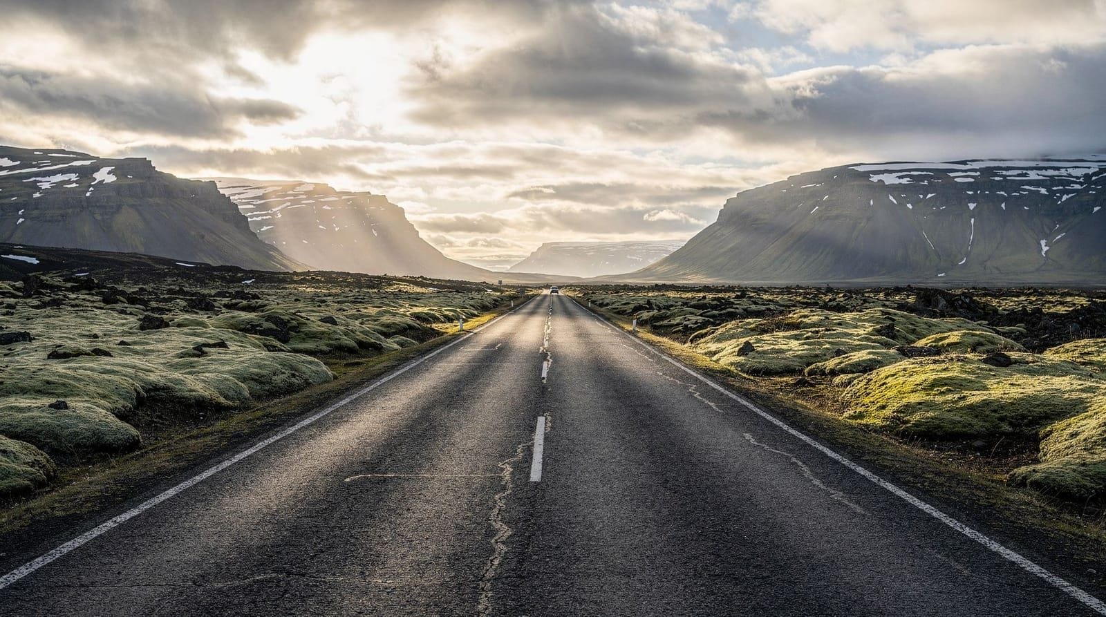
What the Ring Road actually is
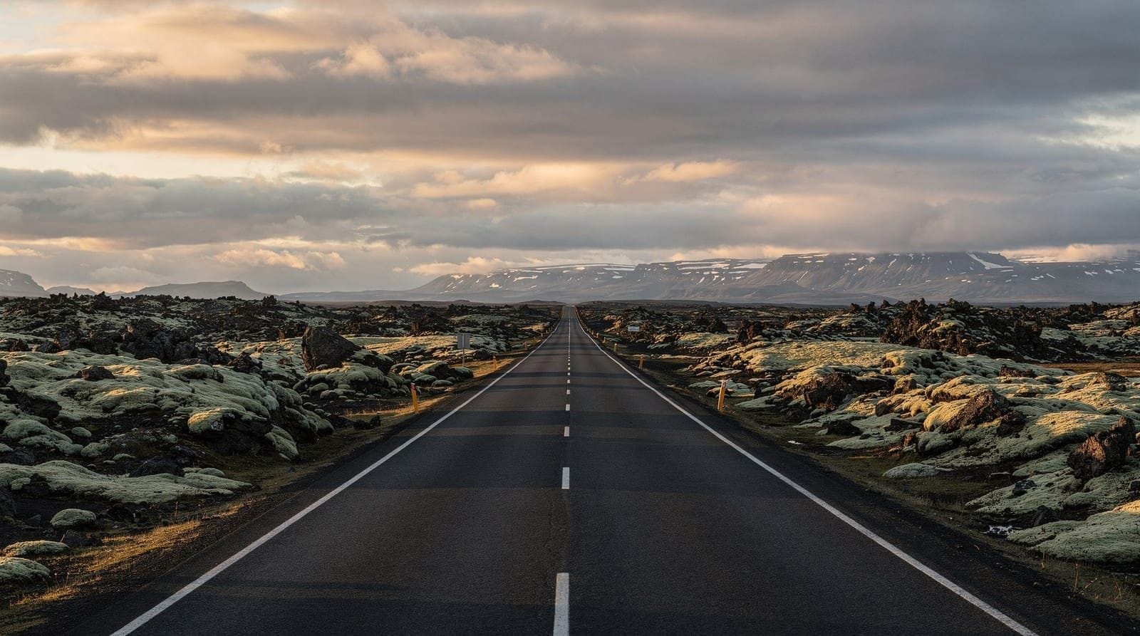
Route 1 — universally called the Ring Road or Hringvegur — is a single paved highway that loops around Iceland’s entire perimeter. The current measured distance is 1,322 km. That figure counts the road itself; total driving with detours to Jökulsárlón, Lake Mývatn, the Snæfellsnes Peninsula, or the Westfjords can easily double it.
The road is entirely paved and maintained year-round, but “paved” and “safe” are not synonyms in Iceland. Wind, ice, and volcanic ash can close sections with minimal warning. Road.is (Vegagerðin, the Icelandic Road Administration) is the only authoritative source for current conditions.
How many days do you actually need?
| Trip length | What you can realistically do |
|---|---|
| 7 days | Drive the full loop with 1–2 stops per day; major landmarks only |
| 10 days | Comfortable full loop plus 1–2 side trips (e.g. Diamond Circle or Snæfellsnes) |
| 14 days | Full loop with Westfjords, highlands, and genuine slow travel |
| Less than 7 days | You will be driving 4–6 hours a day and missing most of the scenery |
If you have fewer than 7 days, consider a South Coast itinerary or a North Iceland focus rather than forcing the full loop.
The Ring Road by region
Reykjavik to Vík (South Coast, ~180 km)
This is the most visited stretch, with reliable infrastructure, frequent petrol stations, and attractions every 20–30 km. Key stops: Seljalandsfoss, Skógafoss, Reynisfjara black sand beach, and Dyrhólaey. Road conditions are generally good year-round, though storm closures near Vík happen several times each winter.
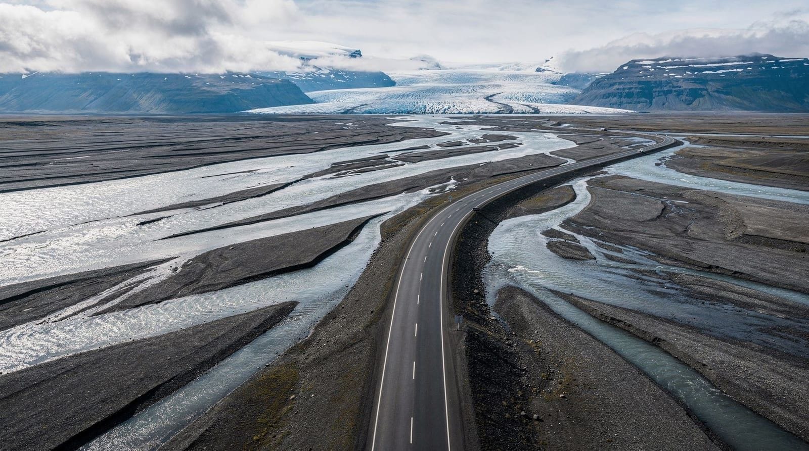
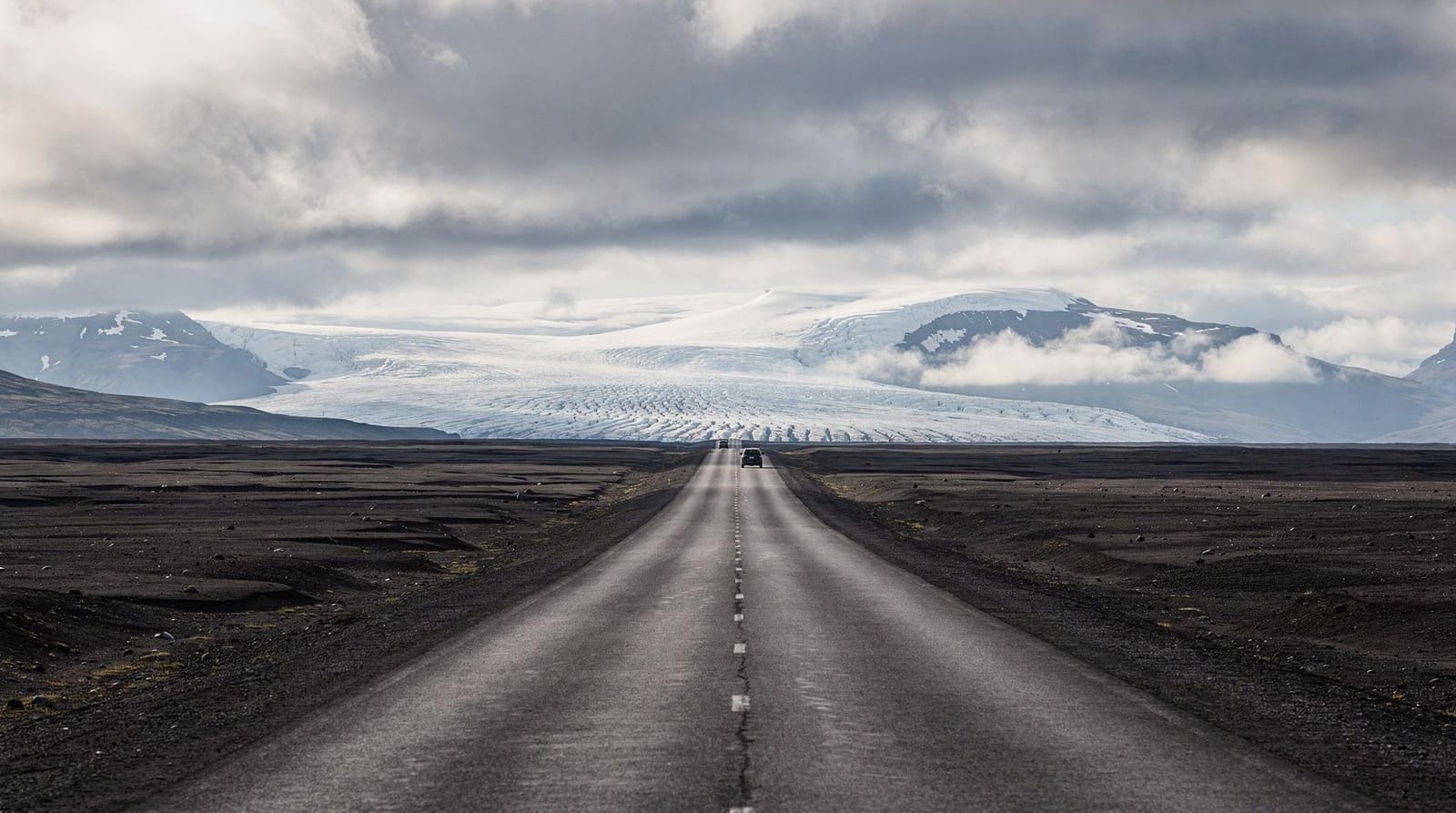
Vík to Höfn (Glacial Southeast, ~260 km)
This section crosses the Eldhraun lava field and Skeiðarársandur glacial outwash plain — one of the largest such plains in Europe. Stops include Skaftafell, Jökulsárlón glacier lagoon, and Diamond Beach. The road is single-lane in a few places near Skaftafell. Allow a full day minimum.
Höfn to Egilsstaðir (East Fjords, ~260 km)
The East Fjords have the quietest Ring Road driving — dramatic but not heavily promoted. The road winds through a series of fjords with minimal tourist infrastructure. Petrol stations are 60–100 km apart; fill up whenever you can. Egilsstaðir is the main service hub. From here you can detour to Seyðisfjörður.
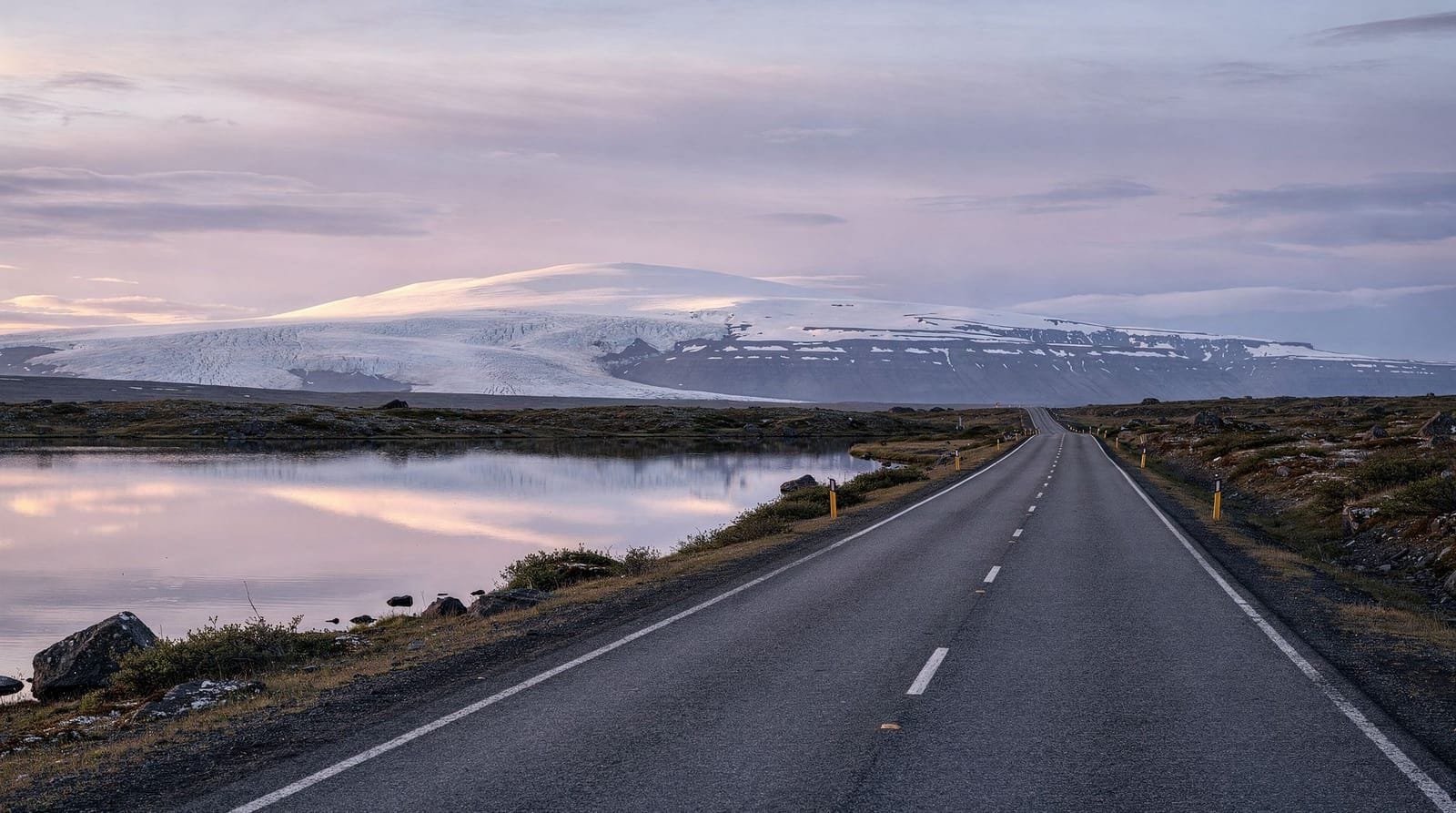
Egilsstaðir to Akureyri (Northeast, ~270 km)
The road passes through interior highlands near Mývatn — stay on Route 1 unless your car is rated for the F-roads that cut through the centre. Mývatn is a full-day detour worth at least one night. Dettifoss and Ásbyrgi are nearby. Akureyri is Iceland’s northern capital and the last large town until Reykjavik.
Akureyri to Reykjavik (Northwest, ~365 km)
This is the longest segment with the least visitor density. Goðafoss is right on the road. The Snæfellsnes Peninsula is a 200+ km round-trip detour from this stretch. The Borgarnes–Reykjavik section near the end has Iceland’s only real highway-style driving with multiple lanes.
Real costs: what you’ll spend per day
Rental car: ISK 8,000–25,000/day (€55–170) for a compact 2WD in summer. 4x4 rentals run ISK 15,000–50,000/day (€100–340). Prices spike in June–August — booking 4–6 months ahead saves 30–50%. See our full car rental guide for Iceland.
Insurance: Standard collision damage waiver (CDW) is included in most quotes but typically excludes gravel, sand, ash, and river crossing damage. Gravel protection (GPSB) and sand/ash protection (SAAP) each cost ISK 1,500–3,000/day extra and are worth taking if you plan to drive anywhere off the main ring. Full breakdown of what each cover protects is in our car rental insurance guide.
Fuel: 1L of 95-octane petrol costs approximately ISK 290–310 (€2.00–2.15) as of mid-2026. A compact car averaging 6L/100km over 1,322 km totals roughly ISK 25,000–28,000 (€170–190) in fuel for the full loop. Filling up in Reykjavik at an N1 or Olís self-service pump saves 5–8% versus remote stations.
Accommodation: Campsites charge ISK 1,500–2,500/person (€10–17) per night and are available all along the route from May to September. Guesthouses and small hotels: ISK 15,000–35,000/night (€100–240) for a double room. Budget: ISK 8,000–12,000/night (€55–80) in smaller hostels away from Reykjavik and major honey-pot areas.
Total daily spend (self-drive): ISK 25,000–50,000 per person (€170–340) depending on accommodation choice and group size. Two people sharing costs and a compact 2WD in a tent: closer to ISK 18,000–25,000/person/day.
Guided tour alternative
If you don’t want to drive, guided Ring Road tours exist at every budget level. Small-group minibus tours of 8–16 days cover the main highlights; you lose flexibility but gain a driver who knows local road conditions, a built-in accommodation chain, and English commentary.
8-day guided Ring Road small-group tour from ReykjavikThe trade-off is real: guided tours visit the same 20 spots that every other tour visits. The Ring Road’s best rewards — an unplanned pull-over at a roadside waterfall, arriving at Jökulsárlón at 2 am in pink midnight sun — only happen when you set your own schedule. For a full comparison, see self-drive vs guided tour in Iceland.
Clockwise or counterclockwise?
Both directions cover the same route. The practical differences:
Clockwise (Reykjavik → South Coast → East → North → back): You hit the busiest sights first when you’re fresh, petrol logistics are slightly easier on the South Coast, and you arrive in the Westfjords detour area before tiredness sets in.
Counterclockwise (Reykjavik → North → East → South Coast → back): You get the North to yourself while most traffic is heading south. The dramatic South Coast light is often better in late afternoon when you arrive from the east. This is generally the better choice for photographers chasing golden hour.
Full analysis in our clockwise vs counterclockwise guide.
When to drive the Ring Road
June–August: All segments open, midnight sun, maximum daylight, maximum tourists. Campgrounds full; book accommodation weeks ahead. Highlands roads open (typically late June).
September–October: Shoulder season with real northern lights possibility from mid-September. Most services still open. Road conditions start deteriorating in October. One of the best times for photography.
November–March: Winter driving is possible on Route 1 but requires experience, winter-rated tyres (mandatory on all rental cars), and daily road condition checks at road.is. Several eastern stretches close temporarily in serious storms. See our winter driving guide.
April–May: Variable. Snow possible in March–April, especially in the north and east. Green starts returning in May. Fewer crowds than summer. Northern lights possible through April.
Essential logistics
Mobile coverage: Coverage on Route 1 is generally good from the main carriers (Síminn, Nova, Vodafone). The East Fjords and some northern stretches have gaps. Download offline maps and the 112.is emergency app before departing Reykjavik. Our eSIM and connectivity guide covers this in detail.
Emergency and road conditions: Road.is (vegagerdin.is) for current closures. Safetravel.is for safety registration — fill in a travel plan before any remote driving. 112 is the emergency number throughout Iceland.
Food: Outside Reykjavik, Akureyri, and Höfn, eating options along the Ring Road are limited. Ring Road petrol stations (N1, Orkan, Olís) have hot food and basic groceries at every significant town. Bring a cooler box and stock up at Bónus or Krónan supermarkets before long stretches. Our budget eating guide has specifics.
Petrol gaps: The longest gap on Route 1 between petrol stations is approximately 140 km in the East Fjords (Breiðdalsvík to Djúpivogur area). Fill up whenever the tank drops below half in this region.
Top highlights you should not rush through
The Ring Road passes hundreds of attractions, but certain ones deserve substantially more time than the typical drive-by stop. These are the places where staying longer pays dividends.
Jökulsárlón glacier lagoon and Diamond Beach: Most visitors allocate 1–2 hours. Arriving at dawn (possible in summer when it never gets fully dark) and staying through the morning gives you the lagoon when mist sits on the water, the ice changes colour as the light shifts, and the beach is clear of tour bus arrivals. Come back twice if you can — the morning lagoon and afternoon/evening Diamond Beach light are genuinely different experiences. Jökulsárlón guide.
Lake Mývatn: Most Ring Road itineraries visit Mývatn as a single day stop. This undersells it badly. The Mývatn area has the Krafla geothermal field and caldera 20 km north (a full half-day), the Hverfjall tuff crater (45-minute hike), Dimmuborgir lava formations, Námaskarð sulphur field, multiple birdwatching hides, and the Mývatn Nature Baths. Allow 2 nights minimum to cover this area without sprinting. See our Lake Mývatn destination guide.
Þórsmörk valley: This valley is only accessible by 4x4 or super-jeep (or on foot from Skógafoss via the Fimmvörðuháls trail). Most Ring Road drivers skip it entirely. This is the correct end point of the Laugavegur Trek and a spectacular canyon system that the main road bypasses completely. If you have a 4x4 and 2 extra days, the Þórsmörk detour is one of Iceland’s best. See Þórsmörk hiking guide.
Snæfellsnes Peninsula: Technically a detour requiring 2 extra days and ~200 km extra driving from the Ring Road. The peninsula contains Kirkjufell (the most photographed mountain in Iceland), Snæfellsjökull glacier, and some of Iceland’s most unusual coastal scenery. Worth every extra kilometre.
Accommodation planning by segment
Finding good accommodation on the Ring Road requires segment-by-segment planning because quality and availability vary enormously.
Reykjavik and surroundings: Widest choice. Book 4–8 weeks ahead in summer for anything below ISK 35,000/night.
South Coast (Vík–Kirkjubæjarklaustur): Accommodation is limited outside Vík. Hótel Kría in Vík (ISK 28,000–45,000/night), Guesthouse Ásólfsskáli near Kirkjubæjarklaustur, and several farmstay options exist but fill up quickly. Camping at Skógar (near Skógafoss) and Vík is excellent.
Höfn: A functional town with several guesthouses. Höfn Hostel is budget-friendly; Hótel Höfn gives glacier views and reliable meals. Book 3–4 weeks ahead.
East Fjords: The quietest Ring Road segment for accommodation. Several farmstays and small guesthouses in Djúpivogur, Breiðdalsvík, and Stöðvarfjörður. Less competitive to book but limited choice. Egilsstaðir has the widest East Iceland selection including a Gistihúsið (guesthouse) and camping.
North Iceland / Akureyri: Akureyri functions as a real city with a full hotel and hostel range. The Hótel KEA is the central mid-range option. Hostelling International Akureyri is budget-friendly. Mývatn area has the Hótel Gígur and several smaller guesthouses at the lakeside.
Snæfellsnes / West Iceland: Options in Grundarfjörður near Kirkjufell and Stykkishólmur are limited but well-run. Camping in the national park is atmospheric.
Photography on the Ring Road
Iceland is one of the most photographed countries per capita in the world, but the photos that stand out from the Ring Road trip require timing, not just location.
Golden hour: Iceland’s summer golden hour lasts 3–5 hours due to the low sun angle. Counterclockwise Ring Road direction delivers the South Coast (Skógafoss, Reynisfjara) in afternoon-to-evening light, which is generally optimal.
Midnight sun: From late May through mid-July, the sun barely dips below the horizon and the sky goes through an extended twilight/golden-hour cycle around midnight. This is when empty Ring Road landscapes — no tour buses, no crowds — look extraordinary. Being parked beside Jökulsárlón at 01:00 in pink light is a legitimate Ring Road experience.
Weather as an asset: Dramatic clouds, fog over glaciers, and storm light over the black sand beaches are features, not obstacles. Iceland’s landscape photography doesn’t require a blue sky. The worst photography condition is flat, white overcast sky with no texture — which is common.
Key photography locations: See our dedicated Iceland photography guide and best photo spots guide.
Ring Road safety: what actually goes wrong
Iceland Search and Rescue (ICE-SAR) is staffed by 4,000+ volunteers who respond to visitor incidents. The most common causes of callouts involving Ring Road drivers:
-
Vehicle stuck off-road: Drivers who pull onto soft ground for photos or to access viewpoints, and get stuck in mud or soft sand. This is especially common near the black sand areas of the South Coast.
-
Wrong road: GPS directing onto F-roads or unclassified tracks. This happens even on the main Ring Road; GPS units don’t show F-road restrictions reliably.
-
Weather caught while driving: Storms move fast in Iceland. The most dangerous scenario is being in a sandstorm on the Mýrdalssandur plain near Vík with poor visibility and crosswind.
-
Aurora driving: Late-night driving on unfamiliar rural roads to find clear skies. More accidents occur during peak aurora events because more people are driving on dark roads in unfamiliar conditions.
Prevention: register your travel plan on safetravel.is, carry the 112.is app, don’t drive onto anything that isn’t a clearly paved or maintained road, and check road.is before any evening driving.
Frequently asked questions about the Ring Road
How do I find petrol stations on the Ring Road?
The best tool is the Orkan or N1 apps, which show station locations and whether they are staffed or self-service. On the Ring Road, petrol stations appear in all towns of any size. The longest gap (East Fjords, approximately 140 km between Breiðdalsvík and Djúpivogur) is the only stretch requiring active planning. A GPS unit with Iceland maps shows stations as points of interest; Google Maps searches “petrol station” accurately along the Ring Road.
Is a 4x4 required for the Ring Road?
No. Route 1 is entirely paved and legally accessible with a standard 2WD car. A 4x4 is only mandatory for F-roads and river crossings. However, a 4x4 is advisable in winter (November–March) when ice and packed snow are common, and if you plan significant highland or F-road detours.
Can I drive the Ring Road in winter?
Yes, with preparation. Route 1 stays open in winter and rental cars are fitted with studded or winter tyres. You must check road.is daily and be ready to adjust plans if a section is closed. Allow more time per day — 4–5 hours of driving is more realistic than summer’s 6–7 hours.
How much does the Ring Road cost to drive?
For a solo traveler in a small rental car staying at campsites: approximately ISK 200,000–250,000 (€1,350–1,700) total for 10 days including car, fuel, insurance, camping, and food. Two people sharing costs: closer to ISK 120,000–160,000 per person.
Where do I start the Ring Road?
Almost everyone starts in Reykjavik (or Keflavik Airport, picking up a car). You can technically start anywhere on Route 1, but Reykjavik has the widest car rental selection and pre-trip logistics.
Do I need to pre-book accommodation?
In June–August: yes, book everything 4–8 weeks ahead. The route has limited beds in the East Fjords and north. In May, September–October: book 1–2 weeks ahead. In winter: often last-minute is fine except near Reykjavik and Akureyri.
Are there tolls on the Ring Road?
No road tolls on Route 1. There is a tunnel toll near Borgarfjörður and a tunnel between the mainland and Westman Islands if you take those detours.
Can I do the Ring Road without a car?
Scheduled buses (Strætó) cover most of Route 1 in summer via the bus passport system, but schedules are infrequent (sometimes once daily) and connections between segments require planning. It’s possible but slow. See our public transport guide.
What’s the best app for road conditions?
Road.is is the official source for closures and conditions. The 112.is Iceland app allows travel plan registration and GPS distress signals. Vedur.is (Icelandic Met Office) for hourly forecasts per location. All three are essential.
Top experiences
Bookable activities with verified prices and instant confirmation on GetYourGuide.
Top experiences
Best-rated activities across GetYourGuide and Viator.

From Reykjavik: Snaefellsness Peninsula small group day tour
- Viator

Lake Myvatn Day Tour and Godafoss Waterfall for Cruise Ships from Akureyri Port
- Viator

Private Jökulsárlón Glacier Lagoon 2 Day Tour & Glacier Hike
- Viator

From Reykjavik: Katla Ice Cave and South Coast Day Tour
- Viator

Reykjanes Peninsula Private Day Tour - up to 9 passengers
- Viator

Thorsmork Hike Day Tour
- Viator