Ásbyrgi travel guide
Ásbyrgi horseshoe canyon in North Iceland — hiking trails, mythology, geology, and how to combine it with the Diamond Circle and Dettifoss.
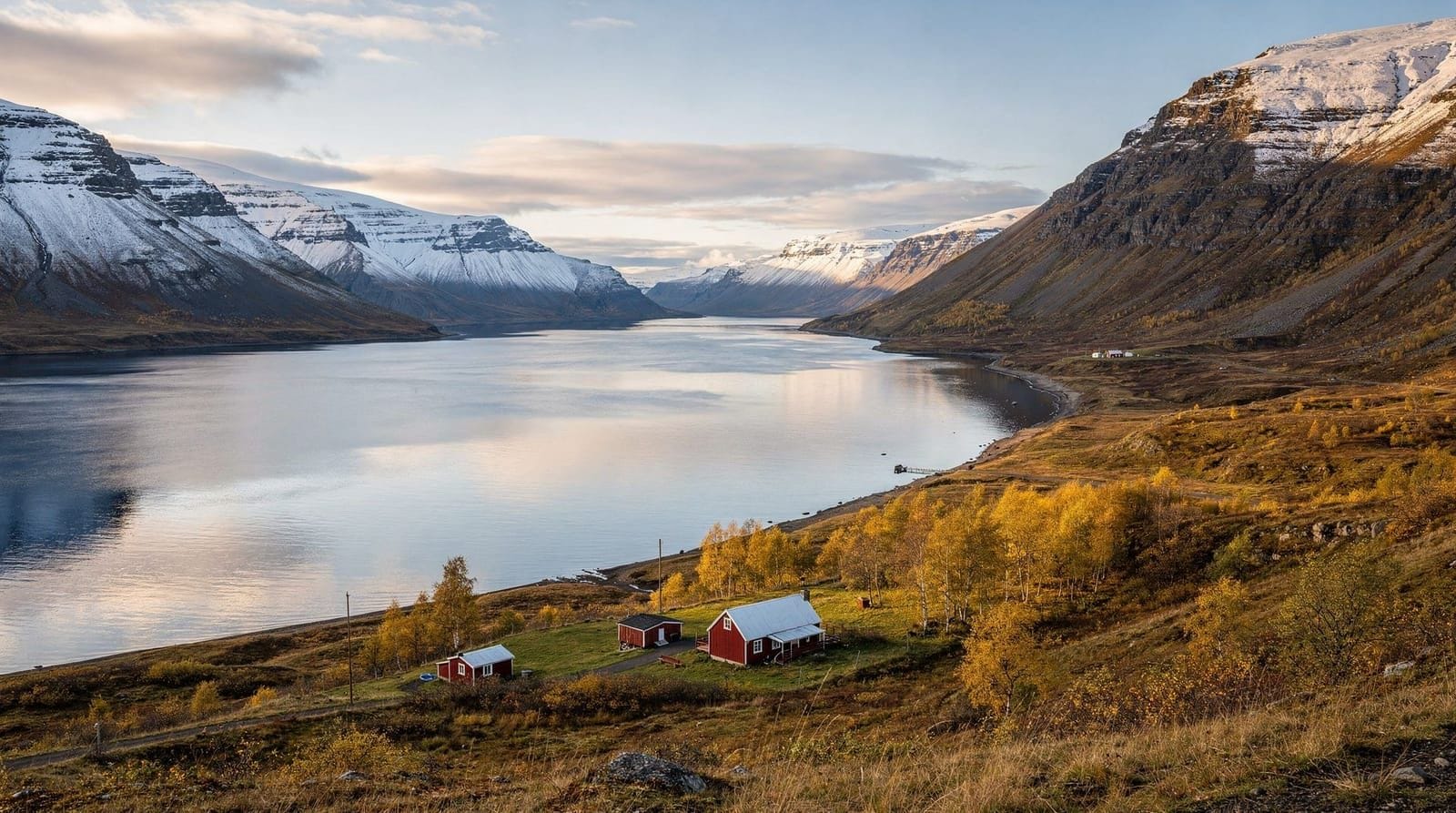
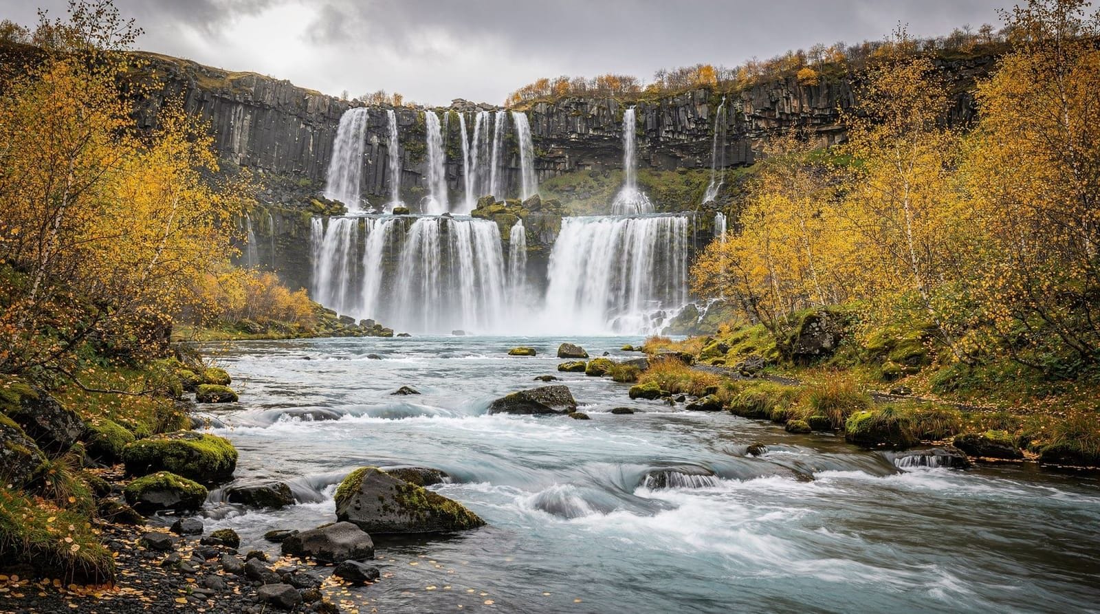
Akureyri: Diamond Circle waterfalls craters full day
Duration: 8 hours, with lunch
Quick facts
- Best time
- Jun–Aug for hiking; Apr and Sep for solitude
- Days needed
- 2–4 hours
- Getting there
- 35 km south of Húsavík via Route 85, ~30 min drive
- Budget per day
- Free entry; fuel cost the main expense
Ásbyrgi is a horseshoe-shaped depression 3.5 km long, 1 km wide, and up to 100 metres deep, surrounded on three sides by vertical basalt cliffs. The floor is flat and covered in dense birch forest, willow scrub, and ponds — a surprising green enclosure in an otherwise open volcanic landscape. A rock island called Eyjan (“the island”) rises from the centre of the canyon floor, dividing the interior. Trails climb the canyon rim and explore the floor; the full circuit takes 2–4 hours.
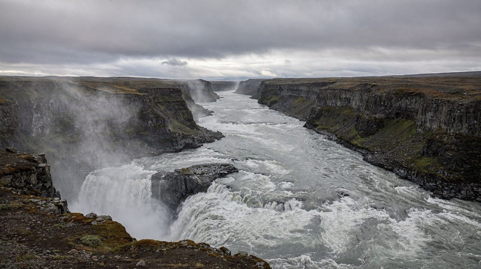
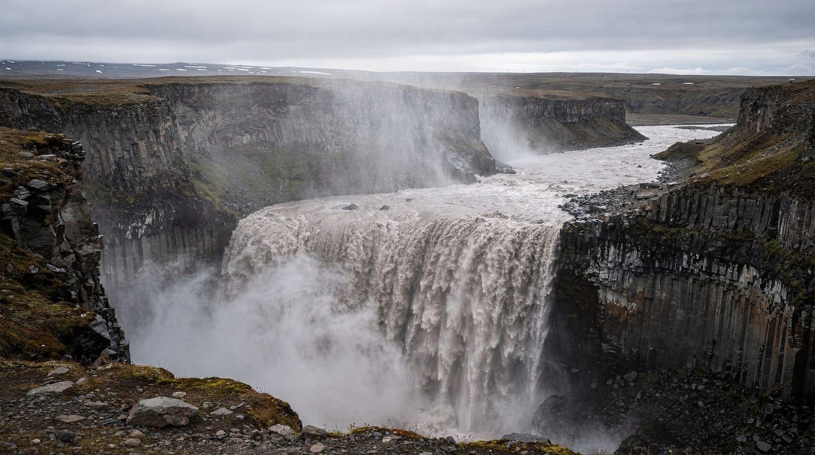
Ásbyrgi is in the northern section of Vatnajökull National Park and sits at the northern end of the Jökulsárgljúfur canyon system that contains Dettifoss 30 km to the south. The canyon was carved by catastrophic jökulhlaup (glacier outburst floods) in the last 10,000 years — the most recent major flood event was around 2,500 years ago.
The mythology
Icelandic tradition holds that Ásbyrgi is the hoof print of Sleipnir, the eight-legged horse of the god Óðinn, made when the horse briefly touched the ground during a flight. The horseshoe shape supports the story enough that it persisted in local lore for centuries. The geological explanation — a catastrophic flood that carved the canyon walls in a matter of hours — is, if anything, more dramatic.
The name Ásbyrgi translates roughly as “shelter of the Æsir gods.” The site is considered sacred in the Ásatrú tradition, the modern revival of Norse paganism.
Hiking trails
Botnstjörn pond (20–30 minutes)
The most accessible short walk from the main car park leads to Botnstjörn, a small lake at the southern end of the canyon floor. The trail passes through birch forest and willow scrub. The pond attracts ducks and waders, and the cliff reflection makes it one of the more photographed spots inside the canyon. Flat, easy terrain.
Eyjan circuit (1–1.5 hours)
The rock island Eyjan can be circumnavigated on a trail that loops around its base, partly along the cliff edges. The island is about 500 metres long and 40 metres high. Views from the island’s flat top (accessible by a marked path) look across the canyon floor to the surrounding walls.
Canyon rim trail (2–4 hours full circuit)
A longer trail climbs to the canyon rim and follows the edge of the horseshoe, giving elevated views into the interior. The eastern rim gives the clearest perspective on the horseshoe shape from above. The trail involves some elevation gain and loose gravel in places; good footwear recommended. This trail is the best way to understand the scale and shape of Ásbyrgi.
Connection to Dettifoss (Jökulsárgljúfur trail)
A multi-day walking route runs from Ásbyrgi south through the canyon to Dettifoss — approximately 30 km, typically done over two days. There are campsites along the route. This is one of the more dramatic long-distance walks in North Iceland and sees far fewer people than comparable routes in the south.
Visitor centre and facilities
Ásbyrgi has a National Park visitor centre at the canyon entrance. It has exhibits on the canyon’s geology, wildlife, and history, plus toilets, maps, and staff who can advise on trail conditions. A campsite nearby costs around 2,200 ISK (€15) per person per night. No food is sold at the visitor centre; the nearest cafés are in Húsavík (35 km north) or along Route 85.
Entry to Ásbyrgi and the National Park is free.
Wildlife
The birch forest on the canyon floor supports a range of birds: redwing, whooper swan, arctic tern, and red-necked phalarope are all recorded. Ásbyrgi is sheltered from wind by its walls, making it warmer and greener than the surrounding landscape. Arctic fox can occasionally be seen; geese and ducks are regular on Botnstjörn.
Getting to Ásbyrgi
From Húsavík: South on Route 85 for 35 km; approximately 30 minutes. The canyon entrance is signed off Route 85 on the right.
From Dettifoss (east bank, Route 864): North on Route 864 for approximately 25 km, then join Route 85 north for a further 5 km. Allow 30–40 minutes; Route 864 is gravel and can be rough.
From Dettifoss (west bank, Route 862): Return to the Ring Road, head east to Route 85 junction, then north on Route 85 to Ásbyrgi. Approximately 55 km, 50 minutes.
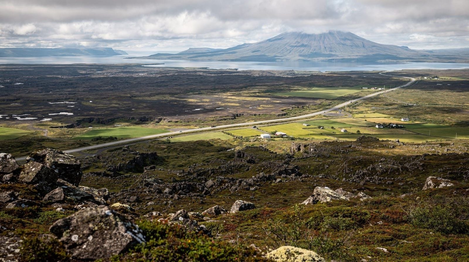
From Akureyri: Via the Ring Road east and Route 85 north, approximately 200 km, 2.5 hours. Most visitors reach Ásbyrgi as part of the Diamond Circle rather than as a standalone trip from Akureyri.
Diamond Circle tour from Akureyri — Dettifoss, Ásbyrgi, Húsavík, and Goðafoss.
Ásbyrgi in the Diamond Circle
Ásbyrgi is the northernmost point of the Diamond Circle route. A typical Diamond Circle day from Akureyri runs: Goðafoss, Mývatn, Dettifoss, Ásbyrgi, Húsavík, return to Akureyri. Ásbyrgi fits naturally between Dettifoss (coming from the south) and Húsavík (35 km north). A 2-hour visit to the canyon — the Botnstjörn pond, the Eyjan loop, and a short climb to the rim — is realistic within a full Diamond Circle day.
For a more relaxed pace, staying overnight near Ásbyrgi or in Húsavík and returning to the canyon in the morning when it is quiet is worth considering.
Full-day Diamond Circle from Akureyri — 8-hour tour, lunch included.
Practical notes
Facilities: Visitor centre, toilets, campsite. No cafés or food at the canyon itself.
Weather: The canyon walls provide some wind shelter, making Ásbyrgi warmer and more sheltered than the open landscape outside. Rain can make the rim trails slippery.
Dogs: Allowed in the campsite area and on some trails; check at the visitor centre for current restrictions within the National Park.
Winter: Ásbyrgi is accessible year-round by car. The main access road (Route 85) is ploughed. Trails inside the canyon can be icy and some may be closed in winter.
Frequently asked questions about Ásbyrgi
How was Ásbyrgi formed?
The current scientific explanation is that Ásbyrgi was carved by multiple catastrophic jökulhlaup (glacier outburst floods) from the Vatnajökull glacier via the Jökulsá á Fjöllum river. These floods, some carrying 200–300 times the river’s current volume, eroded the basalt in relatively short periods. The most recent major formation event was approximately 2,500 years ago. The horseshoe shape results from the flood undercutting and collapsing the canyon walls from two sides.
Is Ásbyrgi worth visiting compared to Dettifoss?
They are completely different experiences. Dettifoss is raw power — loud, wet, overwhelming. Ásbyrgi is quiet, green, intimate, and geological in a subtle way. Both are within 30 km of each other and easily combined. If you are on the Diamond Circle route, there is no reason to skip either.
Can you camp inside Ásbyrgi?
Yes, there is a designated campsite at the canyon entrance, operated by Vatnajökull National Park. The rate is approximately 2,200 ISK (€15) per person per night. Basic facilities; toilets and showers. Book ahead for July and August. Wild camping within the canyon floor is not permitted.
Are there any guided hikes in Ásbyrgi?
Guided geology and nature walks are offered occasionally by the National Park visitor centre, typically during July and August. Check the Vatnajökull National Park website or visit the visitor centre for current schedules. Organised Diamond Circle tours that include Ásbyrgi generally spend 1–2 hours at the canyon, which is enough for the main floor trails.
Is Ásbyrgi easy to hike?
The main valley floor trails (Botnstjörn pond, Eyjan circuit) are easy and accessible to most visitors — flat terrain, well-marked paths. The canyon rim trails involve more elevation and uneven ground. None of the main trails require technical equipment in summer. Winter hiking on the rim requires ice grips on your footwear.
What animals live in Ásbyrgi?
The sheltered birch forest supports whooper swans, various duck species, snipe, redwing, and wader birds. Arctic fox is occasionally sighted. Mink (an invasive species) are also present in the area. The ponds are home to Arctic char. The canyon is a notable botanical site — over 30 species of plants found here are uncommon in North Iceland due to the sheltered, warmer microclimate.
Ásbyrgi as a night stop
Staying overnight at Ásbyrgi campsite transforms the experience. The canyon is at its quietest in the early morning — tour coaches typically arrive around 11am and leave by 3pm. A morning walk on the rim trail in the 5–7am window in summer means near-solitude and golden horizontal light on the basalt walls. If you are driving the Diamond Circle over two days, the campsite at Ásbyrgi is a practical overnight before a morning in Húsavík. Shower facilities are basic; the site is well-maintained.
The campsite is inside the National Park boundary, so quiet hours are enforced and generators are prohibited at night.
Flora of the canyon
Ásbyrgi’s microclimate — sheltered from wind, marginally warmer than the surrounding landscape due to the cliff trap effect — supports plants that are rare elsewhere in North Iceland. The birch forest (Betula pubescens) is unusually dense for this latitude; some trees reach 4–5 metres, compared to the typical knee-high scrub of the open highlands. Angelica (Angelica archangelica), a tall-stemmed herb native to the region, grows along the path edges and reaches shoulder height by July. The ponds have water crowfoot (Ranunculus aquatilis) and water horsetail.
The National Park protects this flora; plant collection is prohibited. Trampling off the paths damages the moss cover, which is slow to recover in cold climates.
Hljóðaklettar and the canyon trail south
Approximately 10 km south of Ásbyrgi (by road, via Route 85 and Route 862/864) is the Hljóðaklettar area — “echo rocks” — a cluster of basalt columns and alcoves with unusual acoustic properties. Clapping or shouting near the curved basalt faces creates clear echoes. The formations here are among the most visually striking columnar basalt in Iceland. A short loop trail takes 30–45 minutes. The Vesturdalur campsite nearby is the starting/end point for the canyon trail to Dettifoss.
Geological context: why Ásbyrgi is horseshoe-shaped
The horseshoe shape of Ásbyrgi is the direct result of how jökulhlaup floods erode. When a catastrophic flood travels down the Jökulsá á Fjöllum, the water does not simply push straight forward — it undercuts and collapses the canyon walls sideways as well as vertically. Where a meander or obstacle forces the flood to split and rejoin, it carves the surrounding rock on both sides simultaneously, leaving the central rock as an island (in this case, Eyjan). The geometry of a meandering channel creates the horseshoe.
Detailed studies of the canyon using aerial photography and radiocarbon dating of flood deposits have identified at least three major flood episodes in the last 10,000 years, each contributed to the current shape.
Nearby: Kelduhverfi wetlands
North of Ásbyrgi on Route 85, the Kelduhverfi wetland area is a system of marsh and shallow lakes created by glacial drainage. Whooper swans, greylags, and various ducks breed here in summer. There is no formal visitor infrastructure, but the road passes through the wetland and roadside observation is possible. This is one of the most productive birdwatching areas in North Iceland in June and July.
Getting to Ásbyrgi from Mývatn or Egilsstaðir
From Lake Mývatn the most direct route is Route 1 east to the Dettifoss junction, north on Route 862 to Dettifoss, then Route 864 north to Route 85 north to Ásbyrgi — approximately 90 km, 1.5 hours. This route allows both Dettifoss and Ásbyrgi in one sweep.
From Egilsstaðir (East Iceland), follow the Ring Road north and west through the northeast corner, approximately 180 km, 2–2.5 hours. The Ring Road in this section passes through Öxarfjörður near the coast before turning south; Ásbyrgi is signed off Route 85.
For the full Ring Road self-drive guide, including how to structure a clockwise or anti-clockwise route that includes the north properly, see the dedicated planning guide.
Ásbyrgi visitor tips summary
A few practical points that come up repeatedly for visitors:
Start early. The canyon opens 24 hours but the visitor centre and toilets open at 9am. Tour buses typically arrive around 10–11am from Húsavík or Akureyri. The hour after sunrise (roughly 4:30am in June) is the best for photography — the cliff faces light from the northeast and the canyon floor is in deep shadow, creating dramatic contrast.
The east rim walk is underused. Most visitors do the flat floor trails (Botnstjörn, Eyjan) and miss the rim. The 1.5-hour east rim circuit gives the full horseshoe view from above. It requires moderate fitness and decent footwear; the reward is a perspective unavailable from the floor.
Bring lunch. The nearest café is in Húsavík (35 km). The campsite has no food service. If you plan a half-day at Ásbyrgi, pack food.
Weather window matters. Ásbyrgi’s cliffs block direct wind but not rain. The canyon floor can become muddy quickly in heavy rain, and the rim trails are slippery. A good weather window makes the difference between an excellent experience and a difficult one.
The Jökulsárgljúfur trail registration. If doing the multi-day trail to Dettifoss, register your plans at the visitor centre or online at the Vatnajökull National Park website. Emergency response in this canyon is slow; letting someone know your plans is basic safety.
Combining Ásbyrgi with the northeast coast
The northeast corner of Iceland, between Ásbyrgi and the Ring Road’s eastern section, is among the least-visited parts of the country. Route 85 from Ásbyrgi north and east through Kópasker and Raufarhöfn passes through small fishing villages and open coastal moorland. Raufarhöfn (350 people) is notable for the Arctic Henge — a large modern stone circle installation inspired by Norse mythology, positioned on the hillside above the village. The drive adds 2–3 hours to a route from Ásbyrgi back toward the Ring Road but is practically uncrowded and representative of Iceland before tourism became the main industry.
This northeast coastal route eventually rejoins the Ring Road near Vopnafjörður, making it a viable alternative to backtracking through Mývatn for Ring Road travellers on a clockwise route.
Top experiences
Bookable activities with verified prices and instant confirmation on GetYourGuide.
Top-rated experiences in Ásbyrgi travel guide
Best-rated activities across GetYourGuide and Viator.

Whale Watching from Downtown Akureyri
- Viator

Big Whales & Puffins RIB boat tour from Húsavík
- Viator

East Glacial River – Grade 4 Rafting with Drysuits, North Iceland
- Viator

Top-Rated Family Rafting – Drysuits & Geothermal Hot Cocoa
- Viator

Original Big Whale Safari & Puffins Speedboat Tour from Húsavík
- Viator

Lake Myvatn Day Tour and Godafoss Waterfall for Cruise Ships from Akureyri Port
- Viator