Vatnajökull National Park — Europe's largest national park
Complete guide to Vatnajökull National Park — ice caves, glacier hikes, Skaftafell, Jökulsárlón, Askja, and how to explore 14% of Iceland responsibly.
Jokulsarlon: Vatnajokull Blue ice cave guided tour
Quick facts
- Best time
- June–Sep for hiking; Oct–Mar for ice caves; Aug for all-in-one
- Days needed
- 2–5 (south only); full park requires 7+
- Getting there
- Skaftafell entrance: ~3h 45min from Reykjavík (320 km east)
- Budget per day
- Park entry free; guided tours 12,000–28,000 ISK / €78–185
Vatnajökull National Park is the largest national park in Europe, covering approximately 14,100 square kilometres — just over 14% of Iceland’s total landmass. It was established in its current form in 2008 by merging the former Skaftafell National Park in the south with the Jökulsárgljúfur National Park in the north, connecting them via the protected zone over the Vatnajökull ice cap.
At the park’s centre sits Vatnajökull itself, Europe’s largest glacier by volume (approximately 3,100 cubic kilometres of ice). The glacier sits atop multiple active volcanoes — Grímsvötn, Bárðarbunga, Öræfajökull — making the park an active geological system, not a static landscape. The interplay of fire and ice here is not metaphor; it is geology happening in real time.
Park zones and access points
The park is enormous and most visitors access only the southern section, organised around two main hubs:
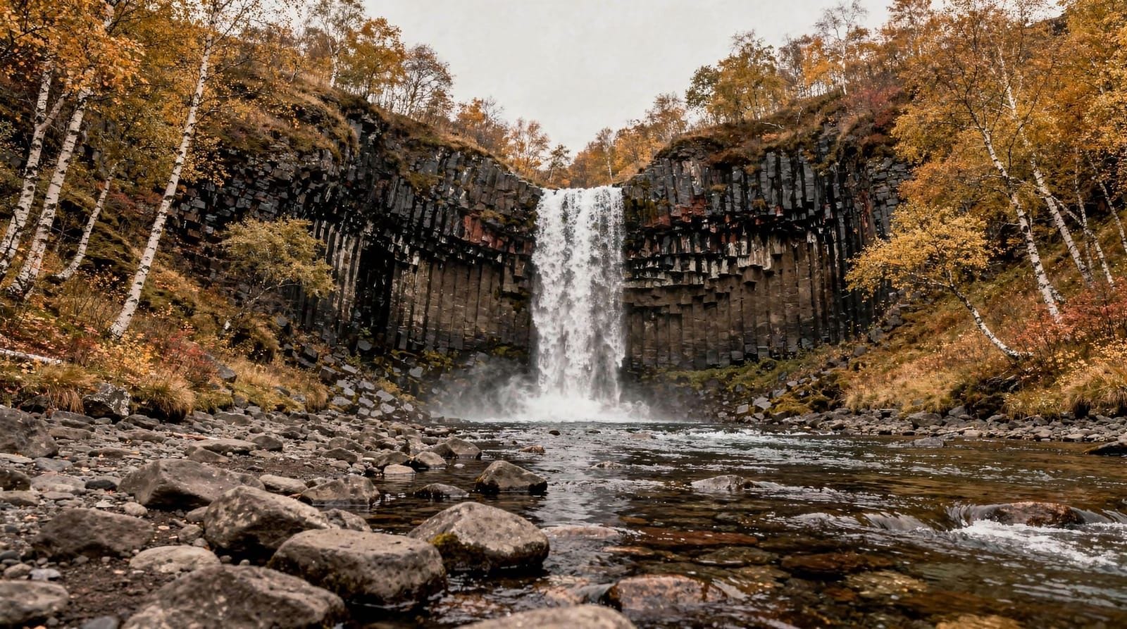
Skaftafell (south-west entrance): The original national park area with developed infrastructure — visitor centre, camping, marked trails, and the primary glacier hiking area. See the dedicated Skaftafell destination page for full detail.
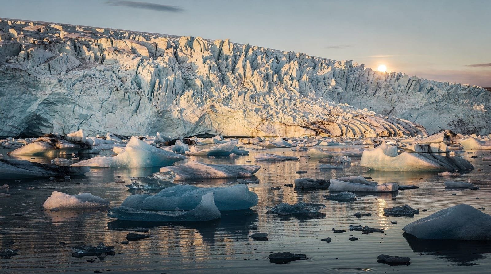
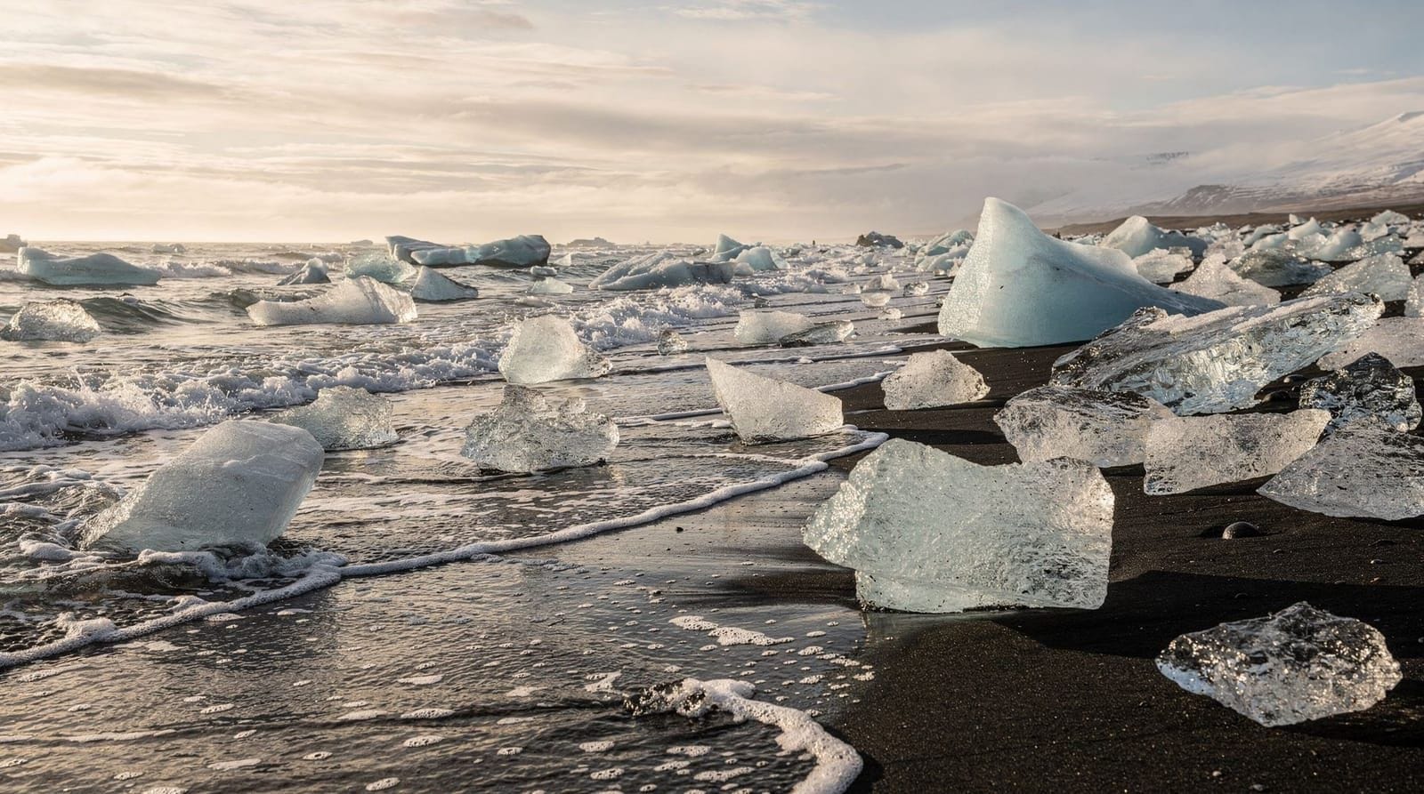
Jökulsárlón (south-east): The glacier lagoon and its associated ice cave tours, sitting at the park’s south-eastern edge. See the Jökulsárlón page for the lagoon and Diamond Beach for the adjacent ice beach.
Northern section (Jökulsárgljúfur): Accessed from the north, this area contains Dettifoss and Ásbyrgi canyon — covered in the North Iceland section of this site. It is not practically accessible from the south in a single day.
Highland interior: The central highlands above the Vatnajökull ice cap include the Askja caldera and the Kerlingarfjöll area. These are summer-only destinations accessible only by F-roads (4WD mandatory) and are closed typically from October to June. See the F-roads Iceland guide for detail.
The Vatnajökull ice cap
The glacier is 950 metres thick at its deepest point and sits at an average elevation of 1,000–1,100 metres. Numerous outlet glaciers descend from the ice cap into surrounding valleys — the most visited in the south being Falljökull and Skaftafellsjökull (at Skaftafell) and Breiðamerkurjökull (calving into Jökulsárlón).
The ice cap is also where four of Iceland’s most active volcanic systems are buried under the ice. Grímsvötn last erupted significantly in 2011 — the eruption punched through 300 metres of glacial ice and created a volcanic column visible from Reykjavík. Öræfajökull, in the south-east corner of the park, has Iceland’s highest point (Hvannadalshnjúkur at 2,110 metres) and is considered potentially hazardous; its last major eruption in 1727 destroyed several farms.
Visitors do not need to be concerned about volcanic activity on a typical visit, but the Icelandic Meteorological Office and SafeTravel (safetravel.is) provide current volcanic status information.
Ice caves — the winter highlight
The ice cave tours operating in winter are the single most spectacular experience available in the park. Natural caves form within the glacier where meltwater channels have carved cavities; in winter, when melt stops, these caves stabilise and can be safely entered with guides.
The most accessible ice caves are at the Jökulsárlón end of the park, where super-jeep operators drive tour groups from the lagoon car park onto the glacier surface and into the caves. The interior ice — pressed glacial ice hundreds of years old — has an intense cyan-blue colour caused by the total absence of air bubbles and the way ice molecules absorb red wavelengths and scatter blue.
Vatnajökull blue ice cave tour — super-jeep from Jökulsárlón, small group, experienced glacier guidesIce cave access is seasonal: caves are accessible from roughly October to late March. The caves are dynamic — they change form as the glacier moves, and access points shift slightly each winter. There is no permanent cave in a fixed location; tour operators scout and assess cave conditions each season.
Cost: 20,000–28,000 ISK (€130–185) per person for a standard half-day tour from the lagoon. Premium tours with smaller groups or specialised photography conditions cost more.
Booking: Book several weeks ahead in December–February, when demand consistently exceeds availability. March tours are sometimes easier to book at shorter notice.
The Skaftafell area also has ice cave access via Falljökull, though the caves here are smaller and less consistently accessible than those at the Jökulsárlón end of the park.
Skaftafell blue ice cave and glacier hike — combines surface hiking with ice cave entry, from the Skaftafell visitor centreSummer hiking and the highland routes
In summer, the park’s trail network opens fully. Beyond the developed trails at Skaftafell, the park includes:
Öræfajökull circuit: A multi-day route around the Öræfajökull volcano, including ascents to the ice cap rim. Requires experience, navigation skills, and good equipment. Not suitable for casual hikers.
Lónsöræfi reserve: In the south-east of the park, a remote and lightly visited area of rhyolite peaks and river valleys accessible by 4WD from Route 1. Increasingly popular for multi-day trekking.
Askja and the central highlands: Accessible in summer only by F-roads (4WD mandatory). The Askja caldera with its volcanic lake (Öskjuvatn) and the nearby Víti geothermal crater are the main attractions. See the hiking in Iceland guide for the full picture.
For most visitors with limited time, the Skaftafell trail network is the most accessible introduction to the park’s walking opportunities without requiring specialist skills or equipment.
Wildlife in the park
The park protects significant populations of:
Arctic foxes — Iceland’s only native land mammal. Present year-round in remote sections, occasionally seen near the Skaftafell woodlands.
Reindeer — introduced in the 18th century from Norway, now wild and found throughout the eastern section of the park. Commonly seen near the highland roads east of Skaftafell.
Ptarmigan — white in winter, brown in summer. Common on the moorland above the treeline throughout the park.
Gyrfalcon — Iceland has the world’s largest population. Nest on cliff faces throughout the park; present year-round.
The park is not a safari-style wildlife destination; the landscape is the primary draw, with wildlife sightings a bonus rather than a guarantee.
Practical planning for the park
Entry: The park has no entrance gate or fee. Most designated viewpoints and car parks are free. The visitor centres at Skaftafell and in the north (Ásbyrgi) charge no entry fee.
Accommodation inside the park: Camping at Skaftafell (bookable, approximately 1,800 ISK / €12 per person). No hotels inside the park proper. The nearest accommodation to the south gate is at Kirkjubæjarklaustur (50 km west of Skaftafell) or at farmstays in the Öræfi area.
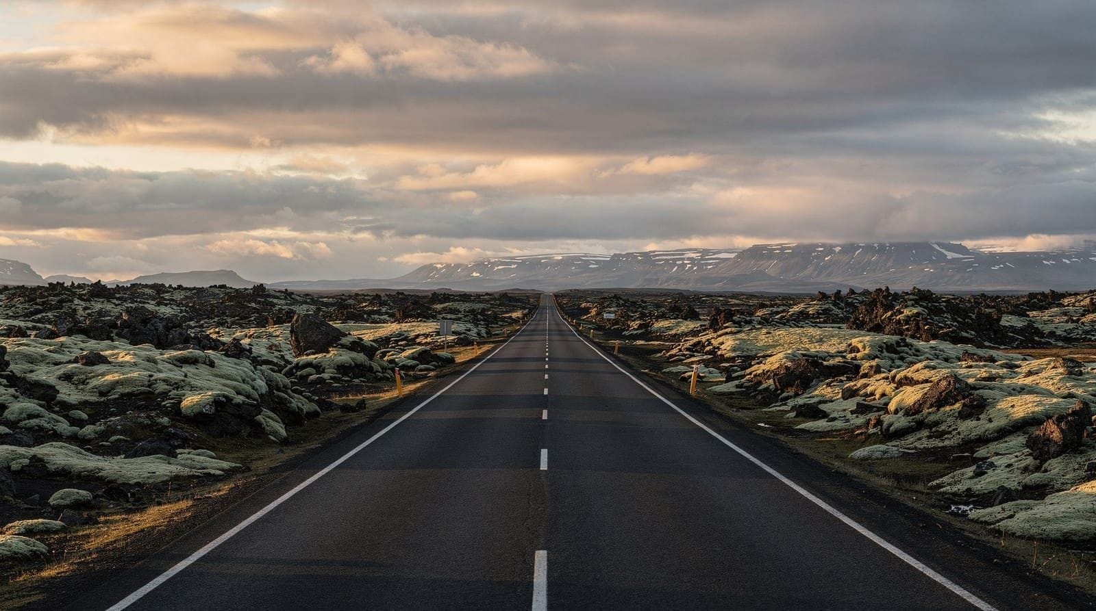
Road conditions: Route 1 through the southern park is fully paved and maintained year-round. F-roads into the highland interior are open approximately June to mid-October depending on snow. Check vegagerdin.is for current F-road status before any highland trip.
Emergency services: The park is covered by Safetravel.is monitoring. Register your trip plan on safetravel.is before any multi-day route in the highlands. Mobile coverage is present at main roadside sites but absent in the highland interior.
The park’s two faces: south and north
The experience of Vatnajökull National Park differs dramatically depending on which section you visit. The southern section — around Skaftafell and Jökulsárlón — is accessible by paved road year-round, is Iceland’s most-visited national park area, and offers glacier hikes, ice caves, and the Diamond Beach. Infrastructure exists: visitor centres, camping, tour operators, a café.
The northern section (Jökulsárgljúfur) — containing Dettifoss waterfall and Ásbyrgi canyon — is accessed from North Iceland via the Diamond Circle route. It is wilder, less visited, and separated from the southern section by approximately 350 km of road around the east coast. The north and south sections are not accessible to each other across the ice cap; you drive around it, not over it.
The ice cap itself is inaccessible to standard visitors. The Langjökull glacier (separate from Vatnajökull) in West Iceland has a tunnel built through it for visitors, but Vatnajökull access is only possible on guided tours for the southern glacier tongues and ice caves. There are no public snowcat tours of the main ice cap surface.
Photography in the park: beyond the obvious shots
The Skaftafell-Jökulsárlón corridor is among the most photographed landscapes in Iceland. The standard shots — wide-angle lagoon with iceberg, basalt-columns-beside-falls at Svartifoss, glacial blue ice cave interior — appear constantly. Here are angles most visitors miss:
The glacier margin at dusk: The moraine ridges left by the glacier’s retreat since 1890 form a series of grey-brown ridges with the glacier behind them. In the low-angle light of a summer evening, these ridges cast long shadows and the glacier ice is lit from the side — a composition that reads as more geological and less tourist-postcard than the standard lagoon shot.
The sandur from above: The outwash plain between Skaftafell and the coast is vast and strange — braided grey rivers, black sand, and the occasionally visible former bridge supports from the 1996 flood. The Route 1 elevation gives limited perspective; driving the small side road toward the coast gives a better view of the scale.
Reindeer: East of Skaftafell along Route 1, reindeer are commonly seen in small groups crossing the road or grazing near the river flats. Evening is the most likely time; patience at a pull-off with a telephoto lens (300mm+) will usually produce an encounter.
The aurora over the lagoon: Covered in the Jökulsárlón section — the combination of the reflective lagoon surface and the ice pieces provides a distinctive foreground that separates a lagoon aurora shot from the generic “green sky over black landscape.”
Park management and visitor pressure
Vatnajökull National Park receives approximately 1.5 million visitors per year at its main sites, the vast majority concentrated at Skaftafell and Jökulsárlón. This creates real pressure on the infrastructure, the glacier surfaces, and the surrounding landscape.
The park authority operates under a management plan that limits certain high-impact activities, regulates drone use (permit required in most zones), and prohibits off-road driving throughout. Drones require a permit from the Environment Agency (ust.is) regardless of the drone’s weight — casual drone use is not permitted.
The campsite at Skaftafell books up weeks in advance in July and August. If you intend to camp, book through the national park website as soon as your trip dates are confirmed.
How to combine the park with the rest of South Iceland
The southern park section slots naturally into the ring road guide or the south coast glaciers 4-day itinerary:
- Days 1–2: Waterfalls and Vík (western South Coast)
- Days 3–4: Skaftafell glacier hiking, Jökulsárlón lagoon, Diamond Beach, ice cave (winter) or kayaking (summer)
- Day 5: East Iceland / Ring Road continuation
This sequence gives the southern section of Vatnajökull National Park proper time without rushing. The 7-day Ring Road itinerary passes through the park as a full day’s dedicated stop.
Frequently asked questions about Vatnajökull National Park
How large is Vatnajökull National Park?
14,100 square kilometres — roughly the size of Yorkshire in England, or larger than the state of Connecticut. It covers 14% of Iceland’s total area and is the largest national park in Europe.
Do you need to pay to enter Vatnajökull National Park?
No. There is no entry fee for the park. Organised tours (glacier hikes, ice cave tours) run by private operators have their own pricing, but access to the park itself — walking trails, viewpoints, visitor centres — is free.
What is the best time to visit Vatnajökull National Park?
It depends on what you want to do. Summer (June–September) for hiking, wildflowers, and 24-hour daylight. Winter (October–March) for ice caves, Northern Lights, and dramatic landscape photography. August is the most popular month because it combines reasonable weather with the possibility of both glacier hiking (surface) and the beginning of ice cave season.
Are the ice caves in Vatnajökull safe?
Yes, when accessed on a guided tour with a licensed operator. The guides assess cave stability daily and will cancel or reroute if conditions are unsafe. Never enter an ice cave independently — the caves are dynamic and unstable without guides who know the current conditions.
How do I get to Vatnajökull National Park from Reykjavík?
Drive Route 1 east for approximately 320 km (about 3h 45min) to reach the Skaftafell entrance in the park’s south-western section. The park has no direct public transport; car or guided tour are the practical options.
Can I see the Northern Lights from within the park?
Yes — the southern park area around Jökulsárlón is excellent for aurora viewing due to very low light pollution. The glacier lagoon’s reflective surface creates the possibility of double aurora images (aurora in sky and reflected in the lagoon). Season is September to March; peak months for aurora activity are October and February-March.
Is a 4WD vehicle necessary for the park?
For the southern section (Skaftafell and Jökulsárlón area) — no, a standard 2WD is sufficient, as Route 1 is fully paved. For the highland interior and F-roads — yes, a 4WD is mandatory and legally required. Driving an F-road in a 2WD vehicle will void your rental insurance entirely and may cause serious damage in river crossings.
Top experiences
Bookable activities with verified prices and instant confirmation on GetYourGuide.

Jokulsarlon: Vatnajokull Blue ice cave guided tour
Jokulsarlon: Original ice cave Vatnajokull
Jokulsarlon: Vatnajokull natural ice cave tour
Vatnajokull National Park: Skaftafell Blue ice cave Glacier hike
Vatnajokull National Park: Skaftafell Blue ice Glacier hike easy
Iceland: Vatnajokull Skaftafell Glacier hike
Top-rated experiences in Vatnajökull National Park — Europe's largest national park
Best-rated activities across GetYourGuide and Viator.