South Iceland — waterfalls, glaciers, and black sand beaches
Plan your South Iceland trip: waterfalls, glaciers, black sand beaches, and the Golden Circle. Driving times, costs in ISK and EUR, and honest advice.
Reykjavik: South Coast black Beach waterfalls full day
Quick facts
- Best time to visit
- June to August for weather; October to March for aurora and ice caves
- Days needed
- 3 to 5 days (more if including Vatnajökull)
- Getting there
- Reykjavík to Vík is 187 km (~2.5 hrs on Ring Road 1); Jökulsárlón 378 km (~4.5 hrs)
- Budget per day
- ISK 18,000–30,000 / EUR 120–200 (accommodation + food + fuel)
Iceland’s most-travelled corridor
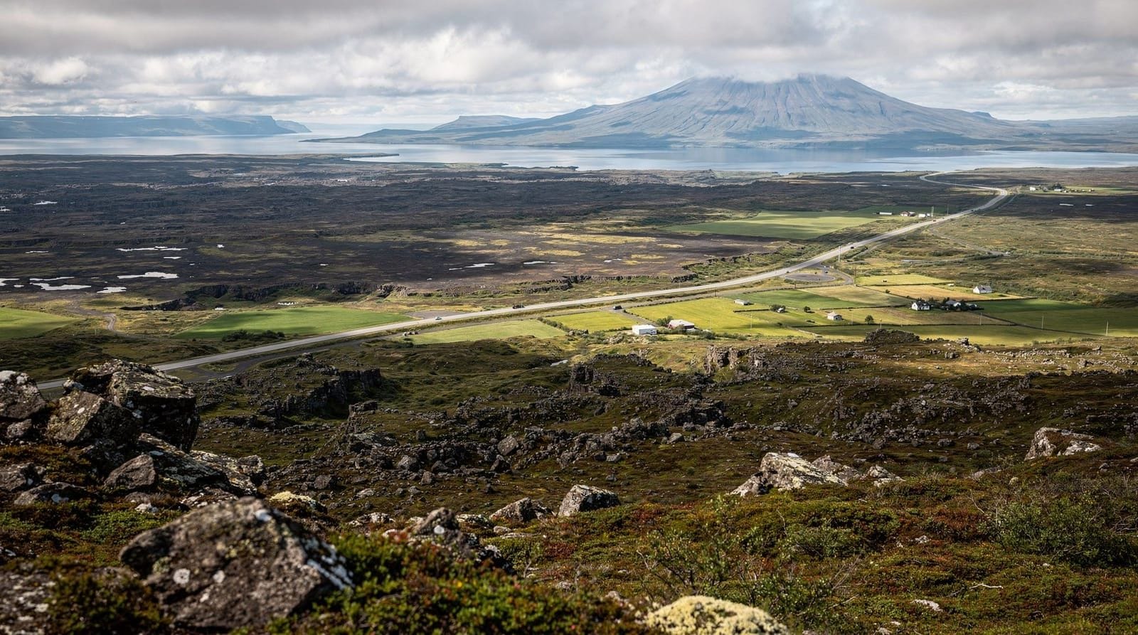
South Iceland is the country’s most accessible and most visited region — a 400-kilometre stretch of Ring Road between Reykjavík and the Vatnajökull glacier belt that concentrates an extraordinary amount of Iceland’s signature scenery into a single driveable route. Waterfall after waterfall, a black sand coastline backed by dramatic sea stacks, glacier tongues reaching down to flat farmland, and the immense white dome of Vatnajökull (Europe’s largest glacier by volume) in the distance.
Most visitors to Iceland spend at least part of their time here. The Golden Circle — Þingvellir, Geysir, and Gullfoss — lies in the western part of the south and is covered in its own guide. This page covers the broader region from Hveragerði east to Jökulsárlón, including the South Coast waterfalls, Vík, and the glacier-fringe around Skaftafell.
The region works well both on guided day trips from Reykjavík and as a self-drive itinerary. Guided tours from the capital handle the 2.5–4 hour return journey and are genuinely convenient for those without a car. But driving it yourself — even in a 2WD — allows you to stop at the dozens of smaller waterfalls and viewpoints that tour buses cannot accommodate.
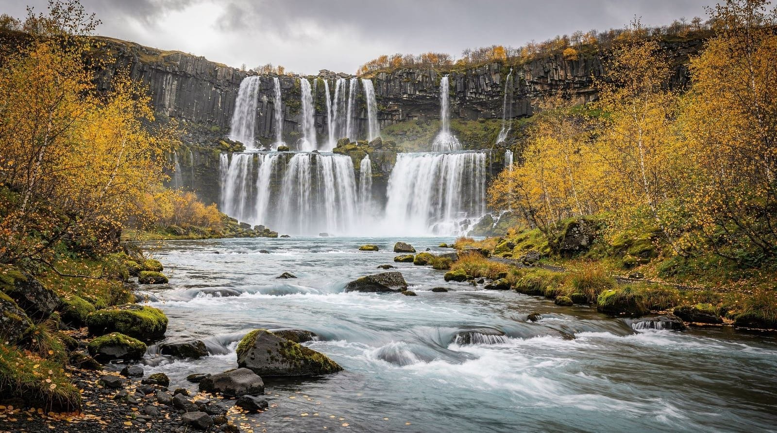
The South Coast waterfalls: Seljalandsfoss and Skógafoss
The first major landmark heading east is Seljalandsfoss, 121 km from Reykjavík (about 1.5 hours). A narrow path runs behind the 60-metre curtain of water, giving a dramatic perspective from inside the waterfall itself. The path is wet — waterproof jacket required — and icy in winter. Nearby Gljúfrabúi, hidden in a narrow canyon just 500 metres away, is far less crowded and genuinely impressive; you wade briefly through shallow water to enter the slot canyon.
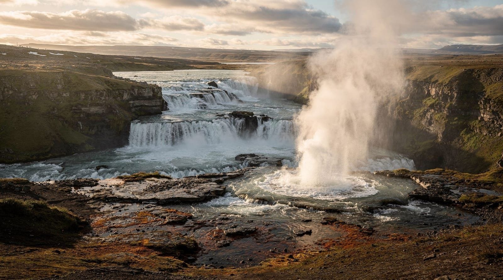
Skógafoss is 30 kilometres further east and a different scale entirely — 25 metres wide and 60 metres tall, generating a persistent mist. You can climb 527 steps to a viewing platform at the top, where the river stretches away toward the Mýrdalsjökull icecap. Sunrise here, when light catches the mist, is one of the most-photographed scenes in Iceland. Admission is free; parking costs ISK 1,000 (EUR 7).
South Coast full day tour from Reykjavík — waterfalls, black beach, glacier — this is the standard guided day trip format covering Seljalandsfoss, Skógafoss, Reynisfjara, and the Vík area. Around ISK 13,000–16,000 (EUR 85–110). Good value if you lack a car; the bus handles the 4-hour round driving so you see maximum scenery.
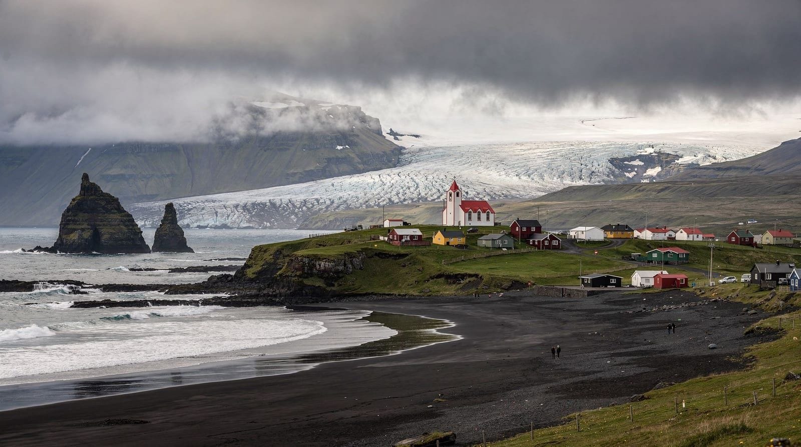
Reynisfjara and Vík
Reynisfjara is the black sand beach south of Vík, 187 km from Reykjavík. The basalt column formations (Reynisdrangar sea stacks standing offshore) and the hexagonal column cliffs are the visual result of lava cooling into geometric forms over millennia. The beach is photogenic and genuinely impressive — but dangerous. Sneaker waves strike without warning and can knock adults off their feet; multiple tourists have died here. The wave warning signs are serious, not decorative.
Vík village (pop. ~1,000) is the southernmost settlement in Iceland and a useful base for the eastern South Coast. The yellow church above the village offers views over the entire headland. Accommodation fills up in summer — book well ahead or expect to drive further east.
Sólheimajökull and glacier hiking
Between Skógafoss and Vík, Sólheimajökull glacier sits 4 km off Ring Road 1. The access road is paved and reaches a car park with a clear view of the glacier snout. Sólheimajökull is a tongue of the Mýrdalsjökull icecap and one of Iceland’s most accessible glaciers — you can walk to within 50 metres of the ice on your own. But the surface is severely crevassed in places; guided glacier hikes are strongly recommended over free exploration.
Sólheimajökull glacier hike from Reykjavík — ISK 17,000–22,000 (EUR 110–145), including transport from Reykjavík, crampons, and a guided 2–3 hour walk on the ice. This is the entry-level glacier experience and is suitable for most fitness levels.
The glacier has retreated significantly in the past 30 years — photographs from the 1990s show the snout roughly 300 metres further forward than today. The retreat is visible and verifiable on site.
Fjaðrárgljúfur canyon
Fjaðrárgljúfur canyon, 8 km north of Kirkjubæjarklaustur, is one of the most striking geological features in the south — a 2-kilometre canyon up to 100 metres deep, carved by glacial meltwater into soft palagonite tuff. The canyon rim path (2 km loop) gives views down into the turquoise river running between sheer walls. There is no admission fee; parking is ISK 700 (EUR 5). Access by 2WD sedan is fine.
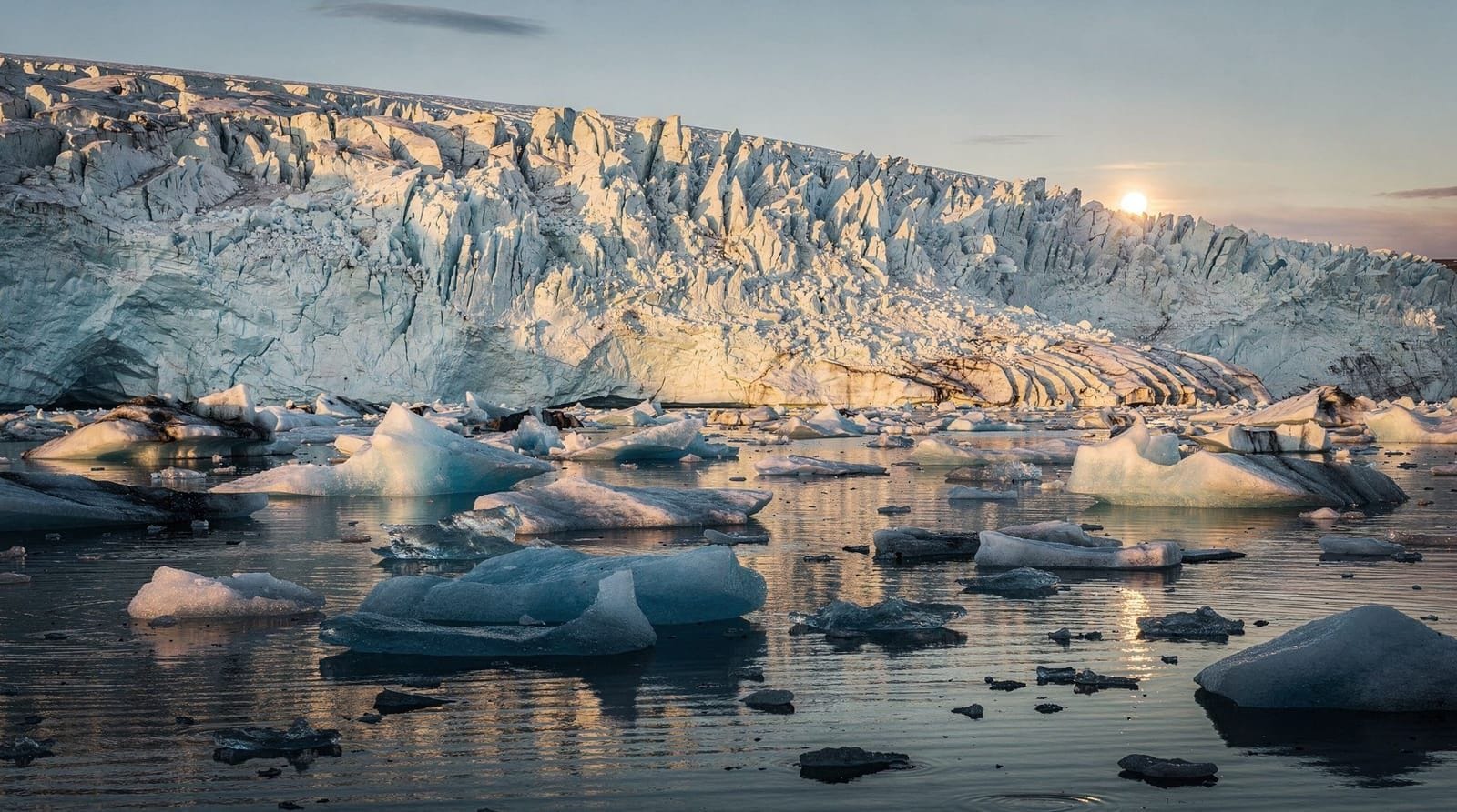
Jökulsárlón glacier lagoon
At 378 km from Reykjavík (4.5 hours without stops), Jökulsárlón is the furthest point on most South Coast itineraries. Icebergs calved from the Breiðamerkurjökull glacier float across the lagoon before eventually washing onto Diamond Beach across the Ring Road. The lagoon is the deepest lake in Iceland (at least 250 metres) and the icebergs range from the size of a car to the size of a three-storey building.
Boat tours on the lagoon — including amphibious vehicles and RIB boats — are available from the car park (ISK 7,000–9,000 / EUR 45–60). The free shore walk gives a good view without booking; the boat tours get you among the icebergs.
Glacier Lagoon boat ride and Diamond Beach — this combines an amphibious boat tour of the lagoon with a walk on Diamond Beach. Around ISK 19,000 (EUR 125) from Reykjavík; ISK 7,500 (EUR 50) if you are already at the lagoon.
The Katla ice cave near Vík
The Katla volcano has a geothermal ice cave accessible year-round inside Mýrdalsjökull glacier, accessed by super jeep from Vík (35 minutes). Unlike the Vatnajökull ice caves (seasonal November–March), Katla’s cave is open throughout the summer. The ice here is dark — ash-streaked from Katla’s volcanic activity — rather than the brilliant blue of Vatnajökull crystal caves. It is a different aesthetic and a slightly rawer experience.
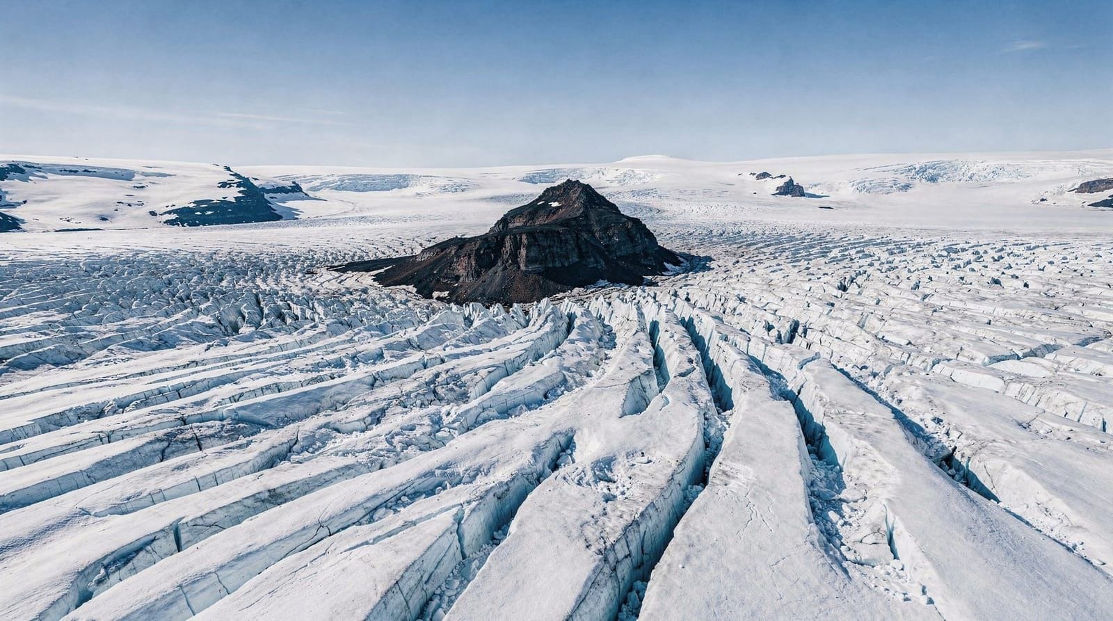
Vatnajökull National Park and Skaftafell
Skaftafell, in the western part of Vatnajökull National Park, offers glacier hiking, waterfall walks (Svartifoss and its basalt column curtain), and birding. The Falljökull and Svínafellsjökull glacier tongues are accessible on day hikes with certified guides. This section of the Ring Road passes through what was buried by the catastrophic 1996 glacial outburst flood (jökulhlaup) — the flat sandy plain between Skaftafell and Jökulsárlón (Skeiðarársandur) was formed by catastrophic flood events, and some of the mangled bridge girders from 1996 are preserved as a memorial.
Practical driving notes
- Ring Road 1 is paved and open year-round through the entire south.
- A 2WD car handles all South Coast highlights (including Seljalandsfoss, Skógafoss, Reynisfjara, Vík, Jökulsárlón, Skaftafell).
- Winter driving (November to March) requires winter tyres (standard on all Icelandic rentals) and weather checking — vedur.is and road.is are the authoritative sources.
- Petrol stations become sparse east of Vík; fill up in Vík before heading toward Kirkjubæjarklaustur and the glacier area.
- The F-roads branching north (Þórsmörk, Landmannalaugar) require a 4WD with high clearance and are closed October through early June.
South Coast highlights small group tour from Reykjavík — smaller groups (max 16) with stops at the main waterfalls, Reynisfjara, and Vík. ISK 14,000–17,000 (EUR 90–115). The small-group format allows faster loading/unloading at busy stops compared to large coaches.
Accommodation along the South Coast
Accommodation is concentrated at key points and fills quickly in summer (June–August). The main options:
Hella / Hvolsvöllur (130–140 km from Reykjavík): First logical overnight stop for those breaking the south coast into two days. Several mid-range guesthouses and farmstays; budget ISK 20,000–30,000 (EUR 130–200) for a double.
Vík (187 km): The most convenient base for Reynisfjara, Sólheimajökull, and the eastern section. Icelandair Hotel Vík and Hótel Katla are the main options, plus several guesthouses. Doubles ISK 25,000–45,000 (EUR 165–300) in summer; book at least 6–8 weeks ahead.
Kirkjubæjarklaustur (280 km): Small village with a few guesthouses; useful for those aiming to reach Jökulsárlón. Prices slightly lower than Vík.
Glacier area (Skaftafell/Jökulsárlón, 350–380 km): Hótel Skaftafell and several guesthouses near the park entrance. These book out months in advance in peak summer.
Costs
South Iceland is Iceland — meaning expensive by most European standards. Indicative costs:
- Petrol: ISK 280–320/litre (EUR 1.80–2.10); a typical rental car from Reykjavík to Jökulsárlón and back uses about 50–60 litres
- Campsite: ISK 2,500–4,500/person (EUR 16–30)
- Mid-range guesthouse: ISK 20,000–35,000 for a double (EUR 130–230)
- Restaurant dinner: ISK 3,500–7,000/person (EUR 23–46)
- Glacier hike: ISK 12,000–20,000/person (EUR 80–130)
The South Coast in cultural context
The South Coast is not simply a tourism corridor. The farms along Ring Road 1 have been inhabited since the Settlement Era (874–930 CE), and the place names on maps reflect this — Hvolsvöllur, Fljótshlíð, Mýrdalur, Dyrhólaey. The Njáls Saga (Njáls saga), one of Iceland’s most celebrated medieval sagas, is set largely in the Hvolsvöllur and Rangá area. The Saga Centre in Hvolsvöllur tells this story in an accessible exhibition (ISK 2,200 / EUR 14 admission; open June–August daily, limited hours other months).
The Eyjafjallajökull eruption of April 2010 — the one that closed European airspace for six days and introduced the world to Icelandic place-name pronunciation challenges — originated in the icecap visible from Ring Road 1 between Seljalandsfoss and Skógafoss. The eruption lasted from April 14 to May 23, 2010. A small museum at Þorvaldseyri farm (free, open in summer) documents the family’s experience of watching the eruption from their farmhouse and the ash fall that followed.
The Westman Islands (Vestmannaeyjar), visible offshore on clear days as a chain of dark volcanic islands south of Vík, are an integral part of South Iceland’s story. The Eldfell eruption of January 23, 1973, buried one-third of the main town of Heimaey under lava and ash and required the complete evacuation of 5,300 residents overnight. The islands are accessible by ferry from Landeyjahöfn (a 35-minute crossing; ISK 2,690 / EUR 18 each way) and make a worthwhile two-day addition to a South Coast itinerary.
South Coast self-drive logistics
A practical breakdown for a 3-day self-drive of the South Coast:
Day 1 (Reykjavík → Vík, ~190 km): Þingvellir and Golden Circle in the morning; Seljalandsfoss and Skógafoss in the afternoon; overnight in Vík.
Day 2 (Vík → Kirkjubæjarklaustur, ~90 km): Reynisfjara black beach in the morning; Sólheimajökull glacier hike (half day); Fjaðrárgljúfur canyon (30 minutes); overnight near Klaustur.
Day 3 (Kirkjubæjarklaustur → Jökulsárlón → Reykjavík, ~550 km return): Skaftafell and Svartifoss (morning); Jökulsárlón and Diamond Beach (afternoon); long return drive to Reykjavík (4.5 hours from Jökulsárlón).
Day 3 is a long day. Consider breaking it with an overnight at the Jökulsárlón area to avoid the 4.5-hour return drive at the end of an active day.
Frequently asked questions about South Iceland
How many days do I need for the South Coast?
Three days is the practical minimum to cover the main highlights between Reykjavík and Jökulsárlón without rushing. This allows one day for the Golden Circle and western South Coast, one day for Vík and Sólheimajökull, and one day for the eastern section including Jökulsárlón and Skaftafell. Five days is more comfortable and allows side trips to Þórsmörk or extended glacier time.
Can I do the South Coast as a day trip from Reykjavík?
You can do a South Coast day trip to the western section — Seljalandsfoss, Skógafoss, Reynisfjara, and Vík — in one long day (14–16 hours). Jökulsárlón is too far for a day trip unless you are combining it with an overnight stop. Guided day trips cover the western section efficiently; for the full south, multi-day itineraries make more sense.
Do I need a 4WD for the South Coast?
No. The Ring Road and all the major South Coast sites (waterfalls, Reynisfjara, Vík, Jökulsárlón, Skaftafell) are accessible in a standard 2WD sedan. A 4WD is needed only if you plan to drive F-roads to Þórsmörk, Landmannalaugar, or the interior highlands.
Is the South Coast better in summer or winter?
Both seasons have genuine advantages. Summer gives access to all roads (including some F-roads), long daylight hours, and the lush green contrast to glacier ice. Winter offers northern lights, the Vatnajökull crystal blue ice caves (open November–March only), fewer crowds, and dramatic stormy scenery. Winter driving requires more care; roads can close in severe weather.
Where is the best place to see the northern lights in South Iceland?
Anywhere away from artificial light and under a clear sky works. Farms and rural guesthouses east of Hella are good bases: flat terrain, low light pollution, and reasonable aurora frequency in autumn and winter. The vedur.is aurora forecast gives a 3-day prediction; cloud cover is the main limiting factor.
Are the black sand beaches safe?
Reynisfjara specifically has a documented history of sneaker waves killing tourists. Stay at least 30 metres from the waterline except during obvious wave troughs, watch the sea carefully, and never turn your back on the ocean. The danger is highest during storms and high tide but exists year-round.
Can I hike on a glacier without a guide?
You should not hike on glaciated terrain without a qualified guide. Crevasses form unpredictably, snow bridges can collapse, and glacier surfaces that look uniform from a distance have hidden hazards. All reputable glacier hike operators provide crampons, harnesses, ice axes, and safety-trained guides as standard. The cost (ISK 12,000–20,000 / EUR 80–130) is proportionate to the equipment and training involved.
Top experiences
Bookable activities with verified prices and instant confirmation on GetYourGuide.
Reykjavik: South Coast black Beach waterfalls full day
Reykjavik: South Coast highlights small group

Reykjavik: South Coast waterfalls black sand Glacier
Reykjavik: Glacier Lagoon boat ride Diamond Beach
Reykjavik: Solheimajokull Glacier hike Reykjavik
Reykjavik: From Reykjavik Golden Circle full day guided trip
Top-rated experiences in South Iceland — waterfalls, glaciers, and black sand beaches
Best-rated activities across GetYourGuide and Viator.