Þórsmörk hiking guide — trails, transport, and what to expect in Thor's valley
Vik: Thorsmork guided day hike super jeep
What is Þórsmörk and why is it worth visiting?
Þórsmörk (Thor's Forest) is a glacially carved valley about 150 km from Reykjavík, sheltered by three glaciers and filled with birch woodland, river canyons, and dramatic viewpoints. It is the southern trailhead of the Laugavegur trek and the midpoint of the Fimmvörðuháls crossing — but it is also a destination on its own.
Þórsmörk — meaning Thor’s Forest — occupies a sheltered valley carved out by three surrounding glaciers: Eyjafjallajökull, Mýrdalsjökull, and Tindfjallajökull. Protected from the harsh winds that sweep the south coast by its glacial walls, the valley floor is warmer and calmer than almost anywhere else at this latitude, which is why birch trees — rare in Iceland’s mostly treeless landscape — grow thick enough to actually count as woodland here.
The combination of sheltered valley, dramatic canyon scenery, and position at the junction of Iceland’s two most famous hiking routes makes Þórsmörk genuinely worth the effort required to reach it. And that effort is real — the final approach requires crossing the glacial Krossá river, which cannot be done in a standard vehicle.
Why Þórsmörk looks the way it does
The valley was formed by glacial erosion over thousands of years, with the Markarfljót river cutting a series of dramatic canyons through the outwash plain as the glaciers retreated. The valley itself sits at around 100–200 m elevation, lower and more sheltered than the surrounding highland plateau, which creates the microclimate that supports the birch forest.
The three glaciers visible from the valley ridges are:
- Eyjafjallajökull (west) — the source of the 2010 eruption
- Mýrdalsjökull (east) — covering the Katla volcano
- Tindfjallajökull (north) — smaller but dramatic when seen from ridge viewpoints
The canyon at Markarfljótsgljúfur, on the eastern edge of the valley, is the most visually striking geological feature in Þórsmörk — a narrow gorge with walls dropping 100+ m to the river below.
The best day hikes
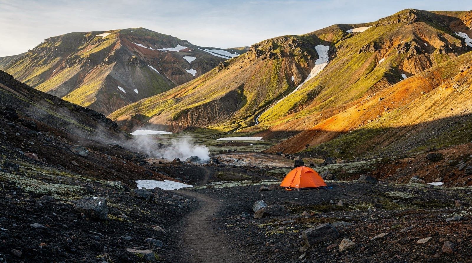
Valahnúkur viewpoint (3 km, 150 m ascent, 1.5–2 hours). This is the most-walked hike in Þórsmörk, with good reason. From the Langidalur hut, the trail climbs steeply to a rocky ridge that gives a 360-degree view of the valley and all three surrounding glaciers. The ascent is short and well-marked. Best done early morning or evening for clear visibility — cloud tends to build mid-afternoon in summer.
Tindfjöll ridge (7 km, 400 m ascent, 3.5–4.5 hours). A harder hike onto the Tindfjöll ridge north of the valley, with dramatic views toward Mýrdalsjökull and back over Þórsmörk. Some scrambling involved on the upper section. Requires good footwear and weather awareness.
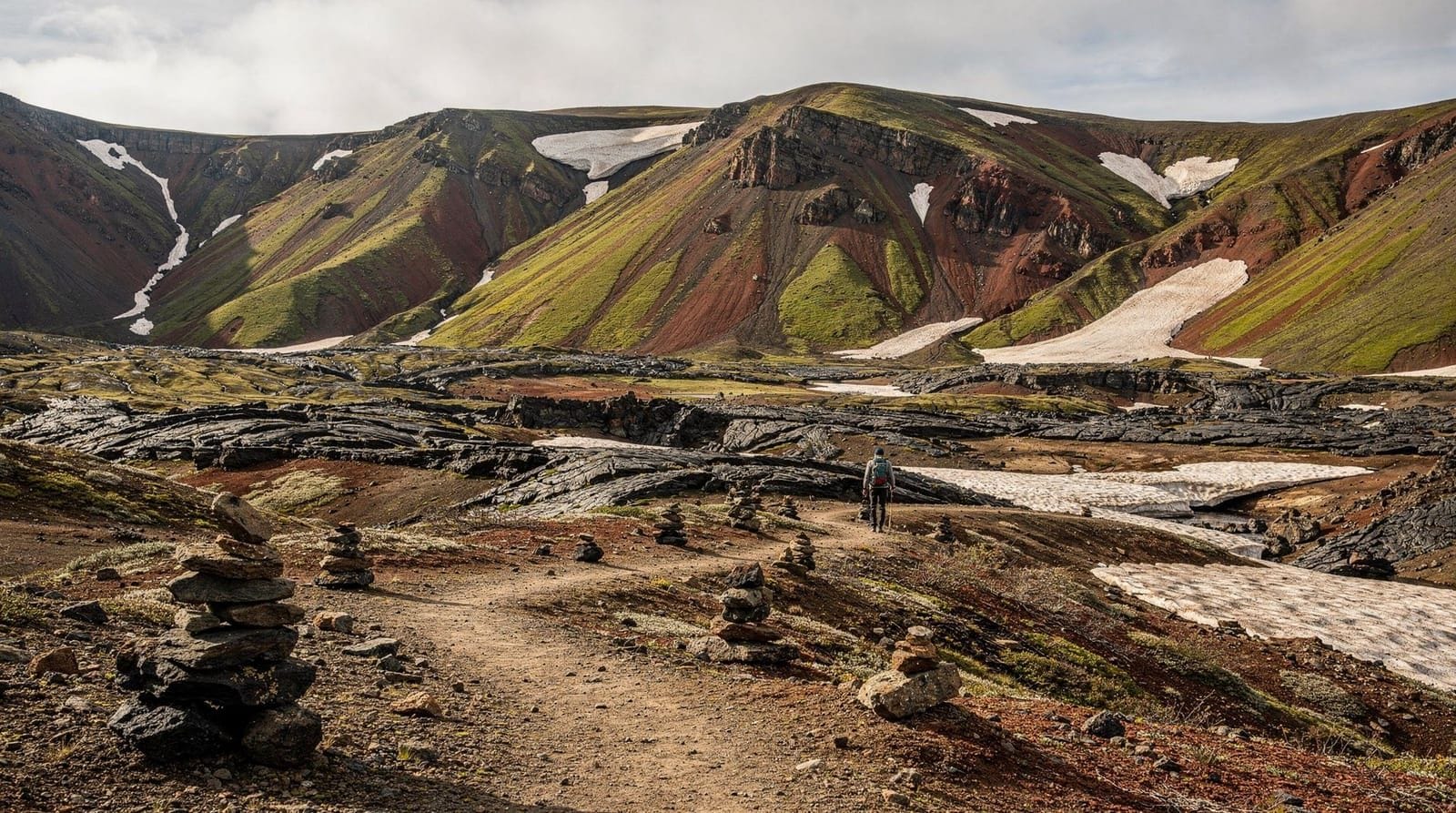
Markarfljótsgljúfur canyon (5–6 km loop, 2.5–3 hours). The canyon trail follows the edge of the Markarfljótsgljúfur gorge, one of the least-visited but most spectacular landscapes in Þórsmörk. The canyon walls are 100+ m high in places, with the river a ribbon of grey glacial water below. Trail markers are intermittent — download an offline map.
Goðaland circuit (8 km, 3–4 hours). A loop through the “land of the gods” terrain on the western side of the valley, passing distinctive rock formations and viewpoints over Eyjafjallajökull. Well-marked and manageable for most hikers.
The Laugavegur and Fimmvörðuháls connections
Þórsmörk is the junction point for two major hiking routes:
The Laugavegur trek arrives from the north after 4 days from Landmannalaugar. Most through-hikers arrive at Langidalur or Básar hut in the afternoon of Day 4 and take the evening or next morning’s bus back to Reykjavík.
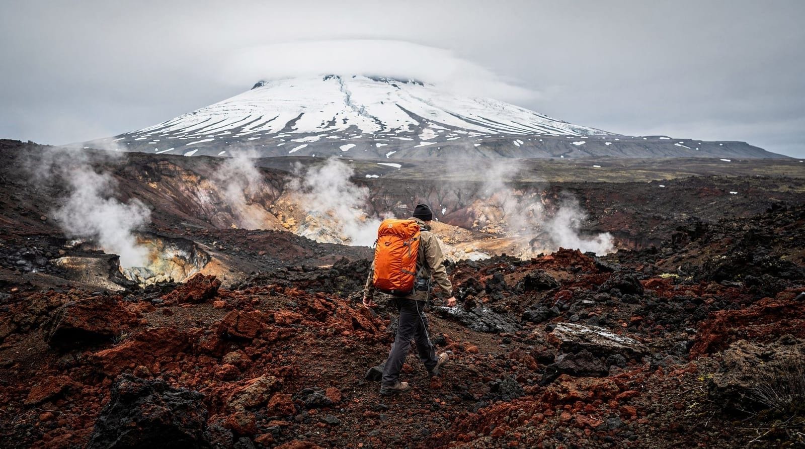
The Fimmvörðuháls hike departs south over the volcano pass toward Skógar. Starting from Þórsmörk, the 24 km trail climbs through the 2010 eruption craters and descends the waterfall canyon to the coast. Most hikers take 8–10 hours in this direction.
If you are combining both routes — the classic 5-day Laugavegur to Þórsmörk plus Fimmvörðuháls to Skógar — plan your overnight stay at Þórsmörk carefully to allow one rest day or at least a late start on the Fimmvörðuháls section.
Guided Þórsmörk day hikes with super-jeep transfer from the south coast put you in the valley for a half-day of hiking with a local guide who knows the conditions and the best viewpoints.
Getting to Þórsmörk
By bus. Reykjavík Excursions and Trex operate scheduled highland buses from Reykjavík BSÍ terminal to Þórsmörk, typically running June to September. The bus journey runs south along Route 1, turns at Seljalandsfoss, and crosses several rivers on F249 before arriving at the valley. Journey time: 3–3.5 hours. Buses are purpose-built high-clearance coaches designed for the river crossings. Current one-way fares are approximately ISK 8,000–10,000 (EUR 52–65). Book at re.is or trex.is.
By super-jeep tour. Several operators run super-jeep day tours from Reykjavík or Hvolsvöllur. These use modified 4x4 vehicles with very high clearance and wide tires, comfortable for the river crossings. Day tours typically include a guided walk in the valley.
A super-jeep day tour from Hvolsvöllur (the closest town at 30 minutes from the valley) is the most comfortable and flexible way to visit Þórsmörk without driving yourself.
By 4WD vehicle (advanced drivers only). The F249 road into Þórsmörk is classified F-road. The critical crossing is the Krossá river near the valley entrance. Water depth varies from 50 cm to 1+ m depending on conditions. This crossing has ended many hire car contracts and stranded many vehicles. Only experienced highland drivers with a true super-jeep should attempt it independently — check vegagerdin.is for current depth readings and heed the warning posts at the river edge.
Accommodation in Þórsmörk
Three main accommodation options exist:
Langidalur hut (FÍ): Dormitory sleeping-bag accommodation, kitchen, toilets. Located on the western side of the valley, closest to the Valahnúkur trail. Price approx ISK 14,000–17,000 (EUR 90–110) per person per night. Book at fi.is.
Básar hut (FÍ): Eastern side of the valley, used primarily by hikers arriving on the Laugavegur trail from Landmannalaugar. Same pricing and facilities as Langidalur.
Húsadalur / Volcano Huts: Private operator with cabins, dormitory rooms, and a restaurant — the most comfortable option in the valley. Prices are higher than the FÍ huts (expect ISK 20,000–30,000 per person in dorms). Book at volcanohuts.com. They also run their own super-jeep buses from Reykjavík.
Camping is available at all three sites. In July, book everything well in advance.
What to pack for a day visit vs overnight
For a day visit, the essentials are layers (the valley can be 5–8°C warmer than the pass but weather changes), waterproofs, hiking boots, and enough food and water for 5–6 hours. There is a small snack shop at Húsadalur but prices are high and selection limited.
For an overnight stay, add sleeping bag (the huts provide mattresses but not bedding), earplugs (dormitories fill up in summer), and extra food for self-catering in the communal kitchen.
Frequently asked questions about Þórsmörk hiking
Is Þórsmörk suitable for families with young children?
The valley floor walks and the lower birch woodland paths are manageable for children over 6. The Valahnúkur climb is steep enough to require supervision for young children. The Tindfjöll and canyon trails are not suitable for children under 12.
Can I drive to Þórsmörk in a normal hire car?
No. The river crossings on F249 require high clearance 4WD. Your hire car insurance will be void if you damage the vehicle on F-roads in a car that is not rated for them. Take the bus or book a guided super-jeep tour.
How far is Þórsmörk from the south coast attractions?
The turnoff for Þórsmörk is near Seljalandsfoss on the Ring Road, making it possible to combine a south coast day trip with a short Þórsmörk visit if you have a super-jeep and the time. Seljalandsfoss is 20 minutes from the F249 junction; Skógarfoss is 40 minutes further east.
What is the weather like in Þórsmörk?
The valley’s sheltered position makes it noticeably calmer than the coast. Rain that hits Seljalandsfoss can miss Þórsmörk entirely. Average July temperatures in the valley are 10–15°C with regular sunshine. However, the pass areas above the valley are fully exposed and can receive rain, wind, and snow even in July.
Is there WiFi in Þórsmörk?
The Húsadalur complex has WiFi for guests. The FÍ huts do not. Mobile coverage is intermittent — some providers have signal near the huts, others do not. Download offline maps before arrival.
The natural history of Þórsmörk
The birch woodland in Þórsmörk is genuinely unusual in Iceland. The country was once substantially forested with birch before Norse settlement began around 874 CE — within a few centuries, timber cutting, sheep grazing, and volcanic activity had reduced Iceland’s woodland cover from approximately 25–40% of the country’s area to less than 1%. Today birch woodland covers under 2% of Iceland.
Þórsmörk survives as woodland for two reasons: its extreme shelteredness from wind and its position between glaciers that moderate both temperature and precipitation. The valley sits in the rain shadow of Eyjafjallajökull and Mýrdalsjökull, which absorb significant moisture from the southwest winds. The birch that grows here is Icelandic downy birch (Betula pubescens), rarely growing above 4–6 m tall given the climate, but forming genuine canopy cover in the most protected spots.
The birch supports a population of redwings and blackbirds unusual for their latitude. In June and July, the valley floor under the birch canopy has wildflowers — wood cranesbill, angelica, and occasionally the vivid blue flower of the Icelandic gentian.
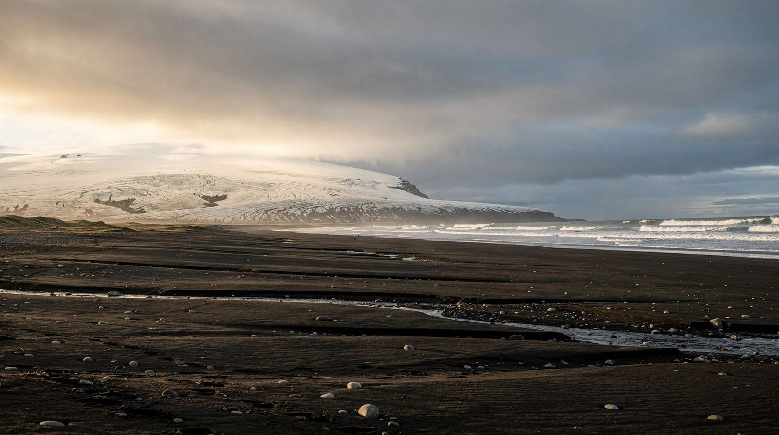
The three glaciers visible from Þórsmörk’s ridges are all retreating. Eyjafjallajökull has lost significant volume since the 2010 eruption, which accelerated melting by depositing dark ash over the white ice surface. Mýrdalsjökull, covering the Katla volcano, is monitored intensively because Katla is overdue for an eruption by historical standards — the last major eruption was in 1918. A Katla eruption while glaciated would produce a jökulhlaup (glacial outburst flood) that would completely transform the Markarfljót river and could make the F249 approach to Þórsmörk temporarily impassable.
Photography in Þórsmörk
The Valahnúkur ridge gives the quintessential Þórsmörk photograph: looking southwest over the birch valley with the Eyjafjallajökull glacier visible above and the Markarfljót outwash plain stretching to the sea beyond. Late afternoon in July produces the best light on this composition.
The Markarfljótsgljúfur canyon is excellent for abstract landscape photography — the sheer walls and ribbon of grey glacial water below frame in a way that emphasises scale. A 24–35 mm focal length handles the canyon width; longer lenses isolate sections of wall texture.
The birch woodland in early September, when the first autumn colour appears on the leaves before the trees lose their foliage, produces a warm tonal range unusual in Iceland’s typically mineral palette.
Practical guide to the F249 bus service
The highland bus services to Þórsmörk are operated by two main companies:
Reykjavík Excursions (re.is): departs Reykjavík BSÍ terminal. Runs via Seljalandsfoss, with an optional stop for photographs. Arrives Langidalur hut. One-way journey: 3–3.5 hours. Current single fare: ISK 8,000–10,000 (EUR 52–65). Multiple departures daily in peak season (July–August); confirm timetable at re.is before travelling.
Trex (trex.is): similar route, also departs Reykjavík. Runs to the Þórsmörk complex including both Langidalur and Básar huts. Check current departure times at trex.is.
Volcano Huts Bus: operated by the Húsadalur resort. Primarily for guests of the resort but has some open seats. Runs from Reykjavík; check volcanohuts.com.
Bus bookings are mandatory, not optional. Arriving at the bus stop without a reservation on a July weekend may mean you cannot board. The return buses from Þórsmörk are equally important to book in advance.
Day visit logistics: maximising your 4–5 hours in the valley
If taking the day bus from Reykjavík, a typical arrival is around 12:00–13:00. The last bus returns around 18:00–19:00. This gives approximately 5–6 hours in the valley.
Optimal day visit sequence:
- On arrival: drop your bag at the hut, eat packed lunch, consult the warden about trail conditions
- Hour 1–2: Valahnúkur hike (short, mandatory for the view)
- Hour 2–4: either the Goðaland circuit or a valley floor walk through the birch
- Hour 4–5: rest, hot drink, photographs near the hut
- Return to bus stop 30 minutes before departure
Prioritise Valahnúkur above everything — the view from the ridge is the defining Þórsmörk experience and takes only 90 minutes return. If you have time only for one hike, this is the correct choice.
Connecting with the Laugavegur and Fimmvörðuháls
Þórsmörk sits at the junction of Iceland’s two most significant multi-day hiking routes. Whether you are arriving having completed the Laugavegur trek or preparing to walk the Fimmvörðuháls crossing to Skógar, the huts here serve as the organisational node.
Hikers finishing the Laugavegur on Day 4 typically: arrive at Langidalur or Básar by 15:00–16:00, take a shower at the hut, eat dinner, and either take the evening bus back or stay overnight. The overnight option is strongly recommended — the valley deserves more than the 2–3 hours remaining after a 15 km Day 4.
Hikers starting Fimmvörðuháls from Þórsmörk: depart from Langidalur by 08:00 for the best conditions on the pass. The birch section of the Þórsmörk-side ascent is pleasant and the temperature in the valley is comfortable for the first 2 hours of climbing. By the time you reach the high exposed section, you will be warmed up.
For the combined 5-day traverse (Landmannalaugar to Þórsmörk on Laugavegur, then Þórsmörk to Skógar on Fimmvörðuháls), the Þórsmörk rest day is not optional for most hikers — legs need recovery and the valley is worth the time.
Þórsmörk in winter
While the majority of Þórsmörk visitors come in summer, the valley is accessible in winter by super-jeep and has a distinct character worth knowing about:
The birch woodland loses its leaves by October and becomes a skeletal structure of white-barked stems against snow or grey sky. The valley floor carries snow from November through April. The surrounding glaciers become more visible without summer haze, and the contrast of white glacier against dark rock is striking.
The main practical challenge is temperature — valley floor temperatures of -10 to -15°C are possible in January, and the exposed approaches to the Valahnúkur ridge involve genuine cold wind. Staying at Húsadalur (which operates year-round) with full winter kit is the only realistic winter approach.
Winter Þórsmörk is primarily visited by Icelandic locals on snowmobile or ski trips rather than international tourists. The experience is authentic and demanding in equal measure.
Þórsmörk for bird watching
The birch woodland in Þórsmörk is one of the best bird watching sites in south Iceland during the breeding season (May–July). The woodland hosts:
- Redwing (Turdus iliacus): Iceland’s most common woodland songbird, with a characteristic song. Nests in birch scrub.
- Blackbird (Turdus merula): established in Iceland’s sheltered woodland areas.
- Snipe (Gallinago gallinago): common on the valley floor wetland areas. The characteristic “drumming” sound (from tail feathers during display dives) is heard in the evenings.
- Merlin (Falco columbarius): Iceland’s only breeding falcon, hunting pipits and sparrows over the heathland above the valley.
- Golden plover (Pluvialis apricaria): present on the highland edges above the valley. Its mournful call is one of the defining sounds of the Icelandic highland summer.
The canyon at Markarfljótsgljúfur also has raven nesting on the cliff faces, and occasional white-tailed eagle (Haliaeetus albicilla) hunting along the river.
Understanding the Þórsmörk microclimate
The valley’s exceptional shelteredness produces measurable differences from the surrounding area. Weather data from the Þórsmörk meteorological station shows:
- Mean July temperature in the valley: 11–14°C (2–4°C warmer than the surrounding upland plateau)
- Annual precipitation in the valley: approximately 1,200 mm (compared to 2,000+ mm on the exposed south coast nearby)
- Wind speeds in the valley: typically 30–50% lower than the adjacent highland plateau
This microclimate is not just comfortable for visitors — it is the direct reason the birch woodland exists here. The species that colonise sheltered, slightly warmer environments in Iceland’s subarctic climate are limited; birch is the primary woodland pioneer. The current woodland extent in Þórsmörk represents perhaps 1,200 years of recovery from the Norse settlement clearances.
What to buy in Þórsmörk
The Húsadalur resort has a small shop with basic hiking supplies — energy bars, freeze-dried meal pouches, headlamps, and basic first aid. Prices are higher than Reykjavík (expect 30–50% premium) reflecting the remote location. The FÍ hut wardens can sometimes sell basic supplies but do not count on this.
Do not rely on being able to buy food in Þórsmörk for your hiking days. Bring everything needed from Reykjavík or the last large supermarket stop (Selfoss or Hvolsvöllur) before the F249 junction. The general rule for highland hiking in Iceland: arrive with 2 days of extra food beyond your plan.
Frequently asked questions about Þórsmörk hiking guide
Can I reach Þórsmörk by normal car?
No. The final approach requires crossing the Krossá river, which cannot be done in a standard 2WD or standard 4WD hire car. Scheduled highland buses use purpose-built high-clearance coaches; private vehicles need a super-jeep or modified 4WD. Never attempt the river crossing in a standard hire car.How long does it take to reach Þórsmörk from Reykjavík?
By bus, approximately 3–3.5 hours. The journey runs south on Route 1 to Seljalandsfoss, then onto F249 and through several river crossings. Bus drivers know the routes; do not underestimate the crossing conditions.What are the best hikes in Þórsmörk?
The Valahnúkur viewpoint hike (3 km, 1.5 hours) is the most popular — a short, steep climb to a ridge above the valley with views of all three surrounding glaciers. Tindfjöll (6–8 km, 3–4 hours) is a harder ridge walk. The canyon trail above Markarfljótsgljúfur is spectacular and less visited.Where can I stay in Þórsmörk?
Three hut complexes serve the area. Langidalur hut (FÍ-operated) and Húsadalur (Volcano Huts) offer dormitory sleeping-bag accommodation. Básar hut (FÍ) is on the eastern side of the valley. All three have basic kitchen facilities, toilets, and camping areas. Book at fi.is or volcanohuts.com.When is Þórsmörk accessible by bus?
Typically late June to mid-September. Services from Reykjavík Excursions and Trex run daily in July and August. Outside this window, access is possible by super-jeep only, and road conditions can change rapidly.Is Þórsmörk on the Laugavegur route?
Yes — it is the southern endpoint. Hikers completing the Laugavegur trek arrive at Þórsmörk on Day 4 from Landmannalaugar. Others use Þórsmörk as the starting point of the Fimmvörðuháls hike toward Skógar.Can I do a day visit to Þórsmörk?
Yes, but the travel time means you get only 4–5 hours in the valley if taking the bus. This is enough for the Valahnúkur hike and a walk through the birch woodland. An overnight stay allows for the longer ridge hikes.
Top experiences
Bookable activities with verified prices and instant confirmation on GetYourGuide.

Top experiences
Best-rated activities across GetYourGuide and Viator.

Sólheimajökull Glacier Hike – Adventure in a Small Group
- Viator

Blue Ice Discovery – Guided Glacier Hike from Skaftafell
- Viator

Glacier Hike from Skaftafell - Extra Small Group
- Viator

Sólheimajökull Glacier Hike - Small Group Blue Ice Adventure
- Viator

Skaftafell Glacier Hike 3-Hour Small Group Tour
- Viator

Solheimajokull Glacier 3-Hour Small-Group Hike
- Viator