South Coast day trip from Reykjavík — waterfalls, black beaches and more
Reykjavik: South Coast black Beach waterfalls full day
What does the South Coast day trip from Reykjavík include?
The standard South Coast day trip covers Seljalandsfoss waterfall (walk behind the curtain), Skógafoss waterfall, Reynisfjara black sand beach (basalt columns, sea caves), and Dyrhólaey cape. Total driving: ~400 km return. Allow 10–12 hours. Driving is straightforward on the Ring Road.
The South Coast of Iceland between Reykjavík and Vík is one of the world’s most concentrated sequences of dramatic natural scenery. Within a 200 km stretch, you encounter two major waterfalls (one walkable behind), a 10 km black sand beach with sea-stack basalt columns, an iconic cape with a sea arch, and the glacier-capped Eyjafjallajökull and Mýrdalsjökull looming over the coastal plain.
This is consistently ranked by visitors as the most photographically rewarding day trip from Reykjavík, and it delivers reliably — weather permitting.
Route overview
The route runs east on the Ring Road (Route 1) from Reykjavík. All stops are either directly on or within 1–3 km of the Ring Road:
- Seljalandsfoss (115 km, 1.5 hours from Reykjavík)
- Gljúfrabúi waterfall (200 m from Seljalandsfoss — often missed)
- Skógafoss (155 km, 2 hours from Reykjavík)
- Skógar folk museum (optional, at Skógafoss)
- Reynisfjara black sand beach (180 km, 2.5 hours)
- Dyrhólaey (190 km, 2.5 hours)
- Vík í Mýrdal village (188 km, optional stop for lunch)
Stop by stop
Seljalandsfoss
Seljalandsfoss is a 60 m waterfall that falls over a hollow in the cliff, creating a path behind the water curtain. This path (May–October, depending on ice conditions) is the main reason visitors come — the experience of standing behind a major waterfall and looking out through the falling water is genuinely unusual.
Preparation: wear waterproof jacket and trousers regardless of the day’s weather — you will be soaked. Waterproof shoes are strongly advised; the path is slippery with wet rock and gravel. The cave behind the falls has standing room for a few dozen people.
The car park is off Route 249 — signed from the Ring Road. Parking fee: 900 ISK (€6) per vehicle.
Don’t miss Gljúfrabúi: 200 m north of the Seljalandsfoss car park, a second waterfall (Gljúfrabúi) falls into a narrow gorge that can be entered by wading through a shallow stream. The interior is dramatic and very few visitors find it. Look for a gap in the cliff face with water splashing out.
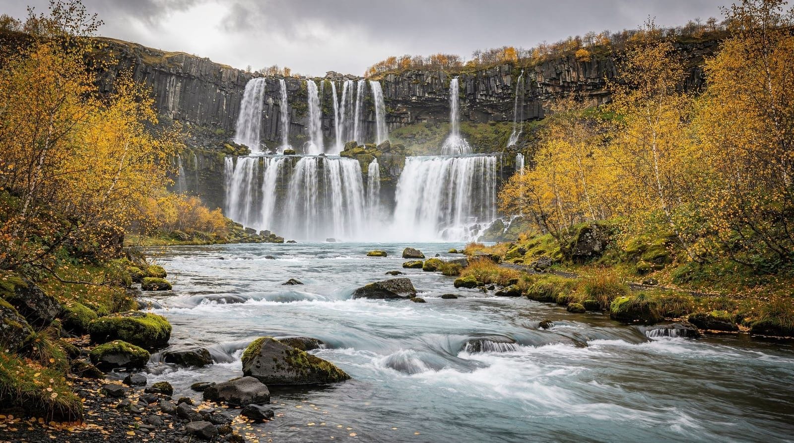
Skógafoss
Skógafoss is one of Iceland’s widest waterfalls — 25 m wide, 60 m drop. The volume of water is substantial, producing a permanent rainbow in the mist on sunny days. A staircase of 430 steps climbs the eastern cliff to the top of the falls, with views north across the Skóga river valley toward Þórsmörk and the Fimmvörðuháls ridge.
The base viewpoint is very close to the falls — expect spray within 30 m. The top viewpoint requires physical effort (430 steps takes most people 15–20 minutes) but the panorama is significantly more rewarding than the base.
Parking is free at the Skógar campsite/hotel car park. The Skógar folk museum (small, excellent collection of traditional Icelandic implements and buildings) is adjacent — allow 45 minutes if interested.
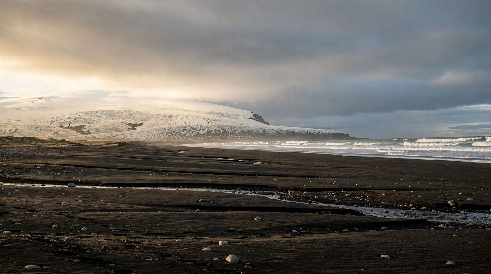
Reynisfjara black sand beach
Reynisfjara is 8 km off the Ring Road south of Vík. It is Iceland’s most famous black sand beach, with two specific features beyond the sand itself:
Reynisdrangar sea stacks: three dramatic basalt pillars rising from the sea just offshore. According to legend they are trolls who were caught out by sunrise while trying to drag a ship ashore.
Basalt column cave: at the east end of the beach, perfect hexagonal basalt columns form a cave ceiling and irregular steps. The formation is geologically identical to the Giant’s Causeway in Northern Ireland — both the result of very slowly cooled lava.
Safety: this beach has a documented record of visitor fatalities. Sneaker waves — waves that appear with no forewarning from calm seas — arrive suddenly and with enough force to knock adults to the ground. The beach drops steeply, making recovery difficult. The safety rules are strict:
- Never turn your back on the sea
- Stay at least 30 m from the waterline at all times
- Watch the wave pattern for several minutes before approaching the base of the columns
- Do not stand on wet rocks at the ocean edge
The safety signs at the entrance are explicit. Take them seriously — several deaths have occurred here in the past decade.
Dyrhólaey
Dyrhólaey is a flat-topped basalt headland with a large sea arch that the sea has eroded through the rock. The access road climbs to a lighthouse car park with panoramic views south over Reynisfjara and west across the black coastal plain.
Atlantic puffins nest on the western promontory; access to the nesting area is restricted from May 1 to June 25 to protect breeding birds. After late June, a path allows closer approach to the colony.
The arch itself is most dramatically viewed from the beach below or from a boat approaching by sea.
The full route timing
A well-timed self-drive day:
- 07:30: Depart Reykjavík (beat the coach tours)
- 09:00–10:00: Seljalandsfoss and Gljúfrabúi
- 10:30–11:30: Skógafoss (climb the stairs)
- 12:00–12:45: Reynisfjara (observe wave safety)
- 13:00–13:30: Vík for lunch (Suður-Vík restaurant, 101 Hotel Kex, or the N1 petrol station bakery)
- 14:00–14:45: Dyrhólaey
- 15:00: Begin return to Reykjavík (arrive ~17:30)
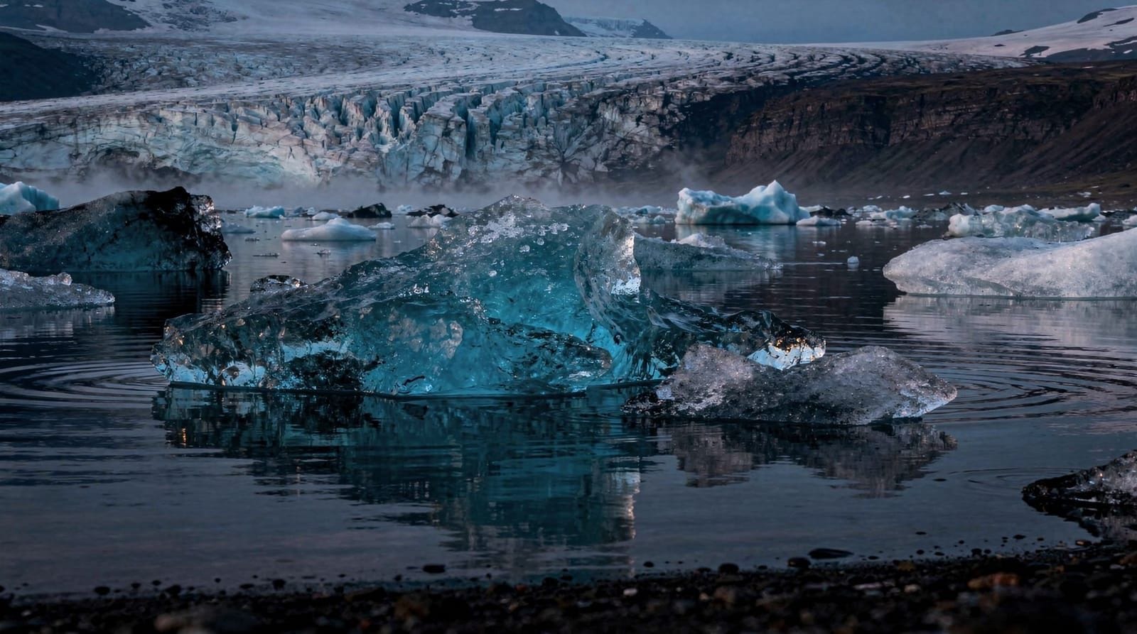
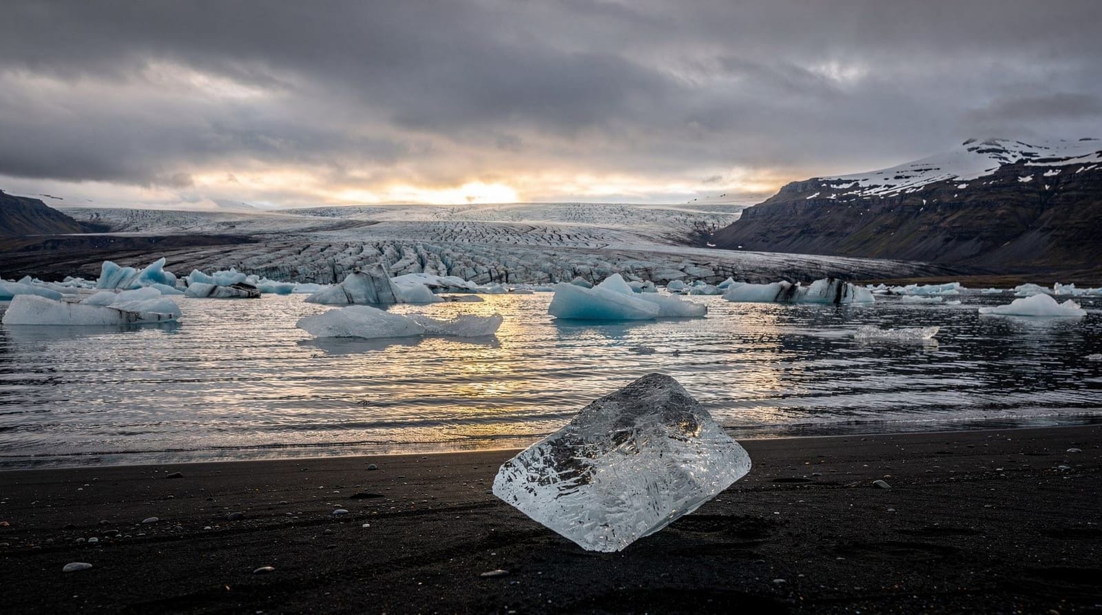
If you want to extend to Jökulsárlón, depart Reykjavík at 07:00 and drive straight to the lagoon first, then return via the South Coast stops (in reverse). You will arrive back in Reykjavík around 22:00.
Guided tours versus self-driving
Self-driving is ideal — all roads are paved, well-signed, and appropriate for 2WD in summer. Driving Route 1 east from Reykjavík is straightforward.
Guided tours are worthwhile if: you want local context and geological explanation, you are travelling solo or without a car, or you want to add glacier hiking (some South Coast tours include a Sólheimajökull glacier walk as an extension).
South Coast small-group day tour — Seljalandsfoss, Skógafoss, Reynisfjara, Dyrhólaey, max 19 passengers, expert guideSouth Coast plus glacier hiking
For travellers who want to add an adventure component, a Sólheimajökull glacier hike combines naturally with the South Coast route. Sólheimajökull is a glacier tongue of Mýrdalsjökull, situated 18 km north of the Ring Road between Seljalandsfoss and Skógafoss. A guided glacier walk on Sólheimajökull takes 2.5–3.5 hours and adds meaningful physical activity and unusual terrain to what would otherwise be a driving/viewpoint day.
South Coast and glacier hike day trip — waterfalls, Reynisfjara, and Sólheimajökull glacier walk, crampons and helmet includedCommon mistakes on the South Coast
Skipping Gljúfrabúi: this hidden waterfall 200 m from Seljalandsfoss is missed by most visitors because it is not on the main path. Walk north from the car park to the cliff gap.
Arriving at Reynisfjara at midday in summer: July midday sees the highest visitor density. Go at 09:00 or 16:00+ for a more manageable experience.
Standing too close to the water at Reynisfjara: the wave safety issue is real, not precautionary. Every year multiple tourists are swept off their feet.
Leaving Vík too late: Vík, the southernmost village in Iceland, has a dramatic church on a hill and a nice beach viewpoint in the village itself. It is easy to skip when running late — but the church viewpoint looking back west toward Reynisfjara and the stacks is exceptional.
Not checking the Seljalandsfoss path closure: from November to April, the path behind the falls is often closed due to ice. Check the sign at the car park or the Icelandic Tourism Board site before making this the specific reason for a winter trip.
Frequently asked questions about the South Coast day trip
Can I swim at Reynisfjara beach?
No. The beach is not safe for swimming under any circumstances — the waves are unpredictable and the undertow is strong. The beach is for visual experience only.
What is the closest accommodation to the South Coast stops?
Vík (188 km from Reykjavík) is the main accommodation hub. Several guesthouses and two hotels (including the characterful Black Beach Suites with ocean views). Booking 2–3 months ahead in summer is necessary. Staying in Vík enables a leisurely morning start and allows you to add the South Coast glaciers itinerary extension eastward.
Is there a bus from Reykjavík to the South Coast?
Sterna operates a summer bus along the South Coast (the South Coast Passport). Stops at Seljalandsfoss, Skógafoss, and Vík. Timetable is fixed; you cannot linger at will. For true flexibility, a rental car is necessary.
What glacier is visible from the South Coast?
Two glaciers are visible: Eyjafjallajökull (the volcano that disrupted European air travel in 2010) and Mýrdalsjökull, which sits above the dangerous Katla volcano. The white caps are visible from the Ring Road throughout clear days on the South Coast. Skaftafell and Vatnajökull are further east.
Detailed notes on each main stop
Seljalandsfoss: the behind-the-falls experience
The path behind Seljalandsfoss is an unusual sensory experience — standing in a shallow cave behind the curtain of water, looking outward through the falls to the flat coastal plain. Visibility through the water is reasonable in good light. In morning or evening sun, the backlit water produces a distinctly cinematic quality.
The path is wet regardless of waterproofing — the mist saturates the air. Budget for getting soaked (it is worth it). The path surface is hardened gravel with a fixed rope handrail on the steeper sections. Waterproof trousers, jacket, and shoes are appropriate gear. The cave behind the falls is occupied by dozens of other visitors at peak times; first thing in the morning (08:00–09:00), you may have it to yourself.
Timing with the sun: the falls face approximately south, so they are best lit from mid-morning through early afternoon. The behind-the-falls experience is better in morning than midday.
Skógafoss: more depth than it looks
Beyond the famous photograph (wide waterfall, rainbow, perfect rectangle of falling water), Skógafoss has more depth than most visitors explore:
The staircase to the top takes 15–20 minutes at a moderate pace. The view from the top overlooks the Skóga river valley northward, with the Fimmvörðuháls ridge visible at the head of the valley — the starting point for the 25 km day hike between Skógar and Þórsmörk. The ridge itself, with its two small craters created during the 2010 Eyjafjallajökull eruption, is one of Iceland’s best single-day hikes.
The Skógar Folk Museum immediately beside the car park is underrated — an open-air museum of preserved Icelandic farm buildings and a collection of traditional implements covering the daily life of rural Iceland from settlement to the 20th century. Entry around 2,500 ISK (€16). Allow 45–60 minutes.
The nearby campsite (Skógar campsite) is one of Iceland’s most pleasant, with a clear river and the waterfall audible from the tents.
Vík for lunch
The village of Vík (population 300) is the southernmost point of Iceland’s mainland and an atmospheric stop for lunch. The black sand beach directly behind the village has excellent views of Reynisdrangar stacks and the headland toward Dyrhólaey.
Suður-Vík: the main restaurant in the village, serving Icelandic lamb soup, fish and chips, and sandwiches. Reliable and reasonably priced (~2,500 ISK / €16 for a main course).
Halldórskaffi: a café in the old community hall, serving locally baked goods, soup, and coffee. Charming, cheaper, and often less crowded than Suður-Vík.
The black church (Víkurkirkja): the hilltop church above Vík with 360-degree views toward Reynisfjara, Mýrdalsjökull, and the coast. A 15-minute walk from the village centre. The best elevated viewpoint on the standard South Coast day trip.
Extending to the east
A well-timed day trip can push east beyond Dyrhólaey to add:
Fjaðrárgljúfur canyon (200 km from Reykjavík, Route F206): a stunning 100 m deep gorge cut by the Fjaðrá river over 9,000 years. A 30-minute walk along the canyon rim gives extraordinary views. Open in summer; the road is gravel (2WD suitable).
Kirkjubæjarklaustur village (250 km from Reykjavík): the site of a medieval nunnery and the location of the famous “fire sermon” during the 1783 Laki eruption. The Systrafoss waterfall (free, 10-minute walk) and Kirkjugólf basalt column floor (free) are both within the village.
These extensions require departing Reykjavík by 07:00 and add 2 hours to the total day, but they push into genuinely less-visited territory with significant rewards.
Why the South Coast beats the Golden Circle for visual impact
The debate between these two routes is worth addressing directly. The South Coast consistently edges the Golden Circle for:
- Visual drama: Skógafoss at full volume in spring melt, Reynisfjara black beach in morning light, Dyrhólaey’s arch — these are cinematic rather than simply impressive.
- Variety: the route moves between waterfalls, beaches, volcanic headlands, and glacier views in continuous contrast.
- Spontaneity: some of the best South Coast moments are unscheduled — a shaft of light illuminating Eyjafjallajökull, a rainbow at Seljalandsfoss appearing unexpectedly, low tide at Reynisfjara revealing extra basalt formations.
The Golden Circle has the historical depth (Þingvellir) that the South Coast lacks, and the Geysir eruption is uniquely reliable entertainment. If you have two days, do both. If you have one, the South Coast wins on visual impact for most visitors.
Frequently asked questions about South Coast day trip from Reykjavík
Is Reynisfjara beach dangerous?
Yes — Reynisfjara has a documented record of visitor injuries and deaths from sneaker waves. Waves arrive suddenly without visible warning, can be strong enough to knock adults off their feet, and the beach drops steeply so retreating is difficult. Strict rule: never turn your back on the sea, stay at least 30 m from the waterline, and watch wave patterns for several minutes before approaching.Can I walk behind Seljalandsfoss?
Yes, from approximately May to October when the path is open. A gravel and stone path circles behind the waterfall curtain — expect to get soaked regardless of waterproof clothing. In winter (November–April), ice on the path makes it dangerous and it is often closed. Entry is free; car park fee applies.How far is the South Coast from Reykjavík?
Seljalandsfoss is 115 km from Reykjavík (about 1.5 hours). Dyrhólaey, the furthest standard stop, is 190 km (about 2.5 hours). The furthest extension for a day trip is Jökulsárlón at 375 km — possible but very long.Is the South Coast route suitable in winter?
Yes, and it is spectacular in winter — Skógafoss partially frozen, black beach and snow, and the road is generally passable. However, weather conditions can change rapidly. Check vedur.is before departing. A 4WD is recommended from November to March. Some tours specifically offer winter South Coast experiences.What is Dyrhólaey?
Dyrhólaey is a basalt headland with a large natural arch large enough for a small boat to pass through. It is also a puffin nesting area (restricted access during breeding season May–June). The lighthouse viewpoint gives panoramic views over Reynisfjara and the black sand coast. Free access; car park fee applies.
Top experiences
Bookable activities with verified prices and instant confirmation on GetYourGuide.

Top experiences
Best-rated activities across GetYourGuide and Viator.

From Reykjavik: Snaefellsness Peninsula small group day tour
- Viator

Lake Myvatn Day Tour and Godafoss Waterfall for Cruise Ships from Akureyri Port
- Viator

Private Jökulsárlón Glacier Lagoon 2 Day Tour & Glacier Hike
- Viator

From Reykjavik: Katla Ice Cave and South Coast Day Tour
- Viator

Reykjanes Peninsula Private Day Tour - up to 9 passengers
- Viator

Thorsmork Hike Day Tour
- Viator