Iceland's most scenic drives beyond the Ring Road
What are Iceland's best scenic drives beyond the Ring Road?
The Snæfellsnes Peninsula drive (Route 54/574), the Westfjords circuit, the Diamond Circle in North Iceland, and the East Fjords coastal routes are the most spectacular drives beyond Route 1. Most require extra days and a 4x4 for certain detours.
Why leave the Ring Road at all?
The Ring Road (Route 1) is remarkable but it is not Iceland’s most scenic driving — it was built for transport efficiency, not landscape drama. Several peninsulas and interior routes offer driving that is meaningfully more dramatic than the main loop, with far fewer other vehicles on the road.
These are the drives worth planning extra days for.
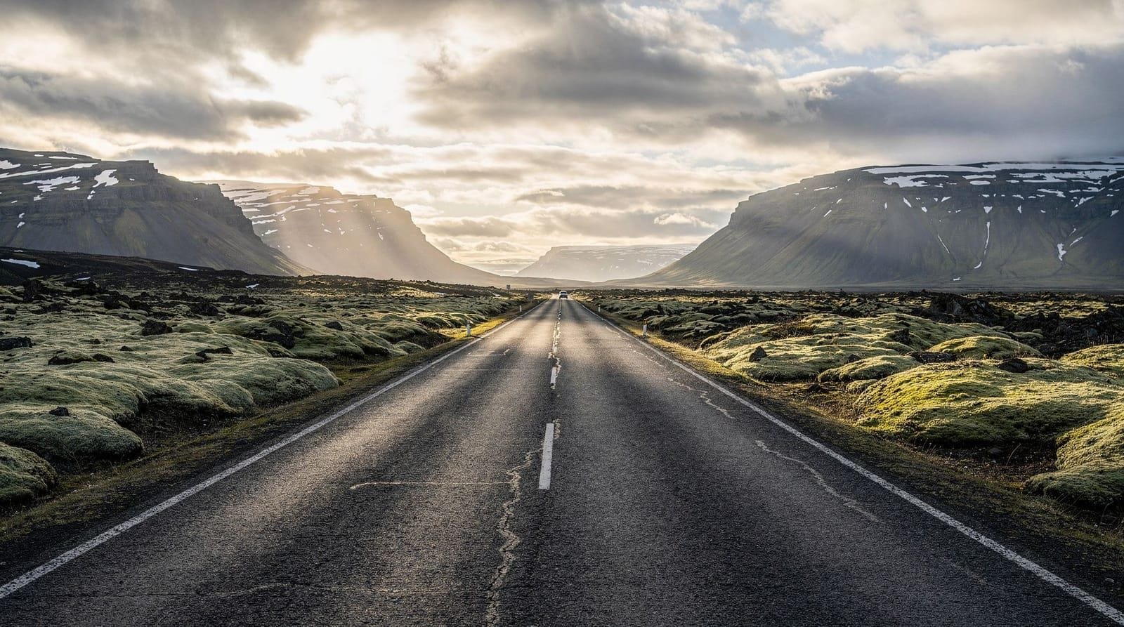
Snæfellsnes Peninsula (Route 54 and Route 574)
Distance: ~170 km for the full loop from Borgarnes back to Borgarnes. Time needed: 1 long day minimum; overnight strongly recommended. Vehicle: Standard 2WD fine in summer; 4x4 for gravel side tracks in winter.
The Snæfellsnes Peninsula is a microcosm of Iceland’s landscapes compressed into one peninsula. In 170 km you pass basalt sea stacks, a glacier-capped stratovolcano, black sand lava beaches, fishing villages built in the 1800s, and Kirkjufell — the most photographed mountain in Iceland outside Reykjavik.
Route 54 runs along the southern coast from Borgarnes through the agricultural valley of Dalir, passing thermal pools and lava formations, before arriving at Snæfellsjökull.
Route 574 circles the glacier tip and the western end of the peninsula, accessing the Arnarstapi-Hellnar coastal walk (5 km between two fishing villages, sea stack arches, dramatic basalt columns), the lighthouse at Öndverðarnes, and the northern coast through Ólafsvík and Grundarfjörður near Kirkjufell.
The Snæfellsjökull National Park covers the glacier and lava field at the western tip — hiking, snowcat tours, and the world’s most famous volcano crater as immortalised in Jules Verne’s Journey to the Centre of the Earth.
Full planning detail in our Snæfellsnes day trip guide and Snæfellsnes 2-day itinerary.
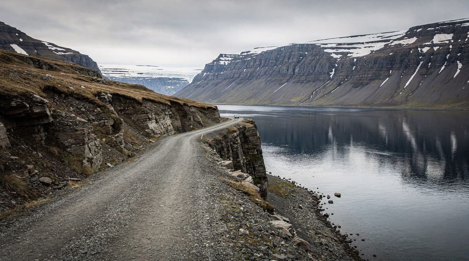
The Westfjords circuit
Distance: ~1,000 km from Reykjavik return, including the peninsula loop. Time needed: 4–6 days minimum. Vehicle: 4x4 strongly recommended; some roads are steep gravel.
The Westfjords are Iceland’s least-visited region and its most scenically dramatic. The peninsula consists of a series of narrow fjords separated by plateaus, creating a driving experience where every 5–10 km brings a new fjord vista. Roads often climb to 200–300 m elevation and descend again — slow driving, extraordinary views.
Key drives within the Westfjords:
Route 60 — main spine: Connects the south entrance (from Borgarfjörður Eystri or the ferry from Stykkishólmur) northwards. Passes Djúpafjörður, Arnarfjörður, and through the main town of Ísafjörður. Paved but narrow with passing places.
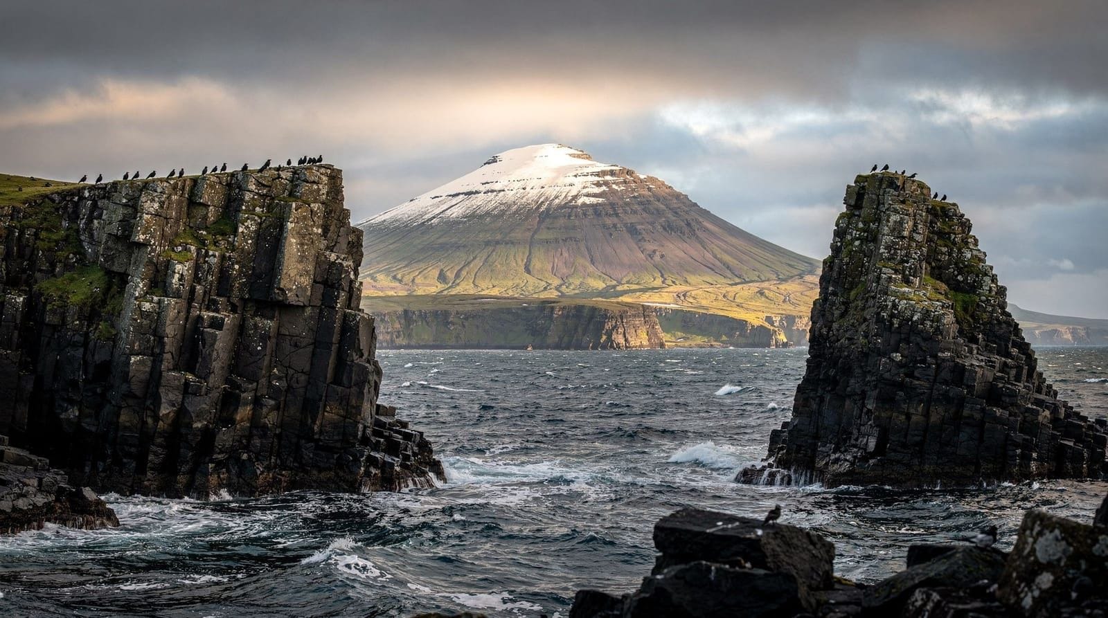
Route 612 — Látrabjarg bird cliffs: A gravel track to Europe’s westernmost point, home to one of the largest puffin and razorbill colonies in Iceland. The drive along the southern Westfjords shore to reach it — through Rauðisandur red-sand beach — is among the most isolated and beautiful roads in Iceland. See Látrabjarg bird cliffs guide.
Dynjandi waterfall loop: A short detour off Route 60 leads to Dynjandi, Iceland’s most spectacular waterfall by volume. The drive in follows the Arnarfjörður fjord with enormous mountains dropping into the sea.
Route 630 — Ísafjörður to Hólmavík: The southern Westfjords road circles through small fishing villages. Some sections gravel and seasonally rough.
Full itinerary planning in our Westfjords 5-day guide.
The Diamond Circle (North Iceland)
Distance: ~240 km loop from Akureyri. Time needed: 1–2 days. Vehicle: 2WD fine on Route 1 and Route 85; gravel tracks for some sight access.
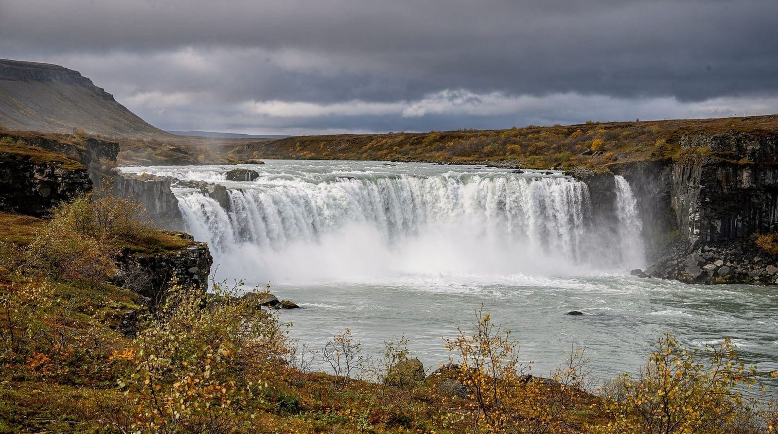
The Diamond Circle is the northern equivalent of the Golden Circle — a loop connecting the highlights of Northeast Iceland from Akureyri. Route: Akureyri → Goðafoss → Mývatn → Dettifoss → Ásbyrgi → Húsavík → back to Akureyri.
Route 1 east from Akureyri: Goðafoss waterfall is right on the road — 12 m drop across a 30 m wide arc. One of Iceland’s most accessible waterfalls and often photographed with minimal crowds in early morning.
Route 848 / Lake Mývatn: Lake Mývatn and its surrounding volcanic landscape is a half-day at minimum — pseudocraters, lava fields, geothermal vents, and the Krafla caldera on a side road. The Mývatn Nature Baths (similar to Blue Lagoon concept, cheaper, less crowded) sit on the south shore.
Route 862 — Dettifoss: Dettifoss is Europe’s most powerful waterfall by flow rate — an intimidating grey torrent in a black basalt canyon. The western bank (Route 862 gravel) gives the most dramatic view; the eastern bank (Route 864) is paved. Both access points lead to Dettifoss; the western side approach is visually superior.
Route 85 — Ásbyrgi and Húsavík: Ásbyrgi is a horseshoe canyon 1 km wide that Icelandic legend attributes to Odin’s horse. The canyon floor is a forested oasis. Húsavík is Iceland’s whale watching capital — see whale watching Húsavík for operators.
East Fjords coastal drives
Distance: ~250 km from Höfn to Egilsstaðir. Time needed: Full day to overnight. Vehicle: 2WD fine on Route 1; gravel for some fjord penetrations.
The Eastfjords section of Route 1 gets skipped by many Ring Road travelers who see it as a “connecting” stretch. That’s a mistake. The road winds through a dozen fjords, each with a different character — some with working fishing villages, some empty, some with mountains dropping straight into the water.
The most dramatic detours:
Route 96 → Seyðisfjörður: A 25 km paved road over a mountain pass descends into Seyðisfjörður — a Norwegian-architecture village at the head of a long fjord. Famous for the rainbow street. The road in crosses 600 m elevation with potential for dramatic cloud inversions.
Stöðvarfjörður and Fáskrúðsfjörður: Small fishing villages worth a stop for coffee. The Petra Stone Collection in Stöðvarfjörður is one of Iceland’s most eccentric and worthwhile small museums.
Route 939 — Öxi shortcut (gravel): A 4x4 gravel track connecting the two sides of the Eastfjords, saving significant Ring Road distance. Steep and rough — do not attempt in a 2WD or standard rental without checking current conditions.
The Reykjanes Peninsula
Distance: ~150 km loop from Reykjavik. Time needed: Half day to full day. Vehicle: 2WD fine.
The Reykjanes Peninsula — site of Keflavik Airport and the Blue Lagoon — has had ongoing volcanic activity since 2021. The Fagradalsfjall and Sundhnúkagígar eruption series created new lava fields that now cover parts of the peninsula.
The driving circuit via Route 43 and Route 425 passes the Blue Lagoon, Grindavík (currently in limited access due to lava risk), the Reykjanes lighthouse on a dramatic cliff, geothermal hot springs at Gunnuhver, and the Mid-Atlantic Ridge fissure at the Bridge Between Continents (free to walk across, ISK 1,500 to pay for a certificate). Fagradalsfjall volcano is accessible on foot from Route 427.
Note: access restrictions around Grindavík and the 2024 eruption zones change frequently. Check safetravel.is for current permitted areas before visiting.
Off the beaten path: lesser-known route highlights
Beyond the established named circuits, several individual drives deliver outsized scenery with minimal traffic.
Route 47 — Hvalfjörður
The Hvalfjörður Tunnel bypasses this fjord on the main highway, so almost nobody drives it. Route 47 traces the fjord clockwise from Reykjavik’s north suburbs — a 60 km loop through the 5 km long fjord with a whale station museum (Iceland stopped commercial whaling here in 1989), steep forested slopes, and the Glymur waterfall trailhead at the fjord’s head. The Glymur waterfall at 198 m is Iceland’s second tallest — accessible on a 2.5-hour hike from the parking area.
Route 76 — Skagafjörður
Running along the eastern side of Skagafjörður in North Iceland, this is farming Iceland at its most traditional. Horse breeding farms (Iceland’s horses are exported worldwide), long turf farmhouses, and the Drangey island — where the outlaw Grettir the Strong hid for three years in the 11th century — visible in the fjord. A 90-minute detour from Route 1 near Varmahlíð.
Route 60 through Arnarfjörður (Westfjords)
The drive into and out of Arnarfjörður passes Europe’s largest dynjandi waterfall complex (multiple falls stacked above each other on the fjord wall) and then continues through Ísafjörður — the Westfjords’ main town in a setting so dramatic (mountain walls on three sides) that the airport runway had to be built on a reclaimed peninsula jutting into the fjord.
Þórsmörk approach road (F249)
For 4x4 drivers who haven’t committed to a full F-road: the approach to Þórsmörk via F249 from Route 1 is 30 km of increasingly dramatic driving as the road winds into the glacier-surrounded valley. The river crossing at Krossá before the valley is the technical crux — if it’s low (often the case in the morning), this is one of the most dramatic short F-road experiences in Iceland.
Practical notes for the Westfjords detour
The Westfjords add approximately 600–800 km to a Ring Road trip and require 3–5 extra days. Specific logistics:
Ferry option: The Baldur ferry runs between Stykkishólmur (Snæfellsnes) and Brjánslæk (Westfjords) twice daily in summer. This avoids driving the long eastern route into the Westfjords via Borgarnes and cuts significant time. The ferry takes 2.5–3 hours across Breiðafjörður. Book well ahead in summer — this ferry sells out. Check seatours.is for schedules and booking.
Petrol stations in the Westfjords: Ísafjörður has a full-service petrol station. Flateyri, Þingeyri, and Bíldudalur have smaller stations. The southern Westfjords (Rauðisandur area) has no petrol for approximately 100 km. Fill up in Ísafjörður before heading south.
Road condition Westfjords specifics: Westfjords mountain roads (over the passes between fjords) can close in any month from October to May. Even in summer, these roads are narrow, steep, and unguarded — extreme attention required on switchbacks. Some visitors use Route 60 (the main Westfjords spine) and skip the cross-fjord mountain roads entirely, which is a legitimate choice.
Combining scenic drives: multi-week itinerary suggestions
For 14+ days in Iceland, combining multiple scenic drives creates the definitive Iceland road trip:
Days 1–3: Reykjavik, Reykjanes Peninsula, Blue Lagoon Days 4–5: South Coast (Seljalandsfoss to Jökulsárlón) Days 6–7: East Fjords including Seyðisfjörður Days 8–10: North Iceland (Mývatn, Diamond Circle, Akureyri) Days 11–12: Snæfellsnes Peninsula Days 13–14: Westfjords (Dynjandi, Látrabjarg minimum)
This covers the Ring Road plus the two best peninsula detours. See our 14-day Ring Road itinerary for the detailed version.
Driving the Reykjanes Peninsula: the eruption landscape
The Reykjanes Peninsula has transformed since 2021. New lava fields now cover parts of the peninsula that were previously farmland and scrubland. The Fagradalsfjall volcano erupted multiple times, creating accessible viewing areas from Route 427. As of mid-2026, the most recent eruption sites are reachable by marked hiking paths from the road.
The drive from Reykjavik through the lava fields to Grindavík (partial access), the geothermal area at Gunnuhver, Reykjanes lighthouse, and the Bridge Between Continents is one of the most geologically raw drives in Iceland. Unlike the photogenic waterfalls and glaciers of the south and east, this is Iceland at its most elemental — grey lava, steam vents, the smell of sulphur, and the visible evidence of ongoing geological activity.
Check before going: Access around Grindavík and the volcanic eruption zones changes with activity. Consult safetravel.is and Almannavarnir before driving to the active eruption areas. This is an active volcanic system, not a heritage site.
North Iceland’s overlooked drive: Route 76 coast
Route 76 follows the coast north of Akureyri through Siglufjörður — a village famous as Norway’s sardine capital in another era, now best known as the filming location for Nordic noir thriller series. The drive winds through steep mountain passes and narrow fjords, with the Tröllaskagi Peninsula creating dramatic scenery between each fjord.
Siglufjörður has the Herring Era Museum (Síldarminjasafn), the best food scene outside Reykjavik and Akureyri by several accounts (Síldarverksmiðjan restaurant), and arguably the most dramatic fjord-approach of any accessible drive in Iceland. The road connecting Siglufjörður through Ólafsfjörður via a double tunnel system (Héðinsfjarðargöng) opened in 2010, making a coastal loop possible.
Allow a full day from Akureyri for the Siglufjörður loop (approximately 180 km return with stops). Combine with North Iceland itinerary.
Tips for photographing the scenic drives
Stopping safely: Pull completely off the carriageway into a gravel layby before stopping to photograph. Never stop on the road shoulder or on the carriageway itself. Iceland’s Ring Road has limited pull-offs at some stretches, particularly in the Eastfjords — identify suitable stops on the map before the drive, not while driving.
Drone regulations: Drones are prohibited in national parks (Þingvellir, Skaftafell, Snæfellsjökull, Vatnajökull), over campsites, and near airports. The Reykjanes Peninsula has a permanent restricted airspace near Keflavik Airport. Our drone rules guide covers the full regulations.
The light changes fast: Iceland’s weather means a golden morning can become overcast by 10:00. When the light is good, stop and photograph immediately — don’t delay hoping the next viewpoint will be better. The next viewpoint may be in fog.
Frequently asked questions about Iceland’s scenic drives
Can I drive the Snæfellsnes Peninsula in one day from Reykjavik?
Yes, technically. It is ~170 km from Reykjavik to Kirkjufell and back, making a 340 km round trip. With 8+ hours of summer daylight this is possible but rushed. An overnight in the peninsula is strongly recommended to avoid spending 4+ hours in the car before you even arrive. See our Snæfellsnes day trip.
Are the Westfjords accessible without a 4x4?
Mostly yes in summer on Route 60 (the main road). The gravel detours to Rauðisandur beach, the Dynjandi approach, and some northern fjord roads benefit from a 4x4. A standard 2WD compact with good ground clearance and careful gravel driving will manage most of the Westfjords’ main routes, but a few will be off-limits.
Is the Diamond Circle accessible on a Ring Road trip?
Yes, as a detour from Akureyri. Allow 1–2 extra days if you are doing the Ring Road. The core Diamond Circle loop from Akureyri is doable as a single long day (240 km, 8–10 hours including stops).
How do I access the Snæfellsnes Peninsula from the Ring Road?
The Snæfellsnes Peninsula branches north from Route 1 at Borgarnes (70 km north of Reykjavik). Take Route 54 from the Borgarnes roundabout onto the peninsula. The full loop (Route 54 south coast, Route 574 glacier tip and north coast) returns to Borgarnes. Total peninsula loop: approximately 170 km. See our Snæfellsnes 2-day itinerary.
What’s the most underrated scenic drive in Iceland?
The East Fjords — specifically Route 1 between Djúpivogur and Egilsstaðir — is consistently skipped and consistently stunning. The drive over Breiðdalsheiði pass in clear weather is among Iceland’s best, and the fjord approach into Reyðarfjörður is dramatic regardless of season.
Can I drive the Westfjords without a 4x4?
The main Westfjords road (Route 60) is paved and driveable with a 2WD in summer. Some side routes (Route 612 to Látrabjarg, Route 630) have gravel sections that benefit from higher clearance but are manageable slowly in a careful 2WD. The mountain passes connecting fjords (which create the most dramatic driving) are steeper and have more gravel — a 4x4 is recommended but not mandatory for most visitors in summer. In winter, a 4x4 is effectively required for all Westfjords driving.
Are drive routes mapped anywhere official?
Iceland Tourism (visiticeland.com) publishes suggested driving routes. Local Bike and Hike rental companies often give good printed maps at collection. The best physical map is the Mál og Menning road atlas (available at Bónus or Kringlumörk bookstores in Reykjavik).
Top experiences
Best-rated activities across GetYourGuide and Viator.

From Reykjavik: Snaefellsness Peninsula small group day tour
- Viator

Lake Myvatn Day Tour and Godafoss Waterfall for Cruise Ships from Akureyri Port
- Viator

Private Jökulsárlón Glacier Lagoon 2 Day Tour & Glacier Hike
- Viator

From Reykjavik: Katla Ice Cave and South Coast Day Tour
- Viator

Reykjanes Peninsula Private Day Tour - up to 9 passengers
- Viator

Thorsmork Hike Day Tour
- Viator