Gullfoss — Iceland's most famous waterfall
Gullfoss waterfall guide: two-tiered falls on the Hvítá river, viewing platforms, driving directions, best photo spots, and what the hype is actually
Reykjavik: Golden Circle Gullfoss Geysir Thingvellir full day
Quick facts
- Best time to visit
- Year-round; June to August for full flow; winter for ice formations and fewer crowds
- Days needed
- 30 to 60 minutes as part of a Golden Circle day
- Getting there
- 124 km east of Reykjavík via Route 35; about 1.5 hours by car
- Budget per day
- ISK 0 entry / EUR 0; parking ISK 800 / EUR 5
A waterfall with a conservation story
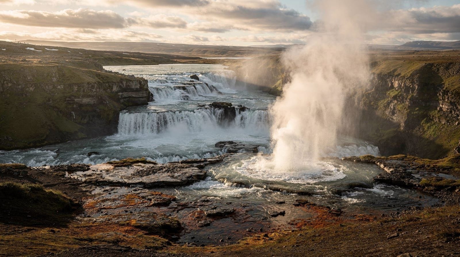
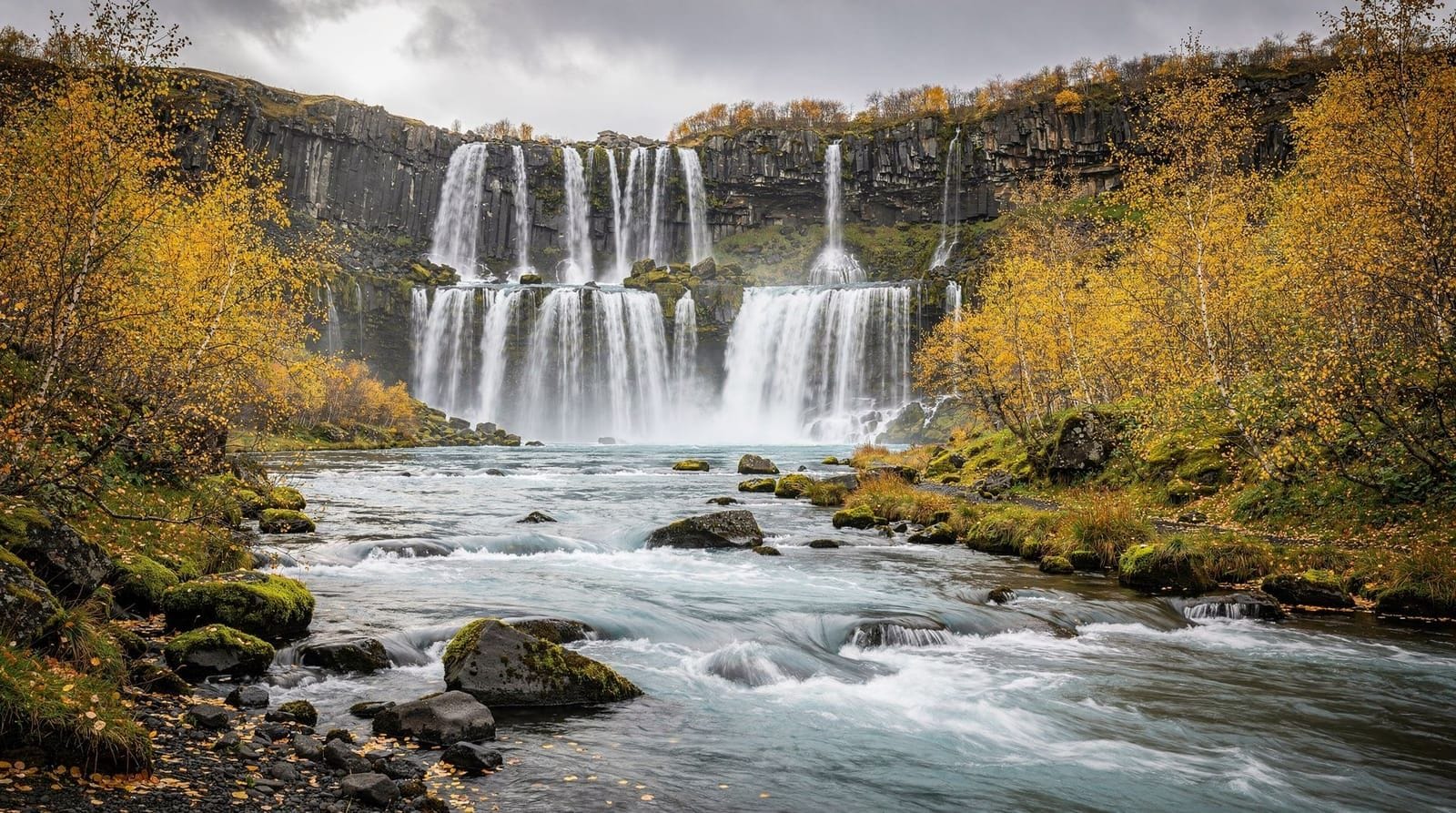
Gullfoss — “Golden Falls” in Icelandic — is a two-tiered waterfall on the Hvítá river, 124 km east of Reykjavík. It is Iceland’s most visited waterfall and a standard stop on the Golden Circle day trip. The falls are genuinely impressive: the Hvítá descends first 11 metres over a wide ledge, then 21 metres more into a narrow gorge oriented at 90 degrees to the first drop, so the full force of the river appears to vanish into the earth. The canyon below is 70 metres deep; on high-flow days the volume of water is around 140 cubic metres per second.
The falls are free to visit and no prebooking is required. Parking costs ISK 800 (EUR 5). The viewing paths are good and the scenery is genuinely dramatic rather than merely scenic.
The waterfall in detail
The Hvítá river originates at Langjökull glacier, Iceland’s second-largest icecap, about 40 km to the north. By the time it reaches Gullfoss, it has gathered considerable volume. The two-step cascade creates a permanent mist over the lower canyon; on sunny days, this generates rainbows visible from the upper viewing platform.
The shape of the falls is defined by a fault running north-south through the basalt: the second drop follows this fault line, cutting perpendicular to the first, which is why the water appears to disappear rather than flowing forward in a single plunge. The canyon walls downstream are dark basalt; on winter days when the mist freezes to the rocks, the entire canyon edge becomes encrusted in ice.
Viewing platforms
There are two main viewing positions:
Upper path (Efri stígur): A paved path from the car park to a platform overlooking both tiers from above and to the side. This gives the widest view and the best compositional sense of the scale. Most tour groups stop here. On clear days, Langjökull glacier is visible to the north.
Lower path (Neðri stígur): Continues from the upper platform down to a point close to the edge of the upper falls, where you are level with the water and the spray is significant. This is the most physically impressive position — the volume and noise of the water at this proximity is overwhelming in a good way. Waterproof jacket essential; cameras need protection. The path can be icy in autumn and winter.
Both paths are well-signed and require reasonable footwear. The lower path involves some uneven stone steps. There are no guardrails at the most dramatic points — take normal care near edges.
The Sigríður conservation story
Gullfoss was nearly dammed. In 1907, the landowner Tómas Tómasson leased the waterfall to foreign investors who planned to harness it for a hydroelectric project. His daughter Sigríður Tómasdóttir reportedly walked barefoot to Reykjavík multiple times (a distance of over 100 km) to petition against the project, and threatened to throw herself into the waterfall if the dam was built. The project eventually fell through when the investors could not raise sufficient capital — the conservation outcome was as much financial as political.
Whether Sigríður’s protests were decisive or the investors simply ran out of money depends on which account you read. The Icelandic conservation narrative emphasises her role, and a monument to her by sculptor Ásmundur Sveinsson stands near the upper viewpoint. The waterfall was eventually donated to the Icelandic state by the Tómasson family in 1979 and has been protected since.
It is a good story and the monument is worth reading. The waterfall is all the more interesting for having an actual history attached to it rather than being simply a natural feature.
Photography at Gullfoss
The main photographic challenge at Gullfoss is the mist. The spray from the lower falls reaches the upper viewing platform on windy days, making lens-drying between shots necessary. Polarising filters reduce the glare on the water but need to be kept dry.
The best light is morning: from roughly 06:30–08:30 in summer, low eastern sun catches the mist and generates double rainbows on clear days. The upper platform faces roughly southwest, so afternoon light is front-lit and less interesting photographically.
In winter, the canyon edges freeze and icicles form on the rock faces — these create genuinely unusual compositions that summer photography cannot replicate. The reduced visitor numbers in winter also mean unobstructed viewpoints.
Facilities
The Gullfoss Visitor Centre is open 09:00–18:00 in summer, with reduced hours in winter. It includes:
- A café (lamb soup ISK 2,600 / EUR 17; coffee ISK 600 / EUR 4)
- Toilets
- A small gift shop
The café is busy from 10:30 to 14:30 during peak season. Vending machines outside provide basic snacks when the café is closed.
Gullfoss as part of a Golden Circle day
Gullfoss is almost always visited in combination with Geysir (9 km west) and Þingvellir (65 km west) on the standard Golden Circle circuit. Most visitors spend 30–60 minutes at Gullfoss — enough to walk both viewing platforms and see the canyon from both levels.
Tour buses typically arrive at Gullfoss between 11:00 and 14:00, when the car park is at its most crowded. Self-drivers arriving before 09:30 or after 16:00 encounter significantly fewer people.
Golden Circle full day — Gullfoss, Geysir, Þingvellir from Reykjavík — the standard guided tour covering all three Golden Circle sites with English commentary. ISK 13,000–15,000 (EUR 85–99). Transport included; guide provided. Spends about 45 minutes at Gullfoss, which covers both viewing platforms comfortably.
Golden Circle express full day from Reykjavík — a slightly faster format covering the three main sites plus additional stops. ISK 13,500–16,000 (EUR 89–105).
The Hvítá river above Gullfoss
Above the falls, the Hvítá river flows through a broad, flat valley before narrowing as it approaches the canyon edge. The river originates at Langjökull glacier’s meltwater outflows and collects additional tributaries along the Hvítárdalur valley. In peak summer (June–July), snowmelt and long days push flow to its maximum; spring floods can exceed 200 cubic metres per second.
On summer days, the riverbank above the falls is worth exploring before descending to the main viewpoints. The flat, glassy water above the first drop contrasts with the violent descent below. You can often watch the water accelerate as it approaches the lip of the upper falls — the transition from calm to rapid is abrupt and visible from the bank.
Visiting Gullfoss with the South Coast
Gullfoss is at the eastern end of the Golden Circle loop, and many visitors continue from here onto the South Coast rather than returning directly to Reykjavík. From Gullfoss, it is 80 km south via Route 35 and Route 1 to Selfoss, then east along Ring Road 1 toward Hella, Seljalandsfoss, Skógafoss, and eventually Vík. This extended route — Golden Circle plus South Coast in two days — is one of the most popular multi-day formats and makes efficient use of the drive east from Reykjavík.
Alternatively, continue east from Gullfoss to the Highlands access point at Hveravellir or toward Kerlingarfjöll — but these routes require 4WD and are typically only open June through September.
What to combine with Gullfoss
The natural combinations within the Golden Circle:
- Geysir: 9 km west, 10 minutes. The most obvious pairing — nearly everyone does both on the same visit.
- Þingvellir: 65 km west, 50 minutes. The third Golden Circle site.
- Kerið crater: 68 km south via Route 35, 55 minutes from Gullfoss. Adds vivid volcanic crater colour to the day.
- Secret Lagoon: 50 km southwest via Routes 35 and 30, 40 minutes. The geothermal soak that rounds off a Golden Circle day.
- Friðheimar farm: 55 km southwest, 45 minutes. Geothermal greenhouse with a well-reviewed tomato soup café. Requires a reservation.
A self-driven Golden Circle day that includes Gullfoss, Geysir, Þingvellir, and the Secret Lagoon covers approximately 300 km and takes 10–12 hours without rushing.
Glacier connection — Langjökull
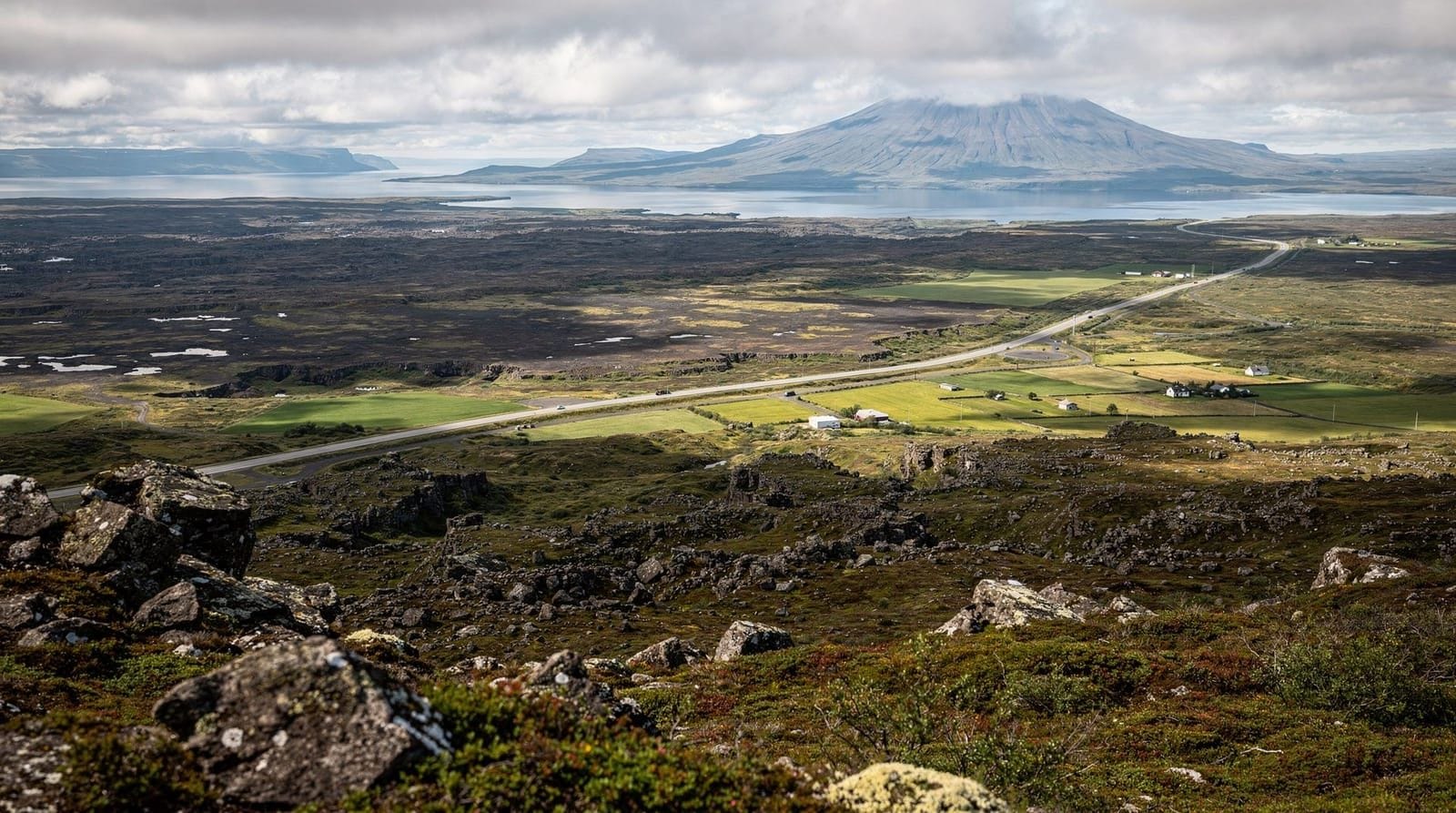
Gullfoss’s water comes from Langjökull, Iceland’s second-largest glacier (surface area approximately 920 km²). Langjökull sits about 40 km north of Gullfoss and is visible on clear days from the upper viewpoint — a white dome on the northern horizon above the brown plateau.
The Into the Glacier tunnel system was constructed inside Langjökull — an artificial ice tunnel open to tours — making Langjökull accessible for travellers who want to experience the ice interior without technical glacier hiking. Tours from Gullfoss to Langjökull exist, typically half-day format by snowmobile or super jeep, adding a geological link between the waterfall and its glacial source.
Gullfoss in winter
Winter (November to March) transforms Gullfoss. The mist from the falls freezes onto the canyon walls, creating massive ice formations that change shape throughout the season. The flow is reduced compared to summer (the glacial snowmelt source is frozen), but the visual drama is arguably greater. Fewer visitors, lower sun angles, and dramatic ice make winter photography here distinctly worthwhile.
The car park is plowed and the upper viewing platform path is maintained, but the lower path can be iced over — crampons or microspikes are useful. Check road conditions at road.is before driving; Route 35 to Gullfoss is a priority road but can accumulate ice in severe weather.
River conditions and seasonal variation
Gullfoss flow rates vary significantly with the seasons. The Hvítá’s peak flow comes in May and June when Langjökull’s winter snowpack melts rapidly — flow can reach 200 cubic metres per second or more, and the spray at the falls extends considerably further than on average days. The mist can reach the upper platform car park on windy days during peak snowmelt.
In late summer (August–September), flow is lower — typically 50–100 cubic metres per second — but the falls remain impressive. In winter, flow drops further, and parts of the canyon edge freeze. The falls themselves do not freeze — the volume and velocity are too high — but the spray freezes on the canyon walls, creating ice formations that build through the winter and collapse in spring.
The Hvítá has flooded severely in jökulhlaup events — glacial outburst floods from Langjökull that temporarily produce extraordinary flow volumes. These events are rare (linked to subglacial volcanic or geothermal activity) but have occurred in historical time, and the canyon at Gullfoss was partly shaped by such events. The most recent significant jökulhlaup from Langjökull occurred in the 1990s.
Beyond Gullfoss — Hveravellir and the Highlands
From Gullfoss, Route F35 continues north into the Iceland Highlands toward Hveravellir, a geothermal oasis with natural hot pools in the middle of the highland desert. This route is strictly 4WD only (river crossings) and is only open late June through September. Hveravellir is a destination in itself for those doing the Kjölur highland route (Reykjavík to Akureyri via the interior).
For most South Iceland day-trippers, Gullfoss is the northern endpoint of the journey. The road north is worth knowing about as context — it confirms that Gullfoss is not at the edge of settled Iceland but at the gateway to a vast, largely roadless interior.
Frequently asked questions about Gullfoss
Is Gullfoss free to visit?
The waterfall and both viewing platforms are free. Parking costs ISK 800 (EUR 5). The café is optional. Total cost without parking: zero.
Is Gullfoss worth visiting?
Yes. The two-tier cascade into the narrow gorge is more dramatic than the standard “waterfall in landscape” format — the perpendicular second drop makes it unusual. The conservation history and monument add context. That said, if you have already seen Skógafoss or Seljalandsfoss, Gullfoss is different in character (grander, more geological, less intimate) rather than simply more impressive.
What is the best time of day to visit Gullfoss?
Early morning (before 09:30) in summer for fewer crowds and the best light for photography. Alternatively, late afternoon (after 16:00) after the tour buses have departed. Avoid midday in July and August when the car park is at peak capacity.
How close can I get to the waterfall?
The lower viewing platform on the “Neðri stígur” path brings you within about 30–50 metres of the edge of the upper falls, close enough that the spray is constant on most days. There are no barriers at this viewpoint — standard edge awareness applies.
Can I access Gullfoss in winter?
Yes. Route 35 is a priority road and is generally passable through winter, though ice and snow occur. The main viewing platform is maintained; the lower path may be icy. Check road.is for current conditions.
How does Gullfoss compare to Iceland’s other waterfalls?
Gullfoss is Iceland’s most famous and most visited waterfall. Skógafoss and Seljalandsfoss are more vertical single-drop falls on the South Coast; Dettifoss in the north is higher volume; Dynjandi in the Westfjords is arguably more spectacular. Gullfoss is distinctive for its two-tier canyon format and the way the river appears to disappear.
Top experiences
Bookable activities with verified prices and instant confirmation on GetYourGuide.
Top-rated experiences in Gullfoss — Iceland's most famous waterfall
Best-rated activities across GetYourGuide and Viator.