Reykjanes Peninsula — volcanic gateway to Iceland
Complete guide to the Reykjanes Peninsula: Blue Lagoon, active volcanoes, geothermal fields, Bridge Between Continents, and what to do near Keflavík
Reykjanesbær: From Reykjavik Blue Lagoon and Reykjanes peninsula tour
Quick facts
- Best time to visit
- Year-round; volcanic hikes best June–September
- Days needed
- Half-day to 2 days depending on interests
- Getting there
- Right from KEF Airport; 45 min southwest of Reykjavík
- Budget per day
- 12,000–30,000 ISK / €82–€205 (highly variable with Blue Lagoon)
What the Reykjanes Peninsula is
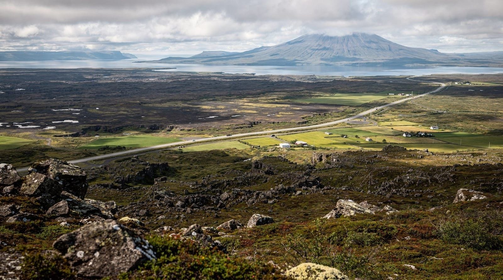
The Reykjanes Peninsula is the roughly 60-kilometre-long lava-covered finger of land that juts southwest from the greater Reykjavík area. Keflavík International Airport sits on its northern coast; the Blue Lagoon geothermal spa occupies a lava field near the town of Grindavík on its southern coast. Between these two well-known landmarks lies one of the most geologically active landscapes in Iceland — a ridge system sitting astride the Mid-Atlantic Ridge where the North American and Eurasian tectonic plates are pulling apart at about 2.5 centimetres per year.
Most tourists pass through Reykjanes without stopping — flying into KEF, transferring to Reykjavík, and continuing their trip. This is understandable but leaves behind a genuinely interesting day (or half-day) of landscape that is accessible without a long drive.
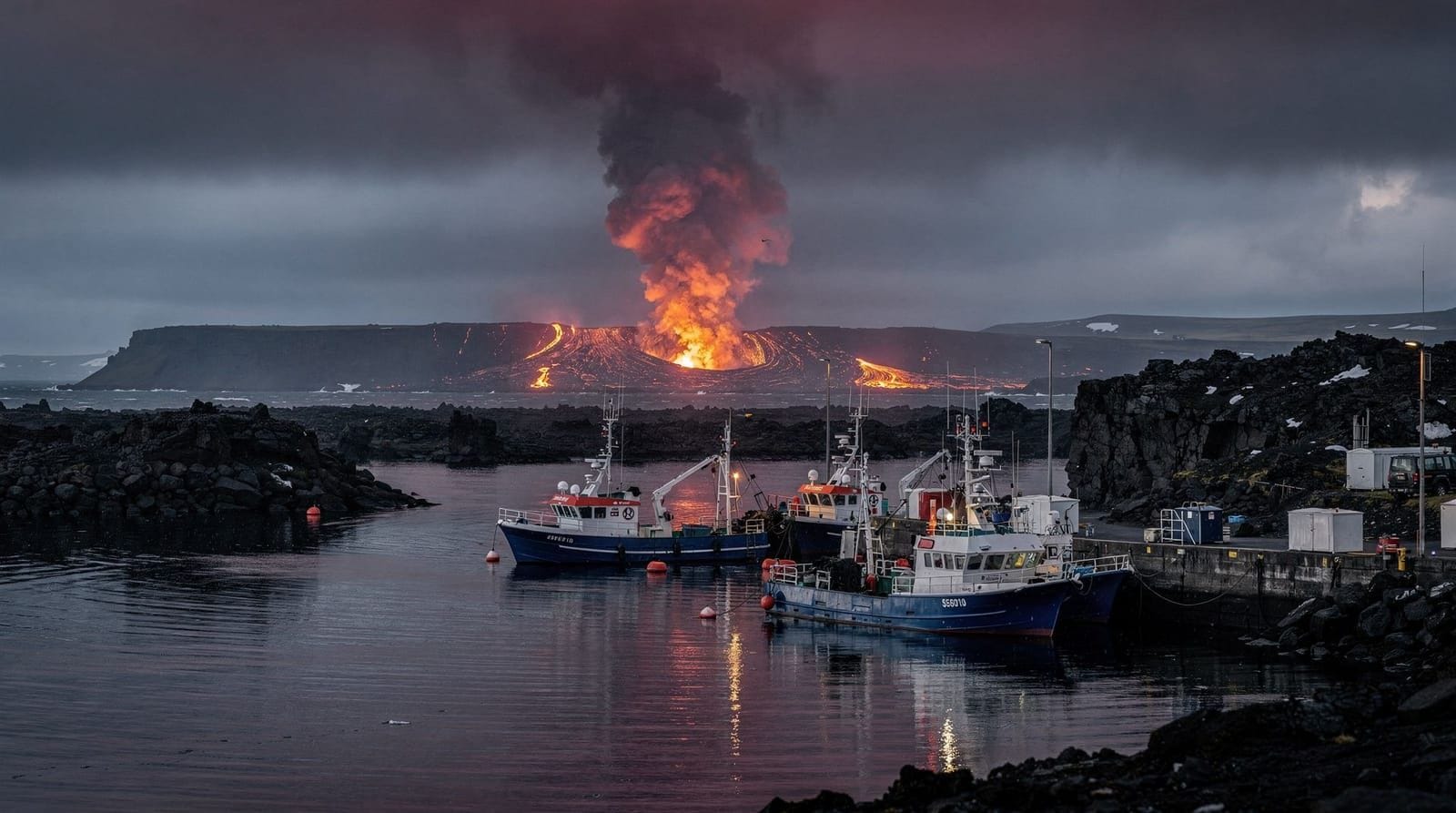
Since 2021, the peninsula has been the site of repeated volcanic eruptions at the Fagradalsfjall and Sundhnúkur crater systems. The eruptions have made the area one of the most actively monitored volcanic zones in Europe. As of 2026, Grindavík remains subject to evacuation restrictions related to ongoing eruptive activity — always check the Icelandic Meteorological Office (Veðurstofa) and Civil Protection Authority (almannavarnir.is) for current status before planning a visit to southern Reykjanes.
The geological context
The Reykjanes Ridge — the submarine continuation of the Mid-Atlantic Ridge — surfaces at the southwestern tip of Iceland and runs northeast across the entire peninsula. Walking across Reykjanes means walking across a rift zone: lava fields, fissures, hot springs, and geothermal vents are the result of this constant geological tension.
The Bridge Between Continents (Leif Eiriksson Road, near Hafnir) is a small pedestrian bridge spanning a fissure that marks the boundary between the North American and Eurasian plates. It costs around 1,000 ISK (€6.80) for a certificate and entrance to a small exhibition; the feature itself is geologically honest — it is a real rift fissure — but the site is primarily a photo stop and is not the most dramatic version of this phenomenon. Þingvellir National Park (on the Golden Circle, 45 minutes northeast of Reykjavík) offers a more extensive and impressive version for free.
The Reykjanes Geopark covers the entire peninsula and is a UNESCO Global Geopark designation reflecting the density of geological features: the Eldvörp and Svartsengi geothermal areas, the Gunnuhver mud pools and steam vents, the lava tube system at Raufarholshellir (accessible by tour), and a series of volcanic craters along the ridge.
Gunnuhver hot spring area
Gunnuhver is the largest hot spring area on the Reykjanes Peninsula and one of the most visually dramatic in Iceland, located near the southwestern tip of the peninsula (about 5 minutes from the Reykjanes lighthouse). The main feature is a mud pool approximately 20 metres across that sits in a steam-filled depression surrounded by boiling mud vents. It is named after a ghost (Gunna) from Icelandic folklore.
Access is free and the viewing platform is a short walk from the car park. The steam and sulphur smell is intense. Do not leave the marked paths — the ground crust around active geothermal areas can be dangerously thin, and there have been accidents at Icelandic geothermal sites when visitors step off marked routes. Entry to the designated paths is free; expect to spend 30–45 minutes here.
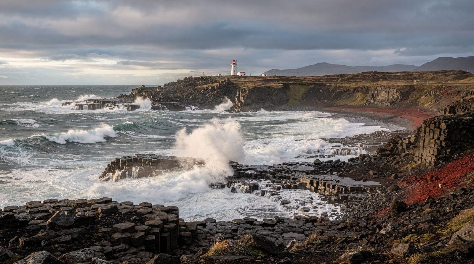
Reykjanes Lighthouse (Reykjanesviti) sits nearby — the current structure is a replacement for the original, which was destroyed by an earthquake in 1906. The area around the lighthouse has good views of the coastline and bird colonies.
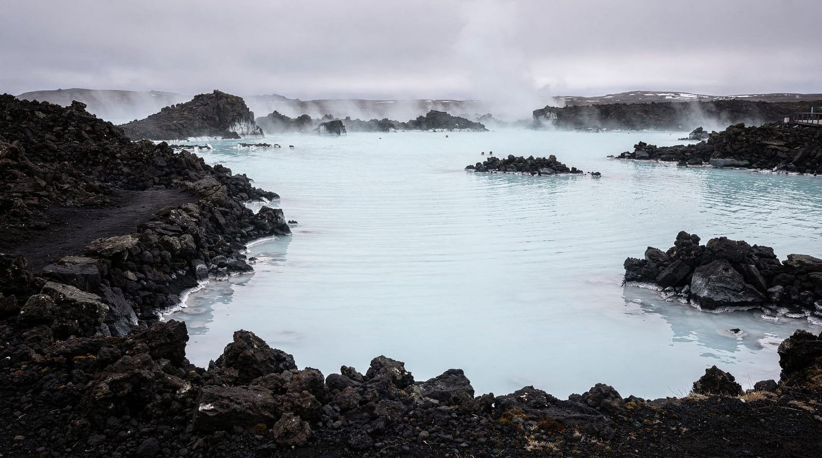
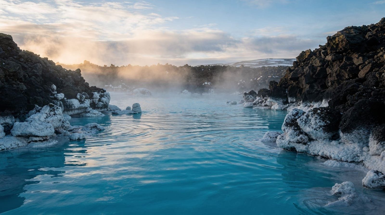
Blue Lagoon
The Blue Lagoon is the peninsula’s single most visited attraction — a geothermal spa built on waste water from the Svartsengi power plant. It sits roughly 4 kilometres from Grindavík town and about 20 minutes from KEF Airport. Entry prices are high: Comfort (basic) admission runs from around €90 per person; Signature (mid-tier with silica mask, drink, and towel) from €120; Premium from €165. Advance booking is mandatory.
The water is genuine geothermal water at around 38–39°C, rich in silica and mineral content that gives it the milky blue colour. Whether it is worth the price is a question every visitor asks; the guide is-the-blue-lagoon-worth-it gives an honest analysis including comparisons with cheaper alternatives. The short version: it is a well-run, comfortable experience in a dramatic setting, but at current prices it is not a neutral recommendation for all budgets.
The Blue Lagoon’s location — between KEF Airport and Reykjavík — makes it a natural first or last stop on an Icelandic trip if you’re flying in or out of KEF.
Blue Lagoon + Reykjanes Peninsula combined tour from ReykjavíkFagradalsfjall volcano area
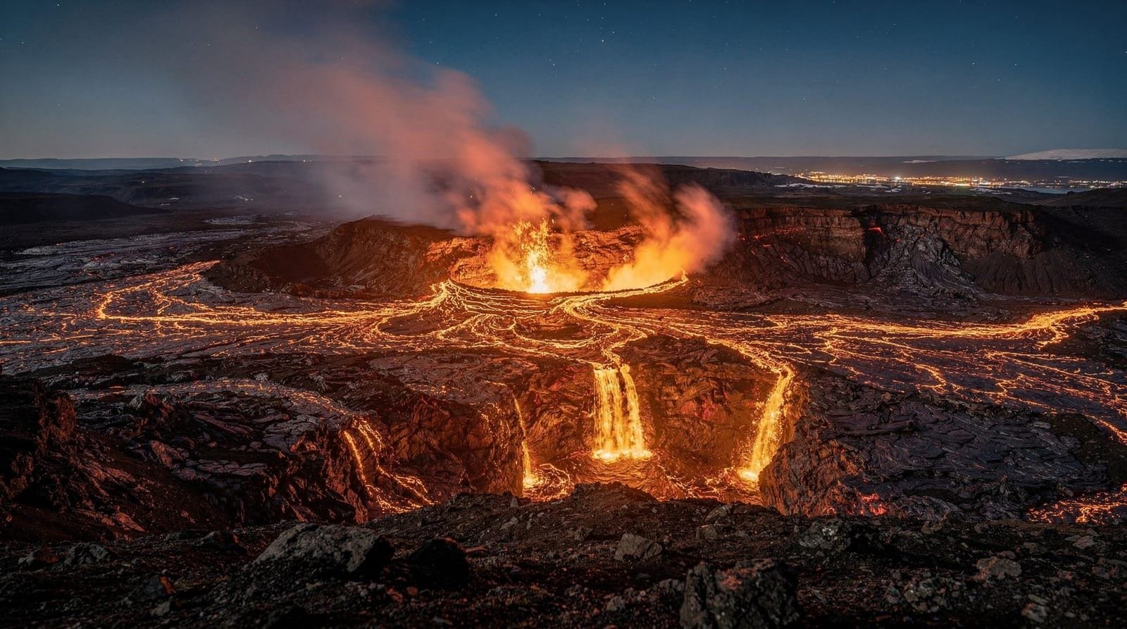
The Fagradalsfjall volcanic system erupted in 2021, 2022, 2023, and 2024, creating new lava fields in the Geldingadalir valley approximately 40 kilometres southwest of Reykjavík. The 2021 eruption was particularly significant — the first eruption on the Reykjanes Peninsula in approximately 800 years — and attracted tens of thousands of visitors who hiked to the active crater.
As of 2026, the most recent lava fields have cooled and hiking routes have been established. The hike to the main crater area (from the Suðurstrandarvegur car park) takes approximately 1.5–2.5 hours each way depending on which trail and which eruption site you’re targeting. The lava is black, ropey, and dramatic. The older Fagradalsfjall mountain provides context as a backdrop. See the fagradalsfjall-eruption-guide for current trail conditions and access.
The area around Grindavík was directly affected by eruptions at the Sundhnúkur crater row in late 2023 and 2024, and parts of the town were damaged by lava flows. This is not a tourist zone — it is a community dealing with an ongoing geological emergency. Respect the exclusion zones and do not attempt to enter restricted areas.
Fagradalsfjall volcano hike with small group and local guideKrýsuvík geothermal area
Krýsuvík (also spelled Krísuvík) sits roughly in the centre of the Reykjanes Peninsula and is the most accessible free geothermal area. The main feature is Seltún — a hillside covered in multicoloured sulphur deposits, steaming vents, and bubbling mud pools, accessible from a free car park on Route 42 with a short boardwalk trail. Entry is free and the site is genuinely visually striking.
Lake Kleifarvatn sits adjacent to the Krýsuvík geothermal field — a crater lake that actually shrank significantly after the 2000 earthquakes when a fissure opened at the lakebed. It is a good spot for a short walk and bird watching. The lake has Arctic terns in summer and is a popular location for local hikers.
Eldvörp and the Svartsengi geothermal complex
The Svartsengi geothermal power station — visible from a wide area as a cluster of white steam plumes — is the industrial infrastructure that powers both the Blue Lagoon and supplies electricity and hot water to the Reykjanes Peninsula population. It is not generally open to public tours, but the visual presence of the plant in the landscape is unavoidable and worth understanding: Iceland meets 85% of its heating and electricity needs from geothermal and hydroelectric sources, and Svartsengi is a functioning example of that.
The Eldvörp crater row extends northeast from Svartsengi — a series of explosion craters formed during the last Reykjanes eruption period approximately 800 years ago. A short walking trail from the Route 426 junction gives views over the crater row and the surrounding lava field. This is a free, unstructured stop — no facilities, just a dirt track and open landscape. Takes 20–30 minutes.
The combination of Svartsengi’s steam plumes, the Sundhnúkur eruption landscape to the southeast (visible from elevated ground), and the Eldvörp craters creates one of the most geologically layered views on the entire peninsula. If you’re interested in volcanic landscape photography, the late afternoon light on the steam plumes can be striking.
Reykjanes Bird Life
The peninsula’s coastline supports significant seabird colonies in spring and summer. The southwestern tip near the Reykjanes Lighthouse is a good spot for seeing kittiwakes, fulmars, and guillemots nesting on the sea cliffs. The area around Gunnuhver has nesting Arctic terns (watch your head from May through July — they dive aggressively).
Migratory ducks and waders use the wetland areas of the peninsula’s interior during spring and autumn passages. For dedicated birdwatching, the birdwatching-iceland guide covers the peninsula’s key sites in the context of Iceland’s broader bird geography.
Getting around the peninsula
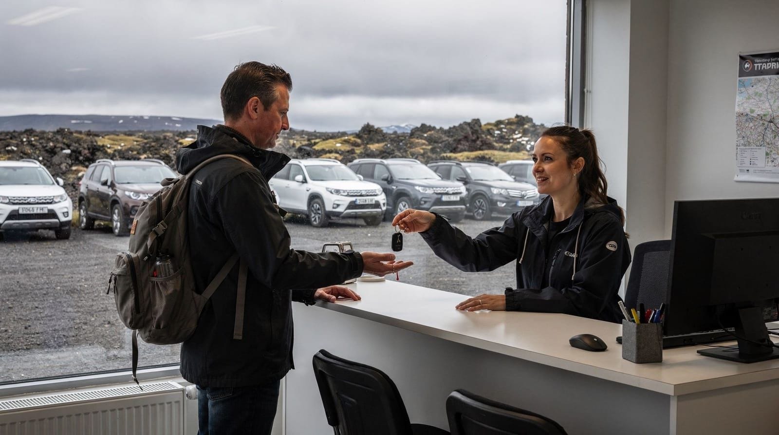
Most visitors explore Reykjanes by rental car (Route 41 from KEF Airport connects to Route 43, which circles the peninsula). The full circuit is about 80 kilometres from KEF and can be done in half a day, or extended to a full day including a Blue Lagoon stop.
Tour operators in Reykjavík offer dedicated Reykjanes Peninsula day tours and half-day tours. These are worthwhile if you want context from a guide, particularly for the volcanic areas where the geology benefits from explanation.
Reykjanes Peninsula half-day private tourPublic transport to most of the peninsula’s highlights does not exist — buses connect Reykjavík to Keflavík and Grindavík, but not to Gunnuhver, Krýsuvík, or the volcano area.
Accommodation and food
Most visitors to Reykjanes stay in Reykjavík and visit on a day trip, or stay in Keflavík for airport convenience. Accommodation within the Reykjanes Peninsula (outside Keflavík) is limited.
Food options are similarly sparse. Keflavík has the best concentration of restaurants and cafes. In Grindavík, options depend on what has reopened following the eruption disruptions of 2023–2024. The Blue Lagoon complex has a restaurant (LAVA) and café, but prices are high — a main course at LAVA typically runs 5,500–8,000 ISK (€37–€54).
Practical notes for the volcanic zone
If you plan to hike in recently erupted areas, check conditions before you go. Volcanic emissions (particularly SO₂) can reach hazardous levels near active vents even when eruptions appear calm. The Icelandic Met Office publishes a gas forecast. Wear sturdy hiking boots — fresh lava is extremely sharp and will cut through lightweight footwear. See the iceland-volcanoes-guide for general safety guidance.
The Reykjanes Peninsula sits within the south-iceland weather zone, which means it receives frequent strong winds and rain — particularly on the southwestern coast. Wind protection matters more than cold protection most of the year.
The Reykjanes UNESCO Global Geopark
The entire Reykjanes Peninsula carries UNESCO Global Geopark designation — a recognition of the density and scientific significance of its geological features. In practical terms, this means there are information boards at many sites explaining the geology in accessible language, and some investment in path maintenance and interpretation. The geopark designation does not restrict access or impose admission fees at natural sites.
The geopark covers eight primary “geo-sites”: Reykjanes Lighthouse and Bird Cliffs, Gunnuhver, the Bridge Between Continents, Krýsuvík-Seltún, Kleifarvatn lake, the Fagradalsfjall/Geldingadalir volcano site, Eldvörp crater row, and the Reykjanes Ridge Visitor Centre at Reykjanes. For a self-guided circuit that covers all eight, allow a full day with an early start.
The Reykjanes Ridge Visitor Centre near the lighthouse provides background on the tectonic setting of the peninsula and the Mid-Atlantic Ridge. Free to enter, runs an audio-visual display on the plate boundary geology. Worth 30 minutes if you want scientific context before driving the peninsula.
Practical planning notes for day trips
The Reykjanes Peninsula circuit is most efficiently planned as a half-day or full-day loop from either Reykjavík or Keflavík. Road distances:
- Reykjavík to Gunnuhver (southwestern tip via Route 43): ~75 km, 55 minutes
- Gunnuhver to Krýsuvík (northeast along Route 42): ~22 km, 25 minutes
- Krýsuvík back to Reykjavík (Route 42 / Route 41): ~35 km, 30 minutes
The full loop without stops takes about 2 hours driving. With stops at Gunnuhver (45 min), Bridge Between Continents (20 min), Krýsuvík/Seltún (40 min), and the Fagradalsfjall viewpoint (30 min), total time is 4–5 hours. Adding a Blue Lagoon visit extends the day to 7–8 hours.
Petrol stations are available in Keflavík, Grindavík (check current status), and on Route 43. The peninsula has no petrol stations in its interior — fill up before leaving the main towns.
Frequently asked questions about the Reykjanes Peninsula
Can I visit the Reykjanes Peninsula as a day trip from Reykjavík?
Yes — a half-day circuit covers Gunnuhver, the Bridge Between Continents, and Krýsuvík with time to spare. Adding the Blue Lagoon makes it a full day. The volcano hike to Fagradalsfjall adds another 3–5 hours. Most visitors combine one or two of these in a single outing rather than attempting all.
Is it safe to visit near the Grindavík eruption areas?
It depends on current conditions. Parts of the Reykjanes Peninsula near Grindavík remain under periodic alert levels due to ongoing volcanic unrest. Always check Veðurstofa Iceland (vedur.is) and the Civil Protection Authority (almannavarnir.is) before visiting. Respect all exclusion zones — they are set by civil engineers who monitor ground deformation daily, not by tourism concerns.
Do I need a 4x4 to drive the Reykjanes Peninsula?
No. All the main sites — Gunnuhver, Krýsuvík, Bridge Between Continents, and the Fagradalsfjall car park — are accessible on paved or well-maintained gravel roads with a standard 2WD vehicle. Only if you plan to drive F-roads into the interior of Iceland do you need a 4x4. See 2wd-vs-4x4-iceland for clarification.
What is the best order to visit Reykjanes Peninsula sites?
Coming from Reykjavík or KEF Airport: start at the Bridge Between Continents (Hafnir turn-off), continue to Gunnuhver and the Reykjanes Lighthouse, then loop northeast to Krýsuvík, then return via Route 43 toward Grindavík (check current access) and the Blue Lagoon if included. Reverse the order if arriving from KEF and heading to Blue Lagoon first.
Are there organised tours to the Reykjanes Peninsula from Reykjavík?
Yes — multiple operators offer half-day and full-day Reykjanes tours with or without Blue Lagoon admission included. These depart from Reykjavík city centre and cover the main geological highlights with guides who can explain the plate tectonics and volcanic history. This is often more practical than self-driving if you don’t have a rental car.
How far is the Reykjanes Peninsula from Reykjavík?
The peninsula starts roughly 30 kilometres southwest of central Reykjavík. KEF Airport is 45 minutes by road; the Blue Lagoon is about 50 minutes; Gunnuhver (the southwestern tip) is about 75 minutes. It is entirely within day-trip range without overnight accommodation.
Top experiences
Bookable activities with verified prices and instant confirmation on GetYourGuide.
Reykjanesbær: From Reykjavik Blue Lagoon and Reykjanes peninsula tour
Reykjanesbær: Reykjanes peninsula half day private tour
Reykjanesbær: Exclusive Reykjanes peninsula and Blue Lagoon private tour
Reykjanesbær: Reykjanes peninsula and bridge between the continents
Reykjavik: From airport to adventure private Reykjanes peninsula tour
Iceland: Fagradalsfjall Volcano hike small group local guide
Top-rated experiences in Reykjanes Peninsula — volcanic gateway to Iceland
Best-rated activities across GetYourGuide and Viator.