Driving the south coast in a storm: what happened, what we learned
The forecast
We checked the forecast the night before. The Icelandic Met Office app showed a yellow weather warning for the south coast — sustained winds of 25–35 m/s (90–126 km/h), gusts potentially exceeding that, and mixed precipitation. The warning was scheduled to begin mid-morning and intensify through the afternoon.
I want to be upfront: we probably should have stayed in Reykjavik.
We didn’t. We left at 7:30 am, before the warning period began, driving a Toyota Land Cruiser with winter tyres from Reykjavik toward Vík. What followed was the most instructive driving day of our combined years of Icelandic travel.
The progression
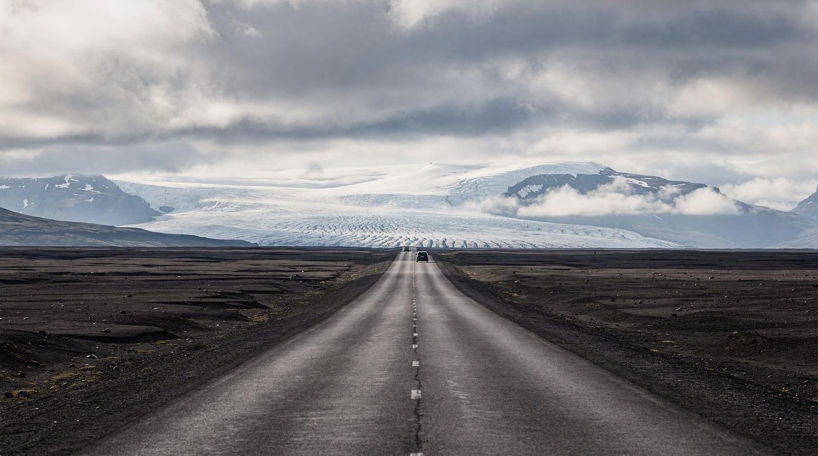
The first hour was fine. Route 1 southeast from the city, past Hveragerði, through the lava fields. The sky was low and grey, wind noticeable but manageable. We stopped at Seljalandsfoss just after 9 am because the warning hadn’t taken effect yet. The path behind the waterfall was slippery with ice from overnight temperatures; we turned back after 50 metres.
By Skógar, the wind had picked up substantially. The car was being pushed by gusts. Not dramatically — the Land Cruiser is heavy — but you could feel each gust as a distinct lateral pressure. Skógafoss car park had one other vehicle. The falls were obscured by horizontal spray. We stayed 10 minutes.
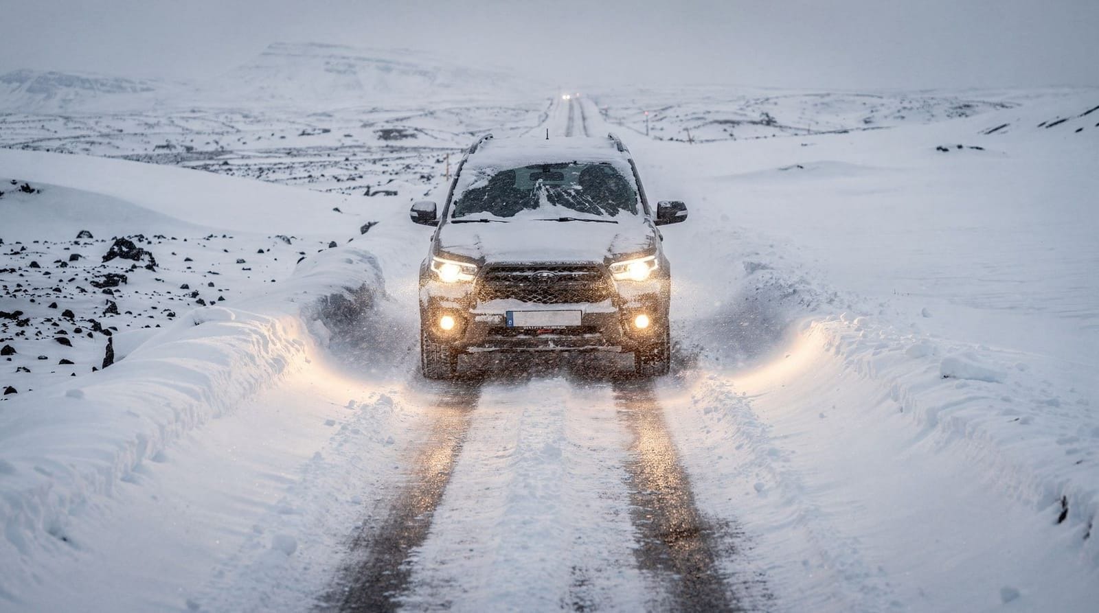
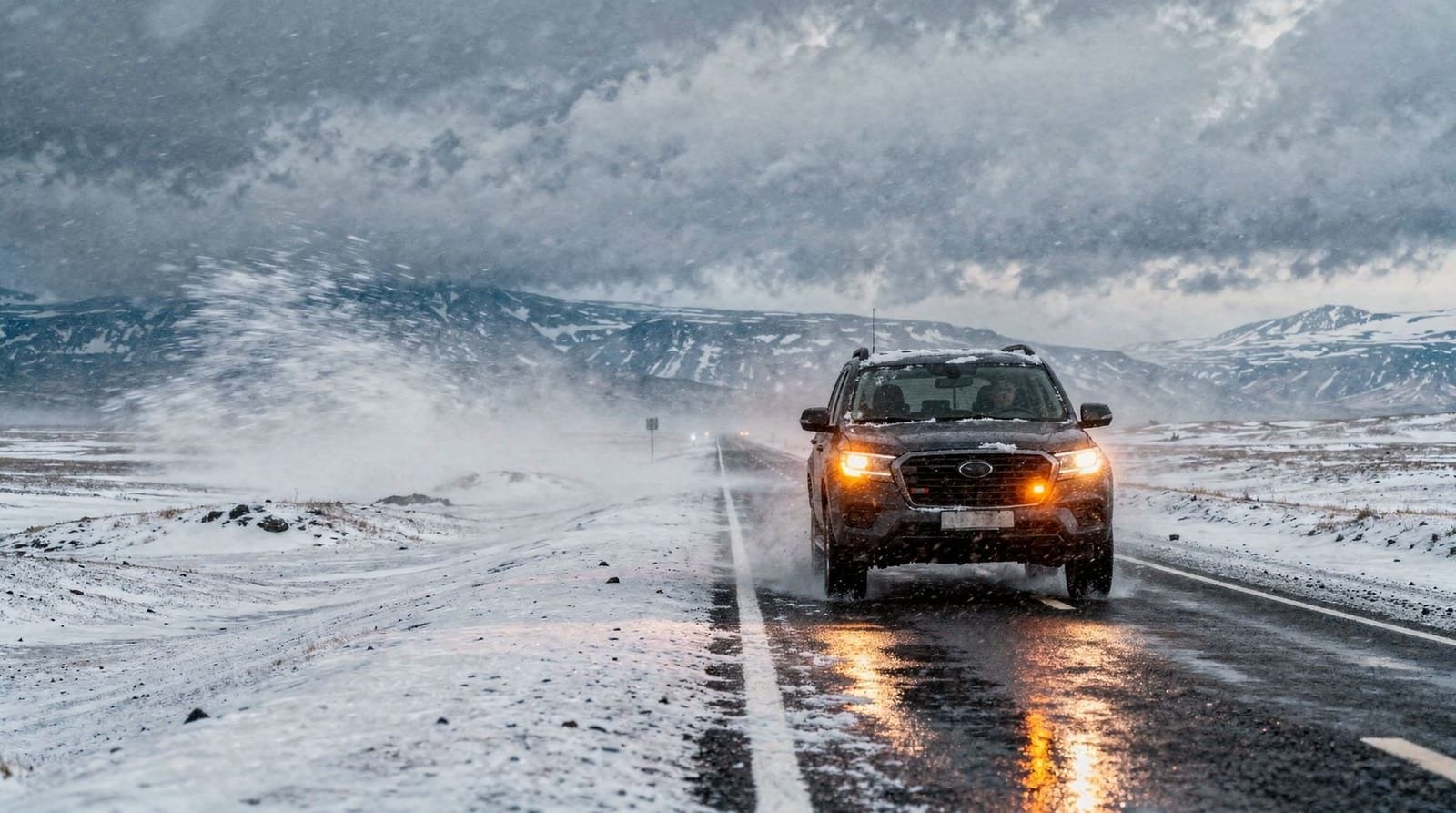
The section between Skógar and Vík is the most exposed stretch of the south coast: a flat volcanic plain running between the base of the Eyjafjallajökull massif and the sea, with no windbreaks. The wind in this section hit orange warning territory. Sustained wind of approximately 30–35 m/s. Driving a high-sided vehicle in these conditions is manageable if you’re experienced and if you’re holding the wheel with both hands and not overcorrecting. For our hire car, the correct speed was about 60 km/h — slow enough to maintain control, fast enough to avoid being stationary in an exposed position.
We did not stop at Reynisfjara black sand beach. We had planned to, but the orange warning signage was displayed at the junction, and Route 1 conditions by that point made turning onto the secondary road toward the beach feel unwise. The beach in those wind conditions, with sneaker waves already unpredictable in normal weather, would have been genuinely dangerous.
What stopped us
We were stopped, literally, by road condition management about 15 km west of Vík. An orange warning closure had come into effect on the stretch of Route 1 that approaches Vík from the west. A vehicle with the Icelandic Road Administration (Vegagerðin) was positioned with a flashing light, and the road was closed.
This is Iceland’s system working correctly. The closure was not dramatic — no barriers, just an official vehicle and a request to turn back. We turned back to Skógar, found the small guesthouse café open (they had clearly seen this situation before — their coffee and cardamom cake turnover that morning was evidently good), and waited three hours for the closure to lift.
The closure lifted at 2:30 pm. The wind had reduced to approximately 15–20 m/s, still gusty but within the manageable range. We drove to Vík in the afternoon. The village had some storm damage to temporary signage and one tree down. The hotels were open. Dinner at the Suður-Vík restaurant (fish stew, ISK 3,900, excellent) tasted significantly better than it would have on a calm day.
What the road closures actually mean
Iceland operates a nationwide road condition system (road.is). Every main road is rated green, yellow, or red. Green means normal conditions. Yellow means caution advised, possible rough conditions. Red means closed.
The Safetravel emergency app (safetravel.is) overlays weather warnings on a map and sends push notifications when conditions change for routes you’ve registered an interest in. We had registered our south coast route when we booked the trip. The notification about the orange warning came at 11:15 pm the night before. We looked at it and drove anyway. This was not our smartest moment.
The Safetravel emergency information guide covers the app and the 112 emergency number system, including Iceland’s mountain rescue (ICE-SAR) which handles vehicle assistance and stranded travellers.
The mistakes we made
Not checking road.is the morning of: We checked it the night before and it showed yellow. By the time we left, it had already been updated to orange for the Vík section. Checking in the morning before departure is essential.
Driving toward a worsening warning rather than away from it: We drove southeast as the front came northeast. Basic error of directionality.
Not having a pre-planned alternative: We had one itinerary without fallback options. When the road closed, we improvised. Improvising at a café in Skógar in a storm with no cell signal to check alternative routes was stressful in a way that having a pre-planned alternative would have prevented.
What we’d do differently
Read the orange warning and stay in Reykjavik, then go the next day. The day after the storm, the south coast was clear, the roads were open, and Skógafoss was running at full volume with storm-fed flow. Storm conditions often make waterfalls more dramatic. Waiting one day and catching the aftermath is often a better photographic and experiential outcome than trying to push through the storm itself.
Know the hierarchy of warnings: Yellow = caution, possible rough conditions. Orange = significant danger, stay on main roads only. Red = road closed. If it’s orange, the sensible response is to not be on that road.
Plan accommodation with flexibility: Booking refundable guesthouses on the route (rather than non-refundable advance rates) allows you to extend a Reykjavik night when the weather demands it.
What it was actually like
This is the honest part: despite the stress and the poor decision-making, driving through an Icelandic storm is an experience. The south coast in those conditions — low cloud over Eyjafjallajökull, horizontal rain, the black sand beach visible from Route 1 with enormous waves, the sheer scale of the weather — was viscerally impressive. The waterfalls we did see were surging with storm runoff. The light, when it came through briefly around noon, was extraordinary.
Iceland in winter is not always comfortable. It is sometimes genuinely awe-inspiring in ways that require being in it, not just seeing photographs. We made poor decisions and the system kept us safe (the road closure existed for a reason). But I understand why people are drawn to being in Iceland in serious weather.
For driving safety specifics, the driving in Iceland guide and the winter driving guide both cover road condition management, warning colours, and what to do when conditions deteriorate. The Iceland weather guide explains the storm systems that come off the North Atlantic.
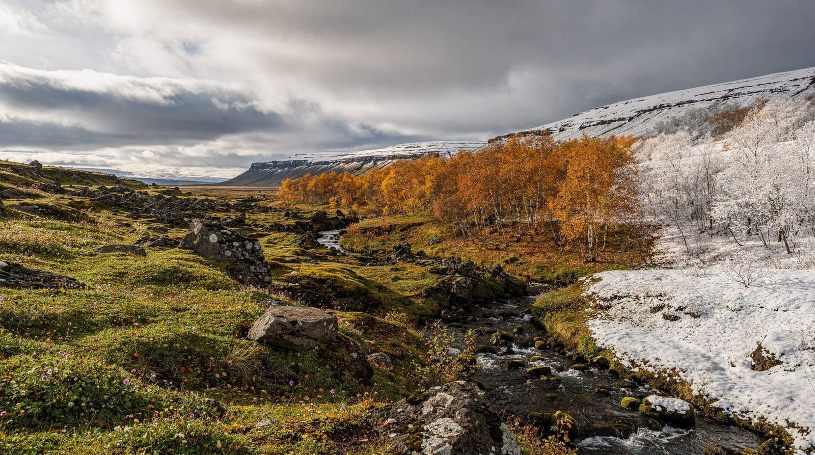
The storm aftermath
The day after the storm, the south coast was in a particular kind of post-storm clarity. The sky had cleared to a deep blue. The mountains had fresh snow above 400 metres. The waterfalls were running at dramatically increased volume from storm runoff and snowmelt.
Skógafoss on the morning after the storm was the most impressive I’ve seen it across four visits to Iceland. The flow volume was significantly higher than normal — the falls were wider and more turbulent, and the spray cloud extended 100 metres into the surrounding air. The ridge trail above the falls, which is normally a pleasant but straightforward climb, had ice patches from overnight temperature drops and required careful footing.
Seljalandsfoss, which we’d been unable to visit properly during the storm, was similarly enhanced by the post-storm flow. The walk-behind path was open again once temperatures rose. The catch is that the path’s drainage couldn’t keep up with the increased spray volume and was running with water; waterproof footwear was genuinely necessary rather than merely advisable.
Reynisfjara beach after a storm carries its own risks. Post-storm wave sets are often larger and more erratic than normal conditions, as residual swell energy continues propagating for 12–24 hours after the storm’s wind field passes. The sneaker wave risk, which is already the primary safety concern at Reynisfjara in normal conditions, is elevated. We visited the morning after and stayed well back — 30+ metres from the wave zone — which is further back than most visitors stand even in calm conditions.
The planning conversation before you go
If you’re planning a south coast road trip, the question of what to do when weather deteriorates is worth deciding in advance rather than in the moment.
Our decision framework, developed retrospectively:
- Yellow warning: Drive, proceed with normal caution, avoid exposed coastal viewpoints.
- Orange warning: Stay put or shelter in the nearest town. Drive only if you need to reach accommodation.
- Red warning: Closure. Not a decision point — the road is closed.
The key is making this decision before you’re in the car watching the weather, when the sunk cost of having already driven 80 km and the visual appeal of dramatic storm conditions both push toward continuing rather than turning back.
For driving safety specifics, the driving in Iceland guide and the winter driving guide both cover road condition management, warning colours, and what to do when conditions deteriorate. The Iceland weather guide explains the storm systems that come off the North Atlantic.
Don’t do what we did. But if you end up in it anyway, know that the cafés in Skógar will have cardamom cake and coffee ready.